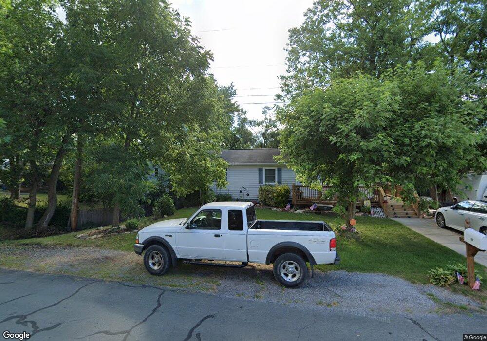
203 Alta Vista Dr Winchester, VA 22602
Estimated Value: $284,832 - $354,000
3
Beds
1
Bath
1,008
Sq Ft
$316/Sq Ft
Est. Value
About This Home
This home is located at 203 Alta Vista Dr, Winchester, VA 22602 and is currently estimated at $318,708, approximately $316 per square foot. 203 Alta Vista Dr is a home located in Frederick County with nearby schools including Admiral Richard E. Byrd Middle School, Millbrook High School, and Sharon's Centre.
Ownership History
Date
Name
Owned For
Owner Type
Purchase Details
Closed on
Mar 3, 2000
Sold by
Braddock Partnership
Bought by
Arnold Richard E
Current Estimated Value
Home Financials for this Owner
Home Financials are based on the most recent Mortgage that was taken out on this home.
Original Mortgage
$93,350
Outstanding Balance
$30,972
Interest Rate
8.21%
Estimated Equity
$287,736
Create a Home Valuation Report for This Property
The Home Valuation Report is an in-depth analysis detailing your home's value as well as a comparison with similar homes in the area
Home Values in the Area
Average Home Value in this Area
Purchase History
| Date | Buyer | Sale Price | Title Company |
|---|---|---|---|
| Arnold Richard E | $89,900 | -- |
Source: Public Records
Mortgage History
| Date | Status | Borrower | Loan Amount |
|---|---|---|---|
| Open | Arnold Richard E | $93,350 |
Source: Public Records
Tax History Compared to Growth
Tax History
| Year | Tax Paid | Tax Assessment Tax Assessment Total Assessment is a certain percentage of the fair market value that is determined by local assessors to be the total taxable value of land and additions on the property. | Land | Improvement |
|---|---|---|---|---|
| 2025 | $1,307 | $272,200 | $93,000 | $179,200 |
| 2024 | $594 | $233,100 | $77,000 | $156,100 |
| 2023 | $1,189 | $233,100 | $77,000 | $156,100 |
| 2022 | $1,175 | $192,600 | $72,000 | $120,600 |
| 2021 | $1,175 | $192,600 | $72,000 | $120,600 |
| 2020 | $1,072 | $175,800 | $72,000 | $103,800 |
| 2019 | $1,072 | $175,800 | $72,000 | $103,800 |
| 2018 | $980 | $160,700 | $72,000 | $88,700 |
| 2017 | $964 | $160,700 | $72,000 | $88,700 |
| 2016 | $877 | $146,100 | $59,500 | $86,600 |
| 2015 | $818 | $146,100 | $59,500 | $86,600 |
| 2014 | $419 | $141,100 | $59,500 | $81,600 |
Source: Public Records
Map
Nearby Homes
- 326 Lehigh Dr
- 308 Lehigh Dr
- 122 Cherry Hill Cir
- 213 Crest Cir
- 107 Dale Ct
- 110 Carter Place
- 138 Country Club Cir
- 211 Eastside Ln
- 206 Eastside Ln
- 112 Fairway Dr
- 105 Worsham Terrace
- Homesite 195 Malbec
- 157 Brookland Terrace Unit 11
- 151 Brookland Terrace Unit 8
- Homesite 184 Malbec
- Homesite 191 Malbec
- 126 Armstrong Place
- 107 Malbec Ct
- 107 Malbec Rd
- 5 Williamson Rd
- 114 Thornton Way
- 318 Lehigh Dr
- 118 Thornton Way
- 112 Thornton Way
- 113 Menasha Ct Unit INNISBROOK
- 312 Lehigh Dr
- 109 Menasha Ct Unit LEXINGTON LOT 147
- 201 Lehigh Dr
- 115 Menasha Ct
- 326 Lehigh Dr Unit PLYMOUTH
- 314 Lehigh Dr
- 139 Lehigh Dr
- 203 Lehigh Dr
- 215 Lehigh Dr
- 209 Lehigh Dr Unit INNISBROOK
- 222 Lehigh Dr
- 210 Lehigh Dr Unit LEXINGTON
- 224 Lehigh Dr Unit LEXINGTON
- 226 Lehigh Dr Unit LEXINGTON
- 104 Thornton Way Unit LEXINGTON