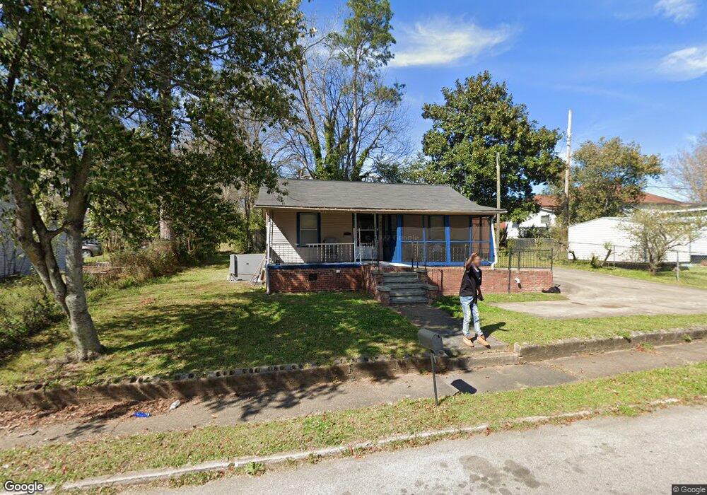
203 Baugh St Lagrange, GA 30241
Estimated Value: $56,000 - $82,000
2
Beds
1
Bath
614
Sq Ft
$105/Sq Ft
Est. Value
About This Home
This home is located at 203 Baugh St, Lagrange, GA 30241 and is currently estimated at $64,657, approximately $105 per square foot. 203 Baugh St is a home located in Troup County with nearby schools including Hollis Hand Elementary School, Franklin Forest Elementary School, and Ethel W. Kight Elementary School.
Ownership History
Date
Name
Owned For
Owner Type
Purchase Details
Closed on
Mar 5, 2004
Sold by
Traditional Neighborhood
Bought by
Dash For Lagrange
Current Estimated Value
Purchase Details
Closed on
Dec 4, 2003
Sold by
Annie Cofeild
Bought by
Traditional Neighborhood
Purchase Details
Closed on
Aug 11, 1997
Sold by
Neighborhood Housing Serv
Bought by
Annie Cofeild
Purchase Details
Closed on
Jul 7, 1997
Sold by
Ketsky Lillian
Bought by
Neighborhood Housing Serv
Purchase Details
Closed on
Jan 1, 1949
Sold by
Callaway Fdn
Bought by
Ketsky Lillian
Create a Home Valuation Report for This Property
The Home Valuation Report is an in-depth analysis detailing your home's value as well as a comparison with similar homes in the area
Purchase History
| Date | Buyer | Sale Price | Title Company |
|---|---|---|---|
| Dash For Lagrange | $45,500 | -- | |
| Traditional Neighborhood | -- | -- | |
| Annie Cofeild | $7,000 | -- | |
| Neighborhood Housing Serv | $30,000 | -- | |
| Ketsky Lillian | -- | -- |
Source: Public Records
Tax History
| Year | Tax Paid | Tax Assessment Tax Assessment Total Assessment is a certain percentage of the fair market value that is determined by local assessors to be the total taxable value of land and additions on the property. | Land | Improvement |
|---|---|---|---|---|
| 2025 | $47 | $15,720 | $2,560 | $13,160 |
| 2024 | $47 | $14,600 | $2,560 | $12,040 |
| 2023 | $2 | $14,800 | $2,560 | $12,240 |
| 2022 | $39 | $13,560 | $2,560 | $11,000 |
| 2021 | $30 | $12,600 | $2,600 | $10,000 |
| 2020 | $79 | $12,600 | $2,600 | $10,000 |
| 2019 | $59 | $11,928 | $2,888 | $9,040 |
| 2018 | $59 | $11,928 | $2,888 | $9,040 |
| 2017 | $59 | $11,928 | $2,888 | $9,040 |
| 2016 | $50 | $11,626 | $2,888 | $8,738 |
| 2015 | $51 | $11,626 | $2,888 | $8,738 |
| 2014 | $37 | $11,166 | $2,888 | $8,278 |
| 2013 | -- | $11,734 | $2,888 | $8,846 |
Source: Public Records
Map
Nearby Homes
Your Personal Tour Guide
Ask me questions while you tour the home.