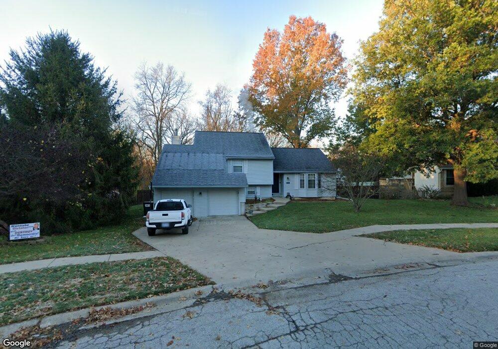
203 Brook Meadow Rd Lansing, KS 66043
Estimated Value: $324,000 - $413,000
4
Beds
3
Baths
1,549
Sq Ft
$225/Sq Ft
Est. Value
About This Home
This home is located at 203 Brook Meadow Rd, Lansing, KS 66043 and is currently estimated at $348,753, approximately $225 per square foot. 203 Brook Meadow Rd is a home located in Leavenworth County with nearby schools including Lansing Elementary School, Lansing Middle 6-8, and Lansing High 9-12.
Ownership History
Date
Name
Owned For
Owner Type
Purchase Details
Closed on
Jul 17, 2022
Sold by
Crisco Telford E and Basile-Crisco Toni M
Bought by
Crisco Telford E and Basile-Crisco Toni M
Current Estimated Value
Purchase Details
Closed on
Apr 29, 2019
Sold by
Crisco Jr Telford E and Crisco Toni M
Bought by
Crisco Telford E
Home Financials for this Owner
Home Financials are based on the most recent Mortgage that was taken out on this home.
Original Mortgage
$117,600
Interest Rate
4.3%
Mortgage Type
VA
Purchase Details
Closed on
Apr 26, 2019
Sold by
Crisco Jr Telford E and Crisco Toni M
Bought by
Crisco Telford E
Home Financials for this Owner
Home Financials are based on the most recent Mortgage that was taken out on this home.
Original Mortgage
$117,600
Interest Rate
4.3%
Mortgage Type
VA
Purchase Details
Closed on
Dec 21, 2006
Sold by
William Holcomb and William Rebecca
Bought by
Crisco Telford E and Crisco Hinchman
Create a Home Valuation Report for This Property
The Home Valuation Report is an in-depth analysis detailing your home's value as well as a comparison with similar homes in the area
Home Values in the Area
Average Home Value in this Area
Purchase History
| Date | Buyer | Sale Price | Title Company |
|---|---|---|---|
| Crisco Telford E | -- | None Listed On Document | |
| Crisco Telford E | $115,248 | New Title Company Name | |
| Crisco Telford E | -- | New Title Company Name | |
| Crisco Telford E | -- | -- |
Source: Public Records
Mortgage History
| Date | Status | Borrower | Loan Amount |
|---|---|---|---|
| Previous Owner | Crisco Telford E | $117,600 | |
| Previous Owner | Crisco Telford E | $117,600 |
Source: Public Records
Tax History Compared to Growth
Tax History
| Year | Tax Paid | Tax Assessment Tax Assessment Total Assessment is a certain percentage of the fair market value that is determined by local assessors to be the total taxable value of land and additions on the property. | Land | Improvement |
|---|---|---|---|---|
| 2025 | $4,252 | $33,070 | $5,710 | $27,360 |
| 2024 | $4,118 | $31,798 | $4,514 | $27,284 |
| 2023 | $4,118 | $31,798 | $4,514 | $27,284 |
| 2022 | $3,883 | $28,359 | $3,442 | $24,917 |
| 2021 | $3,558 | $24,765 | $3,442 | $21,323 |
| 2020 | $3,279 | $22,483 | $3,442 | $19,041 |
| 2019 | $3,284 | $22,483 | $3,442 | $19,041 |
| 2018 | $3,069 | $21,039 | $2,839 | $18,200 |
| 2017 | $2,985 | $20,426 | $2,839 | $17,587 |
| 2016 | $2,986 | $20,426 | $2,839 | $17,587 |
| 2015 | $2,906 | $19,945 | $2,839 | $17,106 |
| 2014 | $2,817 | $19,747 | $2,839 | $16,908 |
Source: Public Records
Map
Nearby Homes
- 860 Meadowlark Ct
- 20958 Ida St
- 26731 147th St
- 415 Fairlane St
- 129 Crestview Ct
- 542 Creekside Ct
- 124 S Main St
- 202 S Main St
- 900 Oakmont Dr
- 811 4-H Rd
- 218 E Kay St
- 922 Southfork St
- 306 E Kay St
- 522 Forestglen Ln
- 728 Eisenhower Rd
- 1015 Mount Calvary Rd
- 1102 N Main St
- 4 Eisenhower Rd
- 1100 N 4th St
- 4923 Parkway Dr
- 625 Brook Meadow Rd
- 127 S Ethel Ln
- 128 Hampton Ct
- 623 Brook Meadow Rd
- 130 Hampton Ct
- 123 S Ethel Ln
- 140 S Ethel Ln
- 126 Hampton Ct
- 621 Brook Meadow Rd
- 124 Hampton Ct
- 136 S Ethel Ln
- 119 S Ethel Ln
- 139 S Meadow Ct
- 619 Brook Meadow Rd
- 131 Hampton Ct
- 135 S Meadow Ct
- 134 S Ethel Ln
- 122 Hampton Ct
- 129 Hampton Ct
- 115 S Ethel Ln