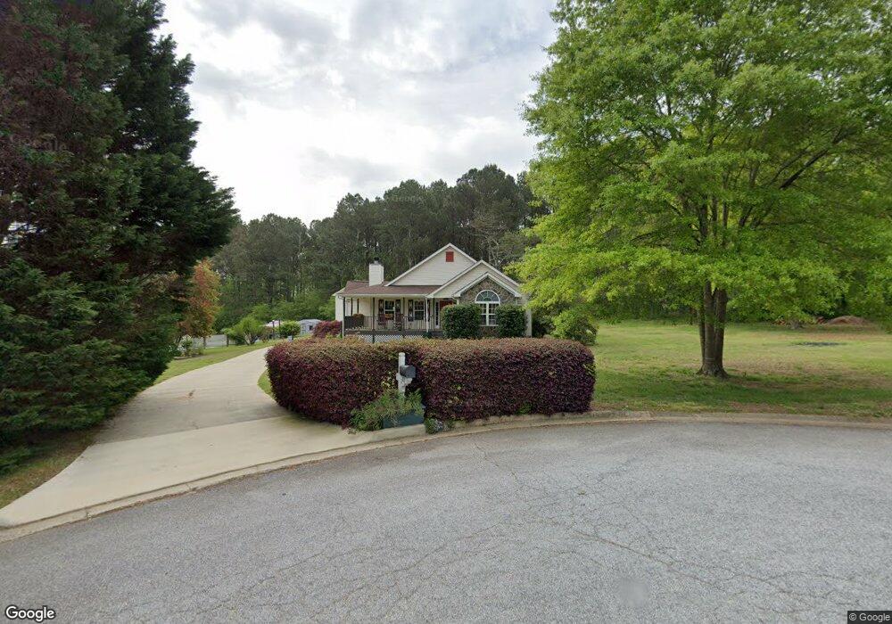
203 Cole Cir Unit 1 Bethlehem, GA 30620
Estimated Value: $389,000 - $452,731
3
Beds
2
Baths
2,579
Sq Ft
$162/Sq Ft
Est. Value
About This Home
This home is located at 203 Cole Cir Unit 1, Bethlehem, GA 30620 and is currently estimated at $417,683, approximately $161 per square foot. 203 Cole Cir Unit 1 is a home located in Barrow County with nearby schools including Yargo Elementary School, Haymon-Morris Middle School, and Apalachee High School.
Ownership History
Date
Name
Owned For
Owner Type
Purchase Details
Closed on
Sep 27, 2004
Sold by
Porter Lanny L and Porter Joanna
Bought by
Kutzner Kenneth J
Current Estimated Value
Home Financials for this Owner
Home Financials are based on the most recent Mortgage that was taken out on this home.
Original Mortgage
$156,000
Outstanding Balance
$77,155
Interest Rate
5.75%
Mortgage Type
New Conventional
Estimated Equity
$340,528
Purchase Details
Closed on
Nov 21, 1997
Sold by
Griffeth Bldrs
Bought by
Porter Lanny L and Porter Joanna F
Home Financials for this Owner
Home Financials are based on the most recent Mortgage that was taken out on this home.
Original Mortgage
$69,000
Interest Rate
7.38%
Mortgage Type
New Conventional
Purchase Details
Closed on
Dec 11, 1996
Sold by
G S Develoopment I C
Bought by
Griffeth Builders In
Purchase Details
Closed on
Jul 9, 1996
Bought by
G S Develoopment I C
Create a Home Valuation Report for This Property
The Home Valuation Report is an in-depth analysis detailing your home's value as well as a comparison with similar homes in the area
Home Values in the Area
Average Home Value in this Area
Purchase History
| Date | Buyer | Sale Price | Title Company |
|---|---|---|---|
| Kutzner Kenneth J | $195,000 | -- | |
| Porter Lanny L | $127,900 | -- | |
| Griffeth Builders In | $33,000 | -- | |
| G S Develoopment I C | $678,600 | -- |
Source: Public Records
Mortgage History
| Date | Status | Borrower | Loan Amount |
|---|---|---|---|
| Open | Kutzner Kenneth J | $156,000 | |
| Previous Owner | Porter Lanny L | $69,000 |
Source: Public Records
Tax History Compared to Growth
Tax History
| Year | Tax Paid | Tax Assessment Tax Assessment Total Assessment is a certain percentage of the fair market value that is determined by local assessors to be the total taxable value of land and additions on the property. | Land | Improvement |
|---|---|---|---|---|
| 2024 | $3,175 | $130,217 | $26,800 | $103,417 |
| 2023 | $2,763 | $130,617 | $26,800 | $103,817 |
| 2022 | $2,974 | $105,960 | $22,400 | $83,560 |
| 2021 | $2,952 | $99,560 | $16,000 | $83,560 |
| 2020 | $2,407 | $81,188 | $16,000 | $65,188 |
| 2019 | $2,448 | $81,188 | $16,000 | $65,188 |
| 2018 | $2,327 | $78,080 | $13,200 | $64,880 |
| 2017 | $1,956 | $67,189 | $13,200 | $53,989 |
| 2016 | $1,745 | $60,060 | $13,200 | $46,860 |
| 2015 | $1,776 | $60,820 | $13,200 | $47,620 |
| 2014 | $1,681 | $56,812 | $8,526 | $48,286 |
| 2013 | -- | $54,678 | $8,526 | $46,152 |
Source: Public Records
Map
Nearby Homes
- 303 Ron Dr
- 758 Clarence Edwards Rd
- 209 Angie Way
- 1111 Otis Dr
- 190 Lokeys Ln
- 1129 Loganville Hwy
- 0 Jb Owens Unit 7552902
- 0 Jb Owens Unit 7552891
- 0 Jb Owens Unit LOT 2 - 2.09 ACRES
- 0 Jb Owens Unit LOT 3 - 2.01 ACRES
- 1024 Lyndhurst Ln
- 575 Mackinaw Dr
- 236 Vision St
- 176 Market St
- 14 Smithwood Dr
- 720 Westbury Ct
- 1164 Otis Dr
- 738 Worth Ct
- 724 Westbury Dr
- 350 Punkin Junction Rd
- 197 Cole Cir Unit 1
- 200 Cole Cir
- 198 Cole Cir Unit 1
- 193 Cole Cir
- 194 Cole Cir
- 1489 Dillard Heights Dr Unit 37
- 1489 Dillard Heights Dr
- 1487 Dillard Heights Dr
- 189 Cole Cir Unit 1
- 1491 Dillard Heights Dr
- 1485 Dillard Heights Dr
- 190 Cole Cir
- 1483 Dillard Heights Dr
- 1481 Dillard Heights Dr
- 187 Cole Cir
- 1479 Dillard Heights Dr
- 188 Cole Cir
- 188 Cole Cir
- 183 Dillard Heights Dr
- 1477 Dillard Heights Dr