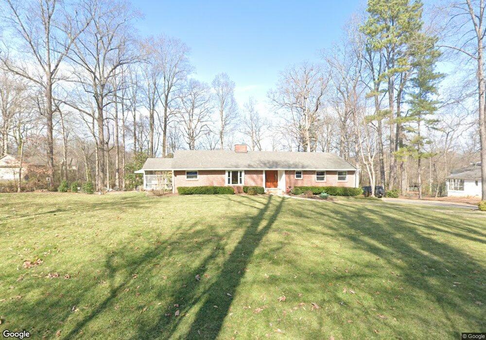
203 Duncan Dr Maryville, TN 37803
Estimated Value: $460,000 - $590,000
--
Bed
2
Baths
2,282
Sq Ft
$227/Sq Ft
Est. Value
About This Home
This home is located at 203 Duncan Dr, Maryville, TN 37803 and is currently estimated at $517,842, approximately $226 per square foot. 203 Duncan Dr is a home located in Blount County with nearby schools including Sam Houston Elementary School, Maryville Junior High School, and Coulter Grove Intermediate School.
Ownership History
Date
Name
Owned For
Owner Type
Purchase Details
Closed on
Feb 17, 1994
Sold by
Brassler Lisa
Bought by
Brassler Andrew
Current Estimated Value
Purchase Details
Closed on
Nov 20, 1992
Bought by
Brassler Andrew Beeson and Brassler Lisa D
Purchase Details
Closed on
Jan 4, 1988
Bought by
Brassler Andrew Beeson
Purchase Details
Closed on
Jan 17, 1952
Bought by
Brassler Harry L and Ila Rhea
Create a Home Valuation Report for This Property
The Home Valuation Report is an in-depth analysis detailing your home's value as well as a comparison with similar homes in the area
Home Values in the Area
Average Home Value in this Area
Purchase History
| Date | Buyer | Sale Price | Title Company |
|---|---|---|---|
| Brassler Andrew | -- | -- | |
| Brassler Andrew Beeson | -- | -- | |
| Brassler Andrew Beeson | $46,000 | -- | |
| Brassler Harry L | -- | -- |
Source: Public Records
Mortgage History
| Date | Status | Borrower | Loan Amount |
|---|---|---|---|
| Open | Brassler Harry L | $25,000 |
Source: Public Records
Tax History Compared to Growth
Tax History
| Year | Tax Paid | Tax Assessment Tax Assessment Total Assessment is a certain percentage of the fair market value that is determined by local assessors to be the total taxable value of land and additions on the property. | Land | Improvement |
|---|---|---|---|---|
| 2025 | -- | $109,875 | $0 | $0 |
| 2024 | $1,747 | $109,875 | $16,500 | $93,375 |
| 2023 | $1,747 | $109,875 | $16,500 | $93,375 |
| 2022 | $2,946 | $62,150 | $13,750 | $48,400 |
| 2021 | $2,946 | $62,150 | $13,750 | $48,400 |
| 2020 | $2,946 | $62,150 | $13,750 | $48,400 |
| 2019 | $2,946 | $62,150 | $13,750 | $48,400 |
| 2018 | $2,788 | $58,825 | $14,825 | $44,000 |
| 2017 | $2,788 | $58,825 | $14,825 | $44,000 |
| 2016 | $2,730 | $58,825 | $14,825 | $44,000 |
| 2015 | $2,541 | $58,825 | $14,825 | $44,000 |
| 2014 | $2,604 | $58,825 | $14,825 | $44,000 |
| 2013 | $2,604 | $60,275 | $0 | $0 |
Source: Public Records
Map
Nearby Homes
- 110 Broady Ln
- 1403 Broad Run Dr
- 1416 Broad Run Dr
- 1407 Wilkinson Pike
- 1401 Wilkinson Pike
- 241 Boardman Ave
- 402 Montvale Station Rd
- 406 Montvale Station Rd
- 1733 Forster St
- 1407 Montvale Rd
- 810 S Cedar St
- 1828 Wilkinson Pike
- 717 Cates St Unit 725
- 308 Ross Springs Dr
- 409 Melrose St
- 424 Ross Springs Dr
- 1305 Topside View Dr
- 1410 Carowinds Cir
- 2322 Chesterfield Dr
- 508 S Ruth St
- 205 Duncan Dr
- 201 Duncan Dr
- 206 Duncan Dr
- 118 Broady Meadow Cir
- 116 Broady Meadow Cir
- 207 Duncan Dr
- 109 Duncan Dr
- 114 Broady Meadow Cir
- 112 Broady Meadow Cir
- 110 Broady Meadow Cir
- 427 Broadmoor Dr
- 121 Broady Meadow Cir
- 117 Broady Meadow Cir
- 107 Duncan Dr
- 115 Broady Meadow Cir
- 119 Broady Meadow Cir
- 108 Broady Meadow Cir
- 113 Broady Meadow Cir
- 440 Broadmoor Dr
- 0 Lot 2 Meadows at Broady Place Unit 1118995