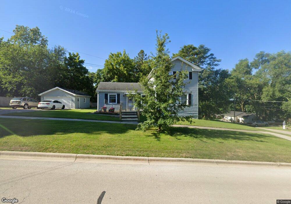
203 E 7th St Lockport, IL 60441
Estimated Value: $243,508 - $318,000
Studio
--
Bath
1,360
Sq Ft
$216/Sq Ft
Est. Value
About This Home
This home is located at 203 E 7th St, Lockport, IL 60441 and is currently estimated at $294,127, approximately $216 per square foot. 203 E 7th St is a home located in Will County with nearby schools including Milne Grove Elementary School, Kelvin Grove Jr High School, and Lockport Township High School East.
Ownership History
Date
Name
Owned For
Owner Type
Purchase Details
Closed on
Mar 22, 2024
Sold by
Johnson Nancy G and Johnson Robert S
Bought by
Nancy G Johnson Revocable Individual Trust and Johnson
Current Estimated Value
Purchase Details
Closed on
Jan 8, 1997
Sold by
Kiely Gerard M and Kiely Emma E
Bought by
Johnson Michael R
Home Financials for this Owner
Home Financials are based on the most recent Mortgage that was taken out on this home.
Original Mortgage
$84,550
Interest Rate
7.58%
Create a Home Valuation Report for This Property
The Home Valuation Report is an in-depth analysis detailing your home's value as well as a comparison with similar homes in the area
Home Values in the Area
Average Home Value in this Area
Purchase History
| Date | Buyer | Sale Price | Title Company |
|---|---|---|---|
| Nancy G Johnson Revocable Individual Trust | -- | None Listed On Document | |
| Johnson Michael R | -- | -- |
Source: Public Records
Mortgage History
| Date | Status | Borrower | Loan Amount |
|---|---|---|---|
| Previous Owner | Johnson Michael R | $84,550 |
Source: Public Records
Tax History
| Year | Tax Paid | Tax Assessment Tax Assessment Total Assessment is a certain percentage of the fair market value that is determined by local assessors to be the total taxable value of land and additions on the property. | Land | Improvement |
|---|---|---|---|---|
| 2024 | $4,898 | $73,050 | $20,958 | $52,092 |
| 2023 | $4,898 | $65,580 | $18,815 | $46,765 |
| 2022 | $4,619 | $61,173 | $17,550 | $43,623 |
| 2021 | $4,333 | $57,488 | $16,493 | $40,995 |
| 2020 | $4,198 | $55,598 | $15,951 | $39,647 |
| 2019 | $3,949 | $52,699 | $15,119 | $37,580 |
| 2018 | $3,659 | $48,717 | $13,976 | $34,741 |
| 2017 | $3,301 | $44,222 | $12,687 | $31,535 |
| 2016 | $3,037 | $40,793 | $11,703 | $29,090 |
| 2015 | $2,776 | $37,536 | $10,407 | $27,129 |
| 2014 | $2,776 | $36,093 | $10,007 | $26,086 |
| 2013 | $2,776 | $36,829 | $10,211 | $26,618 |
Source: Public Records
Map
Nearby Homes
- 519 S Washington St
- 501 S Hamilton St
- 1016 S State St
- 500 Clinton St
- 502 W 7th St
- 1100 S State St
- 1120 S Hamilton St
- 1200 S State St
- 107 S State St
- 120 N State St
- 202 E 14th St
- 118 N State St
- 1015 Grandview Ave
- 417 Thornton St
- 1509 East St Unit ST1511
- 1505 East St
- 1513 Connor Ave
- 136 W 18th St
- 1330 Lacoma Ct
- 1041 Ashley Ct S Unit 2D
Your Personal Tour Guide
Ask me questions while you tour the home.