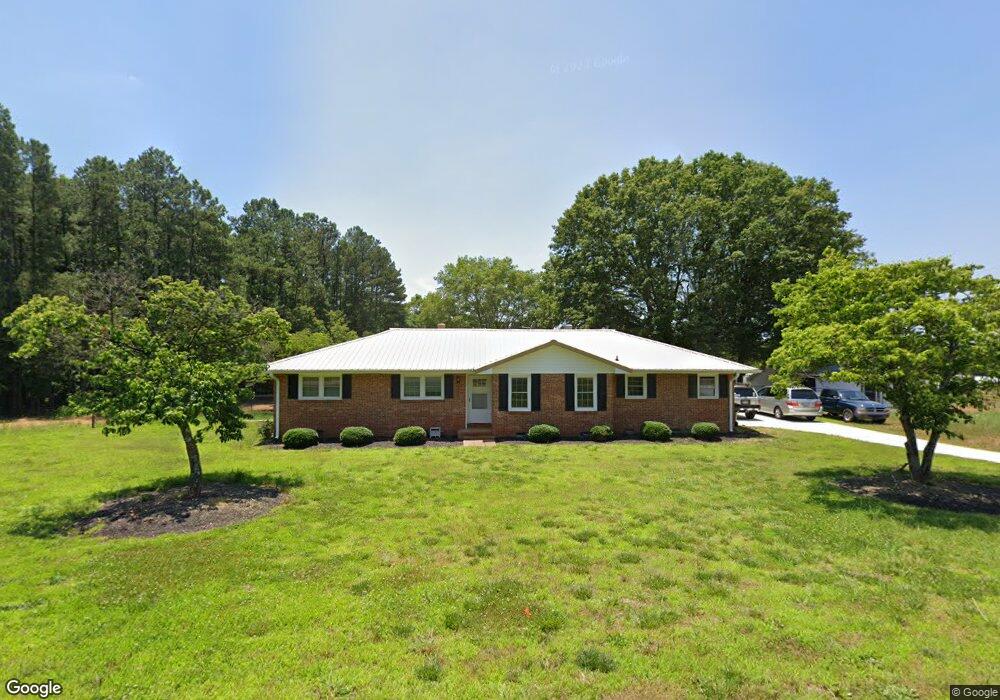
203 Gordon Cir Anderson, SC 29626
Estimated Value: $172,000 - $281,000
3
Beds
2
Baths
1,600
Sq Ft
$154/Sq Ft
Est. Value
About This Home
This home is located at 203 Gordon Cir, Anderson, SC 29626 and is currently estimated at $246,337, approximately $153 per square foot. 203 Gordon Cir is a home located in Anderson County with nearby schools including Varennes Elementary School, Robert Anderson Middle School, and Westside High School.
Ownership History
Date
Name
Owned For
Owner Type
Purchase Details
Closed on
May 13, 2022
Sold by
Brady Patricia Standard
Bought by
Broome Hunter
Current Estimated Value
Purchase Details
Closed on
Apr 7, 2022
Sold by
Standard Casey Dean
Bought by
Broome Hunter
Purchase Details
Closed on
Aug 1, 2019
Sold by
Standard Sr Christopher David and Estate Of Charles Danny Standa
Bought by
Standard Casey Dean
Purchase Details
Closed on
Nov 16, 2007
Sold by
Clark Ethel and Herndon Sharon Dianne Standard
Bought by
Standard Charles Danny
Create a Home Valuation Report for This Property
The Home Valuation Report is an in-depth analysis detailing your home's value as well as a comparison with similar homes in the area
Home Values in the Area
Average Home Value in this Area
Purchase History
| Date | Buyer | Sale Price | Title Company |
|---|---|---|---|
| Broome Hunter | -- | None Listed On Document | |
| Broome Hunter | $99,500 | None Listed On Document | |
| Standard Casey Dean | -- | None Available | |
| Standard Charles Danny | $83,044 | Attorney |
Source: Public Records
Tax History Compared to Growth
Tax History
| Year | Tax Paid | Tax Assessment Tax Assessment Total Assessment is a certain percentage of the fair market value that is determined by local assessors to be the total taxable value of land and additions on the property. | Land | Improvement |
|---|---|---|---|---|
| 2024 | $1,170 | $9,530 | $600 | $8,930 |
| 2023 | $1,170 | $9,530 | $600 | $8,930 |
| 2022 | $660 | $5,250 | $600 | $4,650 |
| 2021 | $611 | $4,720 | $600 | $4,120 |
| 2020 | $604 | $4,720 | $600 | $4,120 |
| 2019 | $2,341 | $7,080 | $900 | $6,180 |
| 2018 | $353 | $4,720 | $600 | $4,120 |
| 2017 | -- | $4,720 | $600 | $4,120 |
| 2016 | $585 | $4,460 | $560 | $3,900 |
| 2015 | $597 | $4,460 | $560 | $3,900 |
| 2014 | $592 | $4,460 | $560 | $3,900 |
Source: Public Records
Map
Nearby Homes
- 3308 New Pond Rd
- 505 Lewis St
- 431 Lewis St
- 00 Hwy 28 Bypass New Pond Rd
- 112 Flowe Rd
- 612 Martha Dr
- AUBURN Plan at Shockley Bend
- BENNINGTON Plan at Shockley Bend
- BERKSHIRE Plan at Shockley Bend
- 114 Hillcrest Cir Unit A
- 114 Hillcrest Cir
- 222 Hillcrest Cir
- 312 W Roosevelt Dr
- 636 Jasmin Dr
- 719 Dora Dr
- 46 S Lyons St
- 701 Delia St
- 701 Delia St Unit B
- 701 Delia St Unit A
- 110 Dixie Dr
- 202 Gordon Cir
- 206 Gordon Cir
- 207 Gordon Cir
- 208 Gordon Cir
- 1220 Highway 29 S
- 209 Gordon Cir
- 1202 Highway 29 S
- 300 Renee Way
- 1300 Highway 29 S
- 305 Gordon Cir
- 301 Renee Way
- 302 Renee Way
- 302 Renee Way
- 1006 Gordon St
- 1201 Highway 29 S
- 303 Renee Way
- 1003 Ferry St
- 1101 Highway 29 S
- 1004 Gordon St
- 305 Renee Way