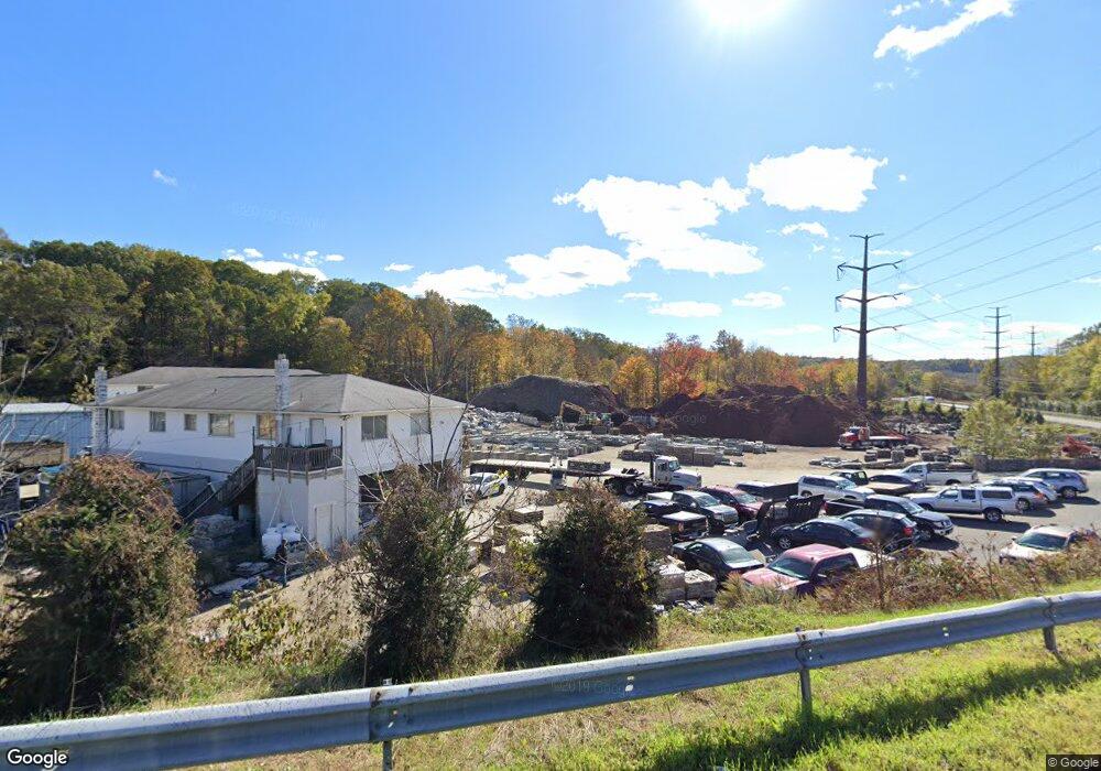
203 Grays Bridge Rd Brookfield, CT 06804
Estimated Value: $1,464,927
--
Bed
--
Bath
--
Sq Ft
6.05
Acres
About This Home
This home is located at 203 Grays Bridge Rd, Brookfield, CT 06804 and is currently estimated at $1,464,927. 203 Grays Bridge Rd is a home located in Fairfield County with nearby schools including Center Elementary School, Whisconier Middle School, and Rio Mesa High School.
Ownership History
Date
Name
Owned For
Owner Type
Purchase Details
Closed on
Dec 7, 2020
Sold by
Obtuse Rocks Dev Llc
Bought by
Southard Brendon
Current Estimated Value
Purchase Details
Closed on
Jun 29, 2010
Sold by
Bridge 203 Grays
Bought by
Grays Bridge Dev
Purchase Details
Closed on
Nov 30, 2009
Sold by
Triple Re
Bought by
203 Grays Bridge Llc
Create a Home Valuation Report for This Property
The Home Valuation Report is an in-depth analysis detailing your home's value as well as a comparison with similar homes in the area
Home Values in the Area
Average Home Value in this Area
Purchase History
| Date | Buyer | Sale Price | Title Company |
|---|---|---|---|
| Southard Brendon | -- | None Available | |
| Southard Brendon | -- | None Available | |
| Grays Bridge Dev | $800,000 | -- | |
| Grays Bridge Dev | $800,000 | -- | |
| 203 Grays Bridge Llc | $534,000 | -- | |
| 203 Grays Bridge Llc | $534,000 | -- |
Source: Public Records
Mortgage History
| Date | Status | Borrower | Loan Amount |
|---|---|---|---|
| Previous Owner | 203 Grays Bridge Llc | $750,000 | |
| Previous Owner | 203 Grays Bridge Llc | $750,000 | |
| Previous Owner | 203 Grays Bridge Llc | $60,000 |
Source: Public Records
Tax History Compared to Growth
Tax History
| Year | Tax Paid | Tax Assessment Tax Assessment Total Assessment is a certain percentage of the fair market value that is determined by local assessors to be the total taxable value of land and additions on the property. | Land | Improvement |
|---|---|---|---|---|
| 2025 | $22,425 | $775,160 | $420,290 | $354,870 |
| 2024 | $21,627 | $775,170 | $420,300 | $354,870 |
| 2023 | $20,821 | $775,170 | $420,300 | $354,870 |
| 2022 | $20,061 | $775,170 | $420,300 | $354,870 |
| 2021 | $24,898 | $827,190 | $421,740 | $405,450 |
| 2020 | $24,526 | $827,190 | $421,740 | $405,450 |
| 2019 | $24,104 | $827,190 | $421,740 | $405,450 |
| 2018 | $23,443 | $827,190 | $421,740 | $405,450 |
| 2017 | $9,330 | $827,190 | $421,740 | $405,450 |
| 2016 | $23,036 | $872,580 | $460,890 | $411,690 |
| 2015 | $21,975 | $855,040 | $460,890 | $394,150 |
| 2014 | $21,975 | $855,040 | $460,890 | $394,150 |
Source: Public Records
Map
Nearby Homes
- 20 Chatham Ct Unit 20
- 2 Old Grays Bridge Rd
- 27 Rollingwood Dr
- 20 Andover Ct Unit 20
- 46 W Whisconier Rd
- 112 A Stony Hill Rd
- 5 Woodland Hills Terrace
- 12 Oak Crest Dr
- 23 Sunset Hill Rd
- 2 Autumn's Way
- 4 Pond View Dr
- 24 Westview Ln Unit 24
- 140 Whisconier Rd
- 2304 Pinnacle Way
- 4001 Heartwood Ln Unit 4001
- 7 Silversmith Dr
- 2106 Pinnacle Way
- 11 Bramble Way
- 23 Bramble Way Unit Homesite 67
- 33 Bramble Way Unit 62
- 88 Stony Hill Rd
- 86 Stony Hill Rd
- 167 Vale Rd
- 90 Stony Hill Rd
- 84 Stony Hill Rd
- 85 Stony Hill Rd
- 22 Stony Brook Rd
- 82 Stony Hill Rd
- 83 Stony Hill Rd
- 20 Stony Brook Rd
- 80 Stony Hill Rd
- 89 Stony Hill Rd
- 18 Stony Brook Rd
- 16 Stony Brook Rd
- 242 Grays Bridge Rd
- 14 Stony Brook Rd
- 81 Stony Hill Rd
- 78 Stony Hill Rd
- 12 Stony Brook Rd
- 21 Stony Brook Rd