Estimated Value: $114,528 - $196,000
2
Beds
1
Bath
988
Sq Ft
$146/Sq Ft
Est. Value
About This Home
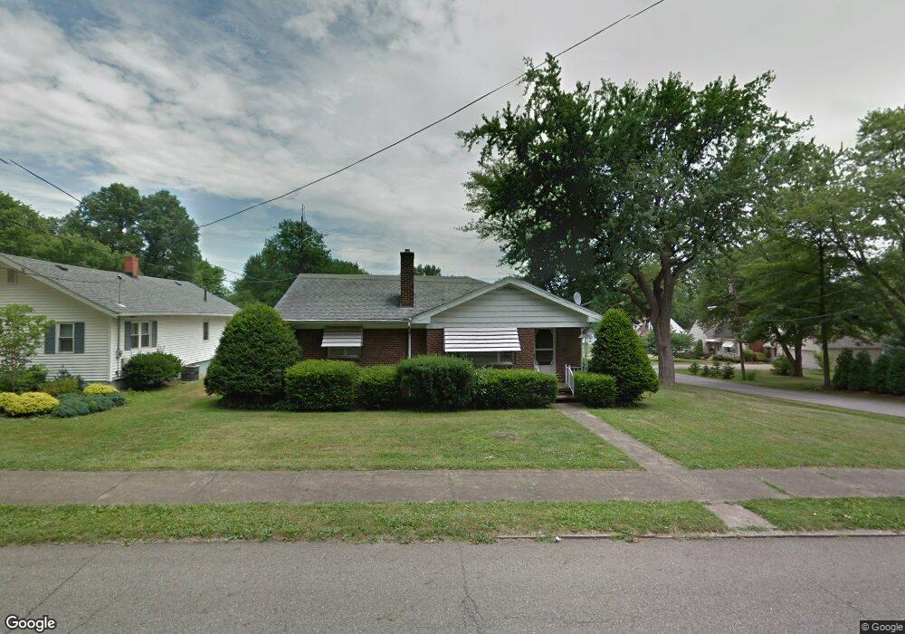
This home is located at 203 Hogarth Ave, Niles, OH 44446 and is currently estimated at $144,132, approximately $145 per square foot. 203 Hogarth Ave is a home located in Trumbull County with nearby schools including Niles Primary School, Niles Intermediate School, and Niles Middle School.
Ownership History
Date
Name
Owned For
Owner Type
Purchase Details
Closed on
May 6, 2014
Sold by
Joseph Fred E
Bought by
Joseph Anthony A
Current Estimated Value
Purchase Details
Closed on
Apr 28, 1999
Sold by
Barber Bernice I
Bought by
Joseph Fred E
Home Financials for this Owner
Home Financials are based on the most recent Mortgage that was taken out on this home.
Original Mortgage
$64,000
Outstanding Balance
$16,550
Interest Rate
7.05%
Estimated Equity
$127,582
Purchase Details
Closed on
Jan 1, 1990
Bought by
Bernice I Barber
Create a Home Valuation Report for This Property
The Home Valuation Report is an in-depth analysis detailing your home's value as well as a comparison with similar homes in the area
Home Values in the Area
Average Home Value in this Area
Purchase History
| Date | Buyer | Sale Price | Title Company |
|---|---|---|---|
| Joseph Anthony A | -- | None Available | |
| Joseph Fred E | $80,500 | -- | |
| Bernice I Barber | -- | -- |
Source: Public Records
Mortgage History
| Date | Status | Borrower | Loan Amount |
|---|---|---|---|
| Open | Joseph Fred E | $64,000 |
Source: Public Records
Tax History Compared to Growth
Tax History
| Year | Tax Paid | Tax Assessment Tax Assessment Total Assessment is a certain percentage of the fair market value that is determined by local assessors to be the total taxable value of land and additions on the property. | Land | Improvement |
|---|---|---|---|---|
| 2024 | $1,114 | $26,710 | $4,240 | $22,470 |
| 2023 | $1,114 | $26,710 | $4,240 | $22,470 |
| 2022 | $982 | $20,100 | $4,240 | $15,860 |
| 2021 | $1,031 | $20,100 | $4,240 | $15,860 |
| 2020 | $1,040 | $20,100 | $4,240 | $15,860 |
| 2019 | $1,093 | $20,100 | $4,240 | $15,860 |
| 2018 | $1,090 | $20,100 | $4,240 | $15,860 |
| 2017 | $1,084 | $20,100 | $4,240 | $15,860 |
| 2016 | $648 | $20,100 | $4,240 | $15,860 |
| 2015 | $1,112 | $20,100 | $4,240 | $15,860 |
| 2014 | $613 | $20,100 | $4,240 | $15,860 |
| 2013 | $695 | $22,330 | $4,270 | $18,060 |
Source: Public Records
Map
Nearby Homes
- 21 Summit Ave
- 364 Hogarth Ave
- 340 Mcevoy Ct
- 352 N Rhodes Ave
- 126 S Rhodes Ave
- 29 S Bentley Ave
- 839 Robbins Ave
- 404 N Bentley Ave
- 311 High Ave
- 17 Belmont Ave
- 39 Belmont Ave
- 719 Robbins Ave
- 812 Hartzell Ave
- 820 Hartzell Ave
- 733 N Bentley Ave
- 816 Fenton St
- 737 N Bentley Ave
- 0 Hughes St SE
- 4,6,8 Lafayette
- 504 High Ave
- 207 Hogarth Ave
- 1332 Clark St
- 121 Hogarth Ave
- 1315 Youll St Unit 1319
- 1323 Youll St
- 1329 Youll St
- 200 Hogarth Ave
- 132 Hogarth Ave
- 1331 Clark St
- 124 Hogarth Ave
- 1335 Youll St
- 240 Hogarth Ave
- 1341 Clark St
- 116 Hogarth Ave
- 1346 Clark St
- 1345 Youll St
- 1328 Kearney St
- 1328 Kearney St
- 1334 Kearney St
- 303 Hogarth Ave