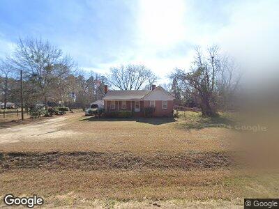
203 Keas Old Mill Pond Rd Adrian, GA 31002
Estimated Value: $101,600 - $161,000
3
Beds
1
Bath
1,536
Sq Ft
$86/Sq Ft
Est. Value
About This Home
This home is located at 203 Keas Old Mill Pond Rd, Adrian, GA 31002 and is currently estimated at $132,150, approximately $86 per square foot. 203 Keas Old Mill Pond Rd is a home with nearby schools including Swainsboro High School.
Ownership History
Date
Name
Owned For
Owner Type
Purchase Details
Closed on
Aug 24, 2011
Sold by
Alfonso Debbie Rutherford and Rutherford Debbie
Bought by
Rutherford Nathan
Current Estimated Value
Purchase Details
Closed on
Sep 27, 1994
Bought by
Sumner Dorothy Gilli
Create a Home Valuation Report for This Property
The Home Valuation Report is an in-depth analysis detailing your home's value as well as a comparison with similar homes in the area
Home Values in the Area
Average Home Value in this Area
Purchase History
| Date | Buyer | Sale Price | Title Company |
|---|---|---|---|
| Rutherford Nathan | -- | -- | |
| Sumner Dorothy Gilli | -- | -- |
Source: Public Records
Mortgage History
| Date | Status | Borrower | Loan Amount |
|---|---|---|---|
| Open | Rutherford Nathan | $32,500 | |
| Closed | Rutherford Nathan | $12,000 | |
| Closed | Rutherford Nathan | $45,000 |
Source: Public Records
Tax History Compared to Growth
Tax History
| Year | Tax Paid | Tax Assessment Tax Assessment Total Assessment is a certain percentage of the fair market value that is determined by local assessors to be the total taxable value of land and additions on the property. | Land | Improvement |
|---|---|---|---|---|
| 2024 | $776 | $28,489 | $628 | $27,861 |
| 2023 | $292 | $28,651 | $628 | $28,023 |
| 2022 | $684 | $26,142 | $628 | $25,514 |
| 2021 | $707 | $24,489 | $546 | $23,943 |
| 2020 | $691 | $22,644 | $1,224 | $21,420 |
| 2019 | $687 | $22,644 | $1,224 | $21,420 |
| 2018 | $651 | $22,644 | $1,224 | $21,420 |
| 2017 | $614 | $21,296 | $1,224 | $20,072 |
| 2016 | $614 | $21,296 | $1,224 | $20,072 |
| 2015 | -- | $21,685 | $1,613 | $20,072 |
| 2014 | -- | $21,406 | $1,613 | $19,793 |
| 2013 | -- | $21,248 | $1,612 | $19,635 |
Source: Public Records
Map
Nearby Homes
- 0 Halls Bridge Rd Unit 10471670
- 126 John Deere Rd
- 0000 Hwy 171
- LOT 6 Kemp Rd
- LOT 2 Kemp Rd
- LOT 5 Coleman Chapel Rd
- LOT 4 Coleman Chapel Rd
- LOT 3 Coleman Chapel Rd
- 22 Smith St
- 5 E Main St
- 317 E Main St
- 311 Church St
- 210 W College St
- 339 Gwenda St
- 97 Meadow Rd
- 57 Georgia Ave
- 1085 Kelly St
- 87 Georgia Ave
- 82 Truckers Trail
- 0 Buckhorn Trail Unit 10434259
- 203 Keas Old Mill Pond Rd
- 207 Keas Old Mill Pond Rd
- 106 Horton St
- 112 Horton St
- 117 Horton St
- 307 Norristown Main St
- 116 Horton St
- 211 Horton St
- 208 Horton St
- 311 Johnson St
- RT 1 Route 1
- 212 Horton St
- 310 River St
- 726 Us Highway 221 S
- 744 Us Highway 221 S
- U S Highway 221 S
- 502 Johnson St
- 744 U S 221
- 748 Us Highway 221 S
- 414 River St