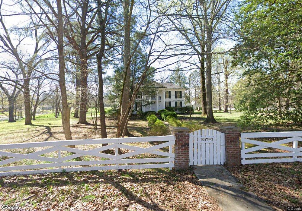
203 Maple St Somerville, TN 38068
Estimated Value: $361,000 - $498,984
Studio
3
Baths
5,477
Sq Ft
$79/Sq Ft
Est. Value
About This Home
This home is located at 203 Maple St, Somerville, TN 38068 and is currently estimated at $429,992, approximately $78 per square foot. 203 Maple St is a home located in Fayette County with nearby schools including Buckley-Carpenter Elementary School, East Junior High School, and Fayette Ware Comprehensive High School.
Ownership History
Date
Name
Owned For
Owner Type
Purchase Details
Closed on
Nov 17, 2021
Sold by
Rhea Margaret A and Rhea Reuben
Bought by
Woodburn Farms
Current Estimated Value
Purchase Details
Closed on
Oct 30, 2020
Sold by
Rhea Reuben S and Rhea Gordon Matthew
Bought by
Reuben And Margaret Rhea Living Trust
Purchase Details
Closed on
Dec 17, 2012
Sold by
Rhea Reuben S Jr Trustee
Bought by
Rhea Reuben S Jr Trustee
Purchase Details
Closed on
Jan 16, 2010
Sold by
Rhea Reuben S
Bought by
Rhea Suzanne M
Purchase Details
Closed on
Jan 1, 1967
Bought by
Rhea Reuben S
Create a Home Valuation Report for This Property
The Home Valuation Report is an in-depth analysis detailing your home's value as well as a comparison with similar homes in the area
Home Values in the Area
Average Home Value in this Area
Purchase History
| Date | Buyer | Sale Price | Title Company |
|---|---|---|---|
| Woodburn Farms | -- | None Available | |
| Reuben And Margaret Rhea Living Trust | -- | None Available | |
| Rhea Reuben S Jr Trustee | -- | -- | |
| Rhea Suzanne M | -- | -- | |
| Rhea Suzanne M | -- | -- | |
| Rhea Suzanne M | -- | -- | |
| Rhea Reuben S Suc | -- | -- | |
| Rhea Reuben S | -- | -- |
Source: Public Records
Tax History
| Year | Tax Paid | Tax Assessment Tax Assessment Total Assessment is a certain percentage of the fair market value that is determined by local assessors to be the total taxable value of land and additions on the property. | Land | Improvement |
|---|---|---|---|---|
| 2025 | $1,243 | $150,775 | $36,750 | $114,025 |
| 2024 | $1,243 | $105,150 | $29,925 | $75,225 |
| 2023 | $2,716 | $105,150 | $0 | $0 |
| 2022 | $1,979 | $105,150 | $29,925 | $75,225 |
| 2021 | $1,979 | $105,150 | $29,925 | $75,225 |
| 2020 | $1,769 | $105,150 | $29,925 | $75,225 |
| 2019 | $1,769 | $80,900 | $27,200 | $53,700 |
| 2018 | $1,769 | $80,900 | $27,200 | $53,700 |
| 2017 | $1,769 | $80,900 | $27,200 | $53,700 |
| 2016 | $1,925 | $83,100 | $27,200 | $55,900 |
| 2015 | $1,925 | $83,100 | $27,200 | $55,900 |
| 2014 | $1,925 | $83,100 | $27,200 | $55,900 |
Source: Public Records
Map
Nearby Homes
- 706 Charleston St
- 12370 S Main St
- 804 Lynn St
- 307 Church St
- 110 Rolling Oaks Dr
- 116 W Marginal St
- 306 Old Jernigan Rd
- 0 W Marginal St
- 126 Rolling Oaks Dr
- 00000 Hwy 64 Hwy
- 0000 U S Highway 64
- 0 Hwy 76 Hwy Unit 10199229
- 0 U S Highway 64 Unit 10210145
- 0 Kay Ln
- 85 Cedar Hill Cove
- 150 Kay Ln
- 115 Cedar Hill Cove
- 460 Woodbridge Rd
- 315 Deerfield Cove
- 11560 S Main St
- 204 Maple St
- 612 S Somerville St
- 202 Maple St
- 708 S Somerville St
- 610 S Somerville St
- 705 S Somerville St
- 609 Charleston St
- 701 S Somerville St
- 300 Jones St
- 608 S Somerville St
- 12445 S Main St
- 613 S Somerville St
- 709 S Somerville St
- 612 Charleston St
- 12415 S Main St
- 606 S Somerville St
- 710 Charleston St
- 12455 S Main St
- 605 Charleston St
- 12465 S Main St
Your Personal Tour Guide
Ask me questions while you tour the home.