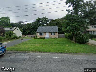
203 Mark Tree Rd Centereach, NY 11720
Centereach NeighborhoodEstimated Value: $481,000 - $497,967
2
Beds
1
Bath
1,224
Sq Ft
$400/Sq Ft
Est. Value
About This Home
This home is located at 203 Mark Tree Rd, Centereach, NY 11720 and is currently estimated at $489,484, approximately $399 per square foot. 203 Mark Tree Rd is a home located in Suffolk County with nearby schools including Our Savior New American School.
Ownership History
Date
Name
Owned For
Owner Type
Purchase Details
Closed on
Aug 19, 2005
Current Estimated Value
Purchase Details
Closed on
Dec 10, 2002
Sold by
Oliveros Jamie
Bought by
Oliveros William and Oliveros Luis E
Home Financials for this Owner
Home Financials are based on the most recent Mortgage that was taken out on this home.
Original Mortgage
$209,000
Outstanding Balance
$98,737
Interest Rate
6.16%
Mortgage Type
Purchase Money Mortgage
Estimated Equity
$359,904
Purchase Details
Closed on
Oct 25, 1999
Sold by
Delarosa Michael and Delarosa Charlotte A
Bought by
Oliveros Jaime
Home Financials for this Owner
Home Financials are based on the most recent Mortgage that was taken out on this home.
Original Mortgage
$132,904
Interest Rate
7.73%
Mortgage Type
FHA
Purchase Details
Closed on
Nov 3, 1995
Sold by
Cass Drew and Cass Raymond
Bought by
Delarosa Michael and Delarosa Charlotte A
Create a Home Valuation Report for This Property
The Home Valuation Report is an in-depth analysis detailing your home's value as well as a comparison with similar homes in the area
Home Values in the Area
Average Home Value in this Area
Purchase History
| Date | Buyer | Sale Price | Title Company |
|---|---|---|---|
| -- | -- | -- | |
| Oliveros William | $220,000 | Commonwealth Land Title Ins | |
| Oliveros Jaime | $134,000 | Commonwealth Land Title Ins | |
| Delarosa Michael | $89,000 | First American Title Ins Co |
Source: Public Records
Mortgage History
| Date | Status | Borrower | Loan Amount |
|---|---|---|---|
| Open | Oliveros William | $209,000 | |
| Closed | Oliveros Jamie | $146,667 | |
| Closed | Oliveros Jaime | $132,904 |
Source: Public Records
Tax History Compared to Growth
Tax History
| Year | Tax Paid | Tax Assessment Tax Assessment Total Assessment is a certain percentage of the fair market value that is determined by local assessors to be the total taxable value of land and additions on the property. | Land | Improvement |
|---|---|---|---|---|
| 2023 | $6,636 | $1,700 | $150 | $1,550 |
| 2022 | $5,778 | $1,700 | $150 | $1,550 |
| 2021 | $5,778 | $1,700 | $150 | $1,550 |
| 2020 | $5,941 | $1,700 | $150 | $1,550 |
| 2019 | $5,941 | $0 | $0 | $0 |
| 2018 | $5,585 | $1,700 | $150 | $1,550 |
| 2017 | $5,585 | $1,700 | $150 | $1,550 |
| 2016 | $5,581 | $1,700 | $150 | $1,550 |
| 2015 | -- | $1,700 | $150 | $1,550 |
| 2014 | -- | $1,700 | $150 | $1,550 |
Source: Public Records
Map
Nearby Homes
- 203 Mark Tree Rd
- 201 Mark Tree Rd
- 199 Mark Tree Rd
- 12 Michael Ct
- 202 Mark Tree Rd
- 197 Mark Tree Rd
- 204 Mark Tree Rd
- 200 Mark Tree Rd
- 206 Mark Tree Rd
- 198 Stanley Dr
- 11 Michael Ct
- 198 Mark Tree Rd
- 10 Michael Ct
- 196 Stanley Dr
- 195 Mark Tree Rd
- 208 Mark Tree Rd
- 196 Mark Tree Rd
- 194 Stanley Dr
- 31 Sunset Dr
- 33 Sunset Dr