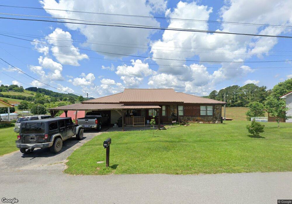
203 Snodgrass Rd New Tazewell, TN 37825
Estimated Value: $215,109 - $276,000
2
Beds
2
Baths
1,844
Sq Ft
$130/Sq Ft
Est. Value
About This Home
This home is located at 203 Snodgrass Rd, New Tazewell, TN 37825 and is currently estimated at $240,527, approximately $130 per square foot. 203 Snodgrass Rd is a home located in Claiborne County with nearby schools including Heriage Christian Academy.
Ownership History
Date
Name
Owned For
Owner Type
Purchase Details
Closed on
May 15, 2024
Sold by
Lyons James Robert
Bought by
Lyons James Robert
Current Estimated Value
Purchase Details
Closed on
Jun 19, 2012
Sold by
Anderson Joan S
Bought by
Lyons James R and Lyons Kathy
Home Financials for this Owner
Home Financials are based on the most recent Mortgage that was taken out on this home.
Original Mortgage
$107,432
Interest Rate
3.79%
Mortgage Type
VA
Purchase Details
Closed on
Jul 12, 2011
Sold by
Federal Home Loan Mortgage Corporation
Bought by
Anderson Joan S
Home Financials for this Owner
Home Financials are based on the most recent Mortgage that was taken out on this home.
Original Mortgage
$75,000
Interest Rate
4.62%
Mortgage Type
Commercial
Purchase Details
Closed on
Jan 21, 2011
Sold by
Scarboro Robert P
Bought by
Federal Home Loan Mortgage Corporation
Purchase Details
Closed on
Nov 29, 2007
Sold by
Williams Russell
Bought by
Scarboro Robert P
Home Financials for this Owner
Home Financials are based on the most recent Mortgage that was taken out on this home.
Original Mortgage
$102,100
Interest Rate
6.22%
Purchase Details
Closed on
Oct 13, 2006
Sold by
Deutsche Bank National Tru
Bought by
Williams Russell
Purchase Details
Closed on
Mar 23, 2005
Sold by
Hubbard Brian Kenneth
Bought by
Parker John T
Home Financials for this Owner
Home Financials are based on the most recent Mortgage that was taken out on this home.
Original Mortgage
$86,000
Interest Rate
5.57%
Purchase Details
Closed on
Mar 21, 2005
Sold by
Hubbard Brian Keith
Bought by
Parker John T
Home Financials for this Owner
Home Financials are based on the most recent Mortgage that was taken out on this home.
Original Mortgage
$86,000
Interest Rate
5.57%
Purchase Details
Closed on
Dec 7, 1998
Sold by
Hubbard Brian Keith
Bought by
Williams Ronnie
Purchase Details
Closed on
Jul 1, 1994
Sold by
Allen Glenn
Bought by
Gubbard Brian
Purchase Details
Closed on
Apr 6, 1993
Bought by
Allen Glenn
Purchase Details
Closed on
Jan 1, 1984
Bought by
Allen Glenn and Allen Phyllis
Create a Home Valuation Report for This Property
The Home Valuation Report is an in-depth analysis detailing your home's value as well as a comparison with similar homes in the area
Home Values in the Area
Average Home Value in this Area
Purchase History
| Date | Buyer | Sale Price | Title Company |
|---|---|---|---|
| Lyons James Robert | -- | None Listed On Document | |
| Lyons James R | $104,000 | -- | |
| Anderson Joan S | $75,000 | -- | |
| Federal Home Loan Mortgage Corporation | $116,891 | -- | |
| Scarboro Robert P | $107,900 | -- | |
| Williams Russell | $64,000 | -- | |
| Parker John T | $86,000 | -- | |
| Parker John T | $86,000 | -- | |
| Williams Ronnie | $13,750 | -- | |
| Gubbard Brian | -- | -- | |
| Allen Glenn | -- | -- | |
| Allen Glenn | -- | -- |
Source: Public Records
Mortgage History
| Date | Status | Borrower | Loan Amount |
|---|---|---|---|
| Previous Owner | Lyons James R | $107,432 | |
| Previous Owner | Anderson Joan S | $75,000 | |
| Previous Owner | Allen Glenn | $102,100 | |
| Previous Owner | Allen Glenn | $86,000 |
Source: Public Records
Tax History Compared to Growth
Tax History
| Year | Tax Paid | Tax Assessment Tax Assessment Total Assessment is a certain percentage of the fair market value that is determined by local assessors to be the total taxable value of land and additions on the property. | Land | Improvement |
|---|---|---|---|---|
| 2024 | $666 | $28,450 | $2,750 | $25,700 |
| 2023 | $666 | $28,450 | $2,750 | $25,700 |
| 2022 | $569 | $28,450 | $2,750 | $25,700 |
| 2021 | $506 | $19,625 | $2,275 | $17,350 |
| 2020 | $506 | $19,625 | $2,275 | $17,350 |
| 2019 | $506 | $19,625 | $2,275 | $17,350 |
| 2018 | $506 | $19,625 | $2,275 | $17,350 |
| 2017 | $506 | $19,625 | $2,275 | $17,350 |
| 2016 | $542 | $21,025 | $2,275 | $18,750 |
| 2015 | $521 | $21,025 | $2,275 | $18,750 |
| 2014 | $521 | $21,036 | $0 | $0 |
Source: Public Records
Map
Nearby Homes
- 510 S Broad St (Commercial 3 9 Acre)
- 1029 Rowe St
- 207 Nunn St
- Lot 492 Citron
- 1210 Rowe St
- 1264 Rowe St
- 402 S Broad St ( 53 Acre)
- 196 Poplar Dr
- 170 Mallory Dr
- 117 Mallory Dr
- Lot 1 Harmon Rd
- 323 Harmon Rd
- 120 Ruby Ln
- 0 Harmon Rd
- 106 Walnut St
- 0 Harmon Cir
- Lot 2 Smokey Quartz Blvd
- 130 Main St
- 352 Rutherford Dr
- 202 N Broad St
- 205 Snodgrass Rd
- 201 Snodgrass Rd
- 105 Snodgrass Rd
- 301 Snodgrass Rd
- 103 Snodgrass Rd
- 101 Snodgrass Rd
- 806 Old Highway 33
- 307 Snodgrass Rd
- 0 S Hwy 33 and Snodgrass Unit 635763
- 808 Old Highway 33
- 745 Old Highway 33
- 115 El Sara Dr
- 0 Hwy 33 and Snoodgrass Ro Unit 738747
- 816 Old Highway 33
- 141 El Sara Dr
- 126 Graydon Ln
- 132 El Sara Dr
- 725 Old Highway 33
- 131 El Sara Dr
- 0 Old Hwy 33 Unit 637469