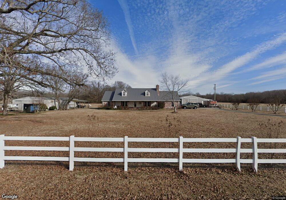
203 Thurman Weir Rd Mc Rae, AR 72102
Estimated Value: $220,000 - $308,000
Studio
2
Baths
1,970
Sq Ft
$138/Sq Ft
Est. Value
About This Home
This home is located at 203 Thurman Weir Rd, Mc Rae, AR 72102 and is currently estimated at $271,528, approximately $137 per square foot. 203 Thurman Weir Rd is a home located in White County with nearby schools including Beebe Elementary School, Beebe Junior High School, and Beebe Middle School.
Ownership History
Date
Name
Owned For
Owner Type
Purchase Details
Closed on
Oct 18, 2016
Sold by
Lovell Samantha Eden
Bought by
Lovell John David
Current Estimated Value
Purchase Details
Closed on
Oct 21, 2013
Sold by
Lovell Sheila Renee
Bought by
Lovell John David
Purchase Details
Closed on
May 4, 2004
Bought by
Annex
Purchase Details
Closed on
Sep 17, 1999
Bought by
Lovell John D and Lovell Sheila R
Purchase Details
Closed on
Apr 1, 1993
Bought by
Lovell John D and Lovell Sheila R
Create a Home Valuation Report for This Property
The Home Valuation Report is an in-depth analysis detailing your home's value as well as a comparison with similar homes in the area
Purchase History
| Date | Buyer | Sale Price | Title Company |
|---|---|---|---|
| Lovell John David | -- | None Available | |
| Lovell John David | -- | None Available | |
| Annex | -- | -- | |
| Lovell John D | -- | -- | |
| Lovell John D | -- | -- |
Source: Public Records
Tax History
| Year | Tax Paid | Tax Assessment Tax Assessment Total Assessment is a certain percentage of the fair market value that is determined by local assessors to be the total taxable value of land and additions on the property. | Land | Improvement |
|---|---|---|---|---|
| 2025 | $1,697 | $41,704 | $4,700 | $37,004 |
| 2024 | $1,697 | $41,704 | $4,700 | $37,004 |
| 2023 | $1,218 | $39,150 | $4,700 | $34,450 |
| 2022 | $1,266 | $39,150 | $4,700 | $34,450 |
| 2021 | $1,193 | $39,150 | $4,700 | $34,450 |
| 2020 | $1,121 | $35,520 | $2,100 | $33,420 |
| 2019 | $1,121 | $35,520 | $2,100 | $33,420 |
| 2018 | $1,146 | $35,520 | $2,100 | $33,420 |
| 2017 | $1,446 | $35,520 | $2,100 | $33,420 |
| 2016 | $1,446 | $35,520 | $2,100 | $33,420 |
| 2015 | $1,449 | $35,610 | $2,280 | $33,330 |
| 2014 | $1,389 | $34,130 | $2,280 | $31,850 |
Source: Public Records
Map
Nearby Homes
- 125 Poindexter Ln
- 0 Webb Hill Rd
- 315 Tweedy Rd
- 307 Copperas Springs Rd
- 597 16th Section Rd
- 000 Shiloh Rd
- 444 Blue Hole Rd
- 661 Blue Hole Rd
- 592 Shiloh Rd
- 3655 Highway 267 S
- 414 N Wilks St
- 410 N Wilks St
- 00 Highway 13 S
- 659 Wagon Train Rd
- 136 Highway 267 Spur
- 107 N Wilks St
- 712 Wagon Train Rd
- 108 Powder River Dr
- 123 Powder River Dr
- 111 Powder River Dr
- 183 Thurman Weir Rd
- 204 Thurman Weir Rd
- 00 Thurman Weir
- 149 Thurman Weir Rd
- 262 Thurman Weir Rd
- 00 Shiloh Rd
- 147 Thurman Weir Rd
- 139 Thurman Weir Rd
- 271 Thurman Weir Rd
- 129 Thurman Weir Rd
- 129 Amber Ln
- 138 Amber Ln
- 125 Thurman Weir Rd
- 123 Thurman Weir Rd
- 108 Amber Ln
- 123 Amber Ln
- 292 Thurman Weir Rd
- 102 Amber Ln
- 3056 Highway 267 S
- 109 Thurman Weir Rd
Your Personal Tour Guide
Ask me questions while you tour the home.