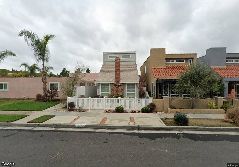
203 Utica Ave Huntington Beach, CA 92648
Yorktown NeighborhoodEstimated Value: $1,274,915 - $1,591,000
3
Beds
3
Baths
1,848
Sq Ft
$788/Sq Ft
Est. Value
About This Home
This home is located at 203 Utica Ave, Huntington Beach, CA 92648 and is currently estimated at $1,455,979, approximately $787 per square foot. 203 Utica Ave is a home located in Orange County with nearby schools including John R. Peterson Elementary, Ethel Dwyer Middle, and Huntington Beach High School.
Ownership History
Date
Name
Owned For
Owner Type
Purchase Details
Closed on
Aug 27, 2012
Sold by
Osborn Jay C and Osborn Barbara Jo
Bought by
Osborn Jay C and Osborn Barbara J
Current Estimated Value
Purchase Details
Closed on
Dec 18, 2001
Sold by
Osborn Barbara J
Bought by
Osborn Jay C and Osborn Barbara Jo
Purchase Details
Closed on
Nov 15, 2001
Sold by
Osborn Barbara J and Osborn Barbara Jo
Bought by
Osborn Barbara J
Create a Home Valuation Report for This Property
The Home Valuation Report is an in-depth analysis detailing your home's value as well as a comparison with similar homes in the area
Home Values in the Area
Average Home Value in this Area
Purchase History
| Date | Buyer | Sale Price | Title Company |
|---|---|---|---|
| Osborn Jay C | -- | None Available | |
| Osborn Jay C | -- | -- | |
| Osborn Barbara J | -- | First American Title Co | |
| Osborn Barbara J | -- | First American Title Co |
Source: Public Records
Tax History Compared to Growth
Tax History
| Year | Tax Paid | Tax Assessment Tax Assessment Total Assessment is a certain percentage of the fair market value that is determined by local assessors to be the total taxable value of land and additions on the property. | Land | Improvement |
|---|---|---|---|---|
| 2025 | $5,063 | $439,272 | $257,762 | $181,510 |
| 2024 | $5,063 | $430,659 | $252,708 | $177,951 |
| 2023 | $4,946 | $422,215 | $247,753 | $174,462 |
| 2022 | $4,815 | $413,937 | $242,895 | $171,042 |
| 2021 | $4,725 | $405,821 | $238,132 | $167,689 |
| 2020 | $4,693 | $401,660 | $235,690 | $165,970 |
| 2019 | $4,638 | $393,785 | $231,069 | $162,716 |
| 2018 | $4,566 | $386,064 | $226,538 | $159,526 |
| 2017 | $4,504 | $378,495 | $222,096 | $156,399 |
| 2016 | $4,307 | $371,074 | $217,741 | $153,333 |
| 2015 | $4,264 | $365,501 | $214,471 | $151,030 |
| 2014 | $4,174 | $358,342 | $210,270 | $148,072 |
Source: Public Records
Map
Nearby Homes
- 215 Wichita Ave Unit 106
- 1821 Lake St
- 1828 Pine St
- 1915 Pine St
- 19562 Pompano Ln Unit 107
- 19562 Pompano Ln Unit 108
- 19581 Pompano Ln Unit 107
- 19561 Pompano Ln Unit 106
- 1824 Park St
- 1701 Lake St
- 19451 Pompano Ln Unit 110
- 19502 Ranch Ln Unit 112
- 219 Portland Ave
- 7412 Seabluff Dr Unit 108
- 118 Adams Ave
- 2612 Del Way Unit B
- 19412 Pompano Ln Unit 106
- 1112 Park St
- 609 Amber Dr
- 1425 Alpine Ln
- 207 Utica Ave
- 209 Utica Ave
- 211 Utica Ave Unit A
- 211 Utica Ave Unit C
- 211 Utica Ave Unit B
- 211 Utica Ave
- 211 W Utica Ave Unit B
- 201 Utica Ave Unit A
- 201 Utica Ave
- 201 W Utica Ave Unit C
- 215 Utica Ave
- 215 Utica Ave
- 210 Venice Ave Unit 1
- 210 Venice Ave Unit 3
- 210 Venice Ave
- 221 Utica Ave
- 214 Venice Ave
- 208 Utica Ave
- 206 Utica Ave
- 210 Utica Ave