Estimated Value: $173,192 - $223,000
--
Bed
2
Baths
1,334
Sq Ft
$155/Sq Ft
Est. Value
About This Home
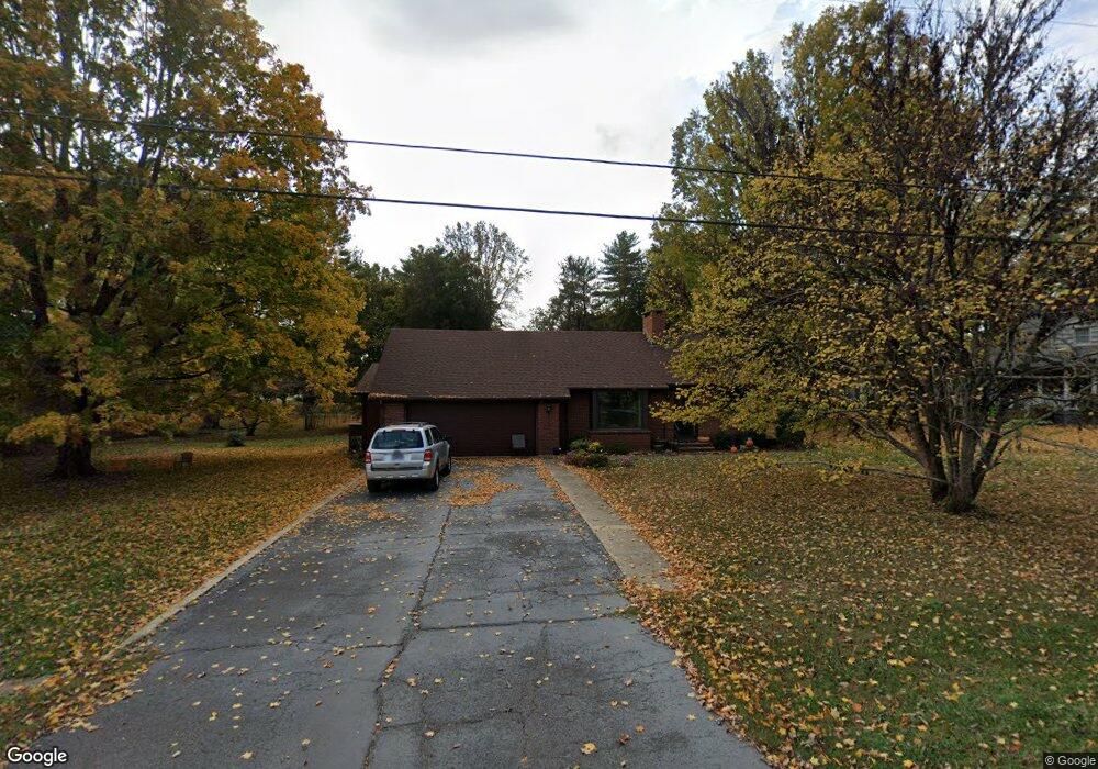
This home is located at 203 Vanderbilt Ln, Cowan, TN 37318 and is currently estimated at $206,298, approximately $154 per square foot. 203 Vanderbilt Ln is a home located in Franklin County with nearby schools including South Middle School and Franklin County High School.
Ownership History
Date
Name
Owned For
Owner Type
Purchase Details
Closed on
Sep 19, 2024
Sold by
Gay Thomas Andrew and Revoc Mary
Bought by
Gay Thomas Andrew and Gay Mary Ann
Current Estimated Value
Purchase Details
Closed on
Aug 12, 2016
Sold by
Vaughan Joyce P
Bought by
Gay Thomas Andrew and Gay Mary Ann
Home Financials for this Owner
Home Financials are based on the most recent Mortgage that was taken out on this home.
Original Mortgage
$75,000
Interest Rate
3.42%
Mortgage Type
New Conventional
Purchase Details
Closed on
Nov 10, 1988
Bought by
Vaughan Joyce P
Purchase Details
Closed on
Feb 5, 1986
Purchase Details
Closed on
Sep 10, 1982
Purchase Details
Closed on
Oct 29, 1981
Purchase Details
Closed on
Jan 1, 1981
Purchase Details
Closed on
Aug 10, 1976
Create a Home Valuation Report for This Property
The Home Valuation Report is an in-depth analysis detailing your home's value as well as a comparison with similar homes in the area
Home Values in the Area
Average Home Value in this Area
Purchase History
| Date | Buyer | Sale Price | Title Company |
|---|---|---|---|
| Gay Thomas Andrew | -- | None Listed On Document | |
| Gay Thomas Andrew | $95,000 | -- | |
| Vaughan Joyce P | $43,500 | -- | |
| -- | $42,500 | -- | |
| -- | -- | -- | |
| -- | -- | -- | |
| -- | $40,000 | -- | |
| -- | -- | -- |
Source: Public Records
Mortgage History
| Date | Status | Borrower | Loan Amount |
|---|---|---|---|
| Previous Owner | Gay Thomas Andrew | $75,000 |
Source: Public Records
Tax History Compared to Growth
Tax History
| Year | Tax Paid | Tax Assessment Tax Assessment Total Assessment is a certain percentage of the fair market value that is determined by local assessors to be the total taxable value of land and additions on the property. | Land | Improvement |
|---|---|---|---|---|
| 2024 | $1,204 | $40,975 | $3,150 | $37,825 |
| 2023 | $1,204 | $40,975 | $3,150 | $37,825 |
| 2022 | $1,143 | $40,975 | $3,150 | $37,825 |
| 2021 | $704 | $40,975 | $3,150 | $37,825 |
| 2020 | $1,088 | $25,100 | $2,100 | $23,000 |
| 2019 | $1,088 | $25,100 | $2,100 | $23,000 |
| 2018 | $1,036 | $25,100 | $2,100 | $23,000 |
| 2017 | $1,036 | $25,100 | $2,100 | $23,000 |
| 2016 | $972 | $23,550 | $2,100 | $21,450 |
| 2015 | $973 | $23,550 | $2,100 | $21,450 |
| 2014 | $972 | $23,549 | $0 | $0 |
Source: Public Records
Map
Nearby Homes
- 116 Poplar St N
- 509 Brakefield St
- 403 Locust St
- 102 Hodges St N
- 201 Hodges St N
- 200 Cowan St E
- 0 Stewart St
- 103 Cowan St W
- 128 Stewart St
- 313 Tennessee Ave S
- 102 Thorogood St
- 108 Looney St
- 112 Looney St
- 116 Looney St
- 328 Cumberland St W
- 34 Bailey Rd
- 0 Hawkins Cove Rd
- 135 Carter Rd
- 0 Blue Springs Road Tract 5
- 0 Blue Springs Road Tract 2&3 Unit RTC2964014