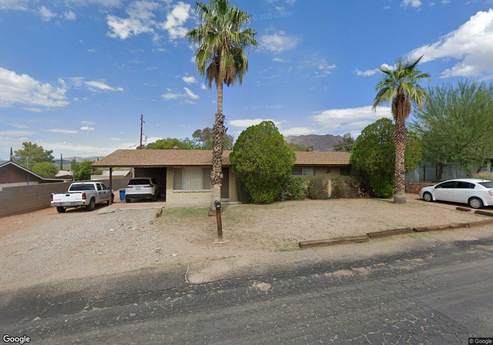
203 W Odonnell Dr Superior, AZ 85173
Estimated Value: $231,531 - $280,000
Studio
--
Bath
1,323
Sq Ft
$197/Sq Ft
Est. Value
About This Home
This home is located at 203 W Odonnell Dr, Superior, AZ 85173 and is currently estimated at $260,133, approximately $196 per square foot. 203 W Odonnell Dr is a home located in Pinal County with nearby schools including John F Kennedy School and Superior Junior-Senior High School.
Ownership History
Date
Name
Owned For
Owner Type
Purchase Details
Closed on
Mar 28, 1998
Sold by
Beneficial Mtg Co Of Arizona
Bought by
Ybarra William G and Ybarra Cynthia A
Current Estimated Value
Home Financials for this Owner
Home Financials are based on the most recent Mortgage that was taken out on this home.
Original Mortgage
$44,150
Interest Rate
7.01%
Mortgage Type
New Conventional
Purchase Details
Closed on
Dec 29, 1997
Sold by
Lewis Freddie and Lewis Frances S
Bought by
Beneficial Mtg Co Of Arizona
Create a Home Valuation Report for This Property
The Home Valuation Report is an in-depth analysis detailing your home's value as well as a comparison with similar homes in the area
Purchase History
| Date | Buyer | Sale Price | Title Company |
|---|---|---|---|
| Ybarra William G | $46,500 | Ati Title Agency | |
| Beneficial Mtg Co Of Arizona | -- | -- |
Source: Public Records
Mortgage History
| Date | Status | Borrower | Loan Amount |
|---|---|---|---|
| Previous Owner | Ybarra William G | $44,150 |
Source: Public Records
Tax History
| Year | Tax Paid | Tax Assessment Tax Assessment Total Assessment is a certain percentage of the fair market value that is determined by local assessors to be the total taxable value of land and additions on the property. | Land | Improvement |
|---|---|---|---|---|
| 2025 | $853 | $19,224 | -- | -- |
| 2024 | $772 | $16,036 | -- | -- |
| 2023 | $813 | $11,587 | $2,577 | $9,010 |
| 2022 | $772 | $8,290 | $1,790 | $6,500 |
| 2021 | $737 | $8,277 | $0 | $0 |
| 2020 | $692 | $6,636 | $0 | $0 |
| 2019 | $689 | $6,203 | $0 | $0 |
| 2018 | $680 | $5,532 | $0 | $0 |
| 2017 | $647 | $5,404 | $0 | $0 |
| 2016 | $636 | $5,297 | $1,685 | $3,612 |
| 2014 | $623 | $4,803 | $371 | $4,433 |
Source: Public Records
Map
Nearby Homes
- 92 W Gorham St
- 835 W Spray St
- 94 Arnett Dr
- 1129 S Edna Ave
- 393 W Highlands Dr Unit 35
- 1097 S Stone Ave
- 454 W Ray St
- 452 W Ray St
- 831 S Western Ave
- 444 W Valentine St
- 639 U S 60
- 701 S Belmont Ave
- 740 S Church Ave
- 631 W Hill St Unit LOT
- 0 W 200 Bllk Gibbs St Unit 74
- 0 Highway 60 Hwy Unit 6908796
- 315 W Wight St
- 451 S Stone Ave
- 681 W Main St
- 311 W Terrace Dr
- 205 W Odonnell Dr
- 201 W Odonnell Dr
- 204 W Odonnell Dr
- 214 W Harrington Place
- 210 W Harrington Place
- 207 W Odonnell Dr
- 206 W Odonnell Dr
- 200 W Odonnell Dr
- 216 W Harrington Place
- 205 W Gray Dr
- 211 S Hing Dr
- 207 W Gray Dr
- 219 S Hing Dr
- 203 W Gray Dr Unit 9
- 217 S Hing Dr
- 209 W Gray Dr
- 206 W Harrington Place
- 208 W Harrington Place
- 204 W Harrington Place
- 199 W Gray Dr
Your Personal Tour Guide
Ask me questions while you tour the home.