2030 Elwood Blvd Unit 8 Spring Arbor, MI 49283
Estimated Value: $350,000 - $394,000
--
Bed
2
Baths
1,912
Sq Ft
$194/Sq Ft
Est. Value
About This Home
This home is located at 2030 Elwood Blvd Unit 8, Spring Arbor, MI 49283 and is currently estimated at $370,083, approximately $193 per square foot. 2030 Elwood Blvd Unit 8 is a home located in Jackson County with nearby schools including Western High School and Trinity Lutheran School.
Ownership History
Date
Name
Owned For
Owner Type
Purchase Details
Closed on
May 24, 2004
Sold by
Poling Lori Sue and Cook Lori Sue
Bought by
Gebhardt Mark and Gebhardt Michaela
Current Estimated Value
Home Financials for this Owner
Home Financials are based on the most recent Mortgage that was taken out on this home.
Original Mortgage
$136,000
Outstanding Balance
$63,720
Interest Rate
4.87%
Mortgage Type
Purchase Money Mortgage
Estimated Equity
$299,983
Purchase Details
Closed on
Sep 9, 2003
Sold by
Poling Timothy J
Bought by
Poling Lori Sue
Purchase Details
Closed on
Jan 25, 2002
Sold by
Greenbriar Land Investment Llc
Bought by
Poling Timothy and Poling Lori
Home Financials for this Owner
Home Financials are based on the most recent Mortgage that was taken out on this home.
Original Mortgage
$163,500
Interest Rate
5.87%
Mortgage Type
Purchase Money Mortgage
Create a Home Valuation Report for This Property
The Home Valuation Report is an in-depth analysis detailing your home's value as well as a comparison with similar homes in the area
Home Values in the Area
Average Home Value in this Area
Purchase History
| Date | Buyer | Sale Price | Title Company |
|---|---|---|---|
| Gebhardt Mark | $216,000 | Chicago Title Company | |
| Poling Lori Sue | -- | -- | |
| Poling Timothy | $22,900 | -- |
Source: Public Records
Mortgage History
| Date | Status | Borrower | Loan Amount |
|---|---|---|---|
| Open | Mark | $49,000 | |
| Closed | Gebhardt | $24,990 | |
| Open | Gebhardt Mark | $136,000 | |
| Previous Owner | Poling Timothy | $163,500 |
Source: Public Records
Tax History Compared to Growth
Tax History
| Year | Tax Paid | Tax Assessment Tax Assessment Total Assessment is a certain percentage of the fair market value that is determined by local assessors to be the total taxable value of land and additions on the property. | Land | Improvement |
|---|---|---|---|---|
| 2024 | $2,330 | $157,500 | $0 | $0 |
| 2023 | $2,332 | $138,600 | $0 | $0 |
| 2022 | $3,644 | $134,200 | $0 | $0 |
| 2021 | $3,579 | $124,210 | $0 | $0 |
| 2020 | $3,537 | $121,470 | $0 | $0 |
| 2019 | $3,362 | $111,800 | $0 | $0 |
| 2018 | $3,350 | $104,670 | $9,600 | $95,070 |
| 2017 | $3,177 | $104,440 | $0 | $0 |
| 2016 | $1,980 | $103,730 | $103,730 | $0 |
| 2015 | $81,361 | $91,840 | $91,840 | $0 |
| 2014 | $81,361 | $82,660 | $82,660 | $0 |
| 2013 | -- | $82,660 | $82,660 | $0 |
Source: Public Records
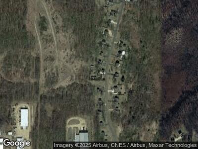
Map
Nearby Homes
- 2017 Elwood Blvd Unit 18
- 7949 Village Green Ln
- 7959 Sunnydell Dr
- 181 Remington Dr
- 2503 Milford Rd
- 388 Richard St
- V/L S Dearing Rd Unit 40 Acres Vacant Land
- 3521 Henderson Rd
- 82 Dickens St
- 68 Dickens St
- 8295 Mccain Rd
- 0 Riegel Rd
- 216 Wickenham Dr
- 111 Blenheim Dr
- 9720 King Rd
- 9719 King Rd
- 5933 Mccain Rd
- 5951 Riverside Dr
- 0 N Harrington Rd
- 10526 Spring Arbor Rd
- 2030 Elwood Blvd Unit 8
- 2034 Elwood Blvd Unit 9
- 2018 Elwood Blvd Unit 5
- 2022 Elwood Blvd Unit 6
- 2029 Elwood Blvd Unit 15
- 2038 Elwood Blvd Unit 10
- 2026 Elwood Blvd Unit 7
- 2033 Elwood Blvd Unit 14
- 2025 Elwood Blvd Unit 16
- 2037 Elwood Blvd Unit 13
- 2021 Elwood Blvd Unit 17
- 2042 Elwood Blvd Unit 11
- 2041 Elwood Blvd Unit 12
- 2046 Elwood Blvd Unit 19
- 2014 Elwood Blvd Unit 4
- 2050 Elwood Blvd Unit 20
- 2010 Elwood Blvd Unit 3
- 2054 Elwood Blvd Unit 21
- 2006 Elwood Blvd Unit 2
- 2058 Elwood Blvd Unit 22