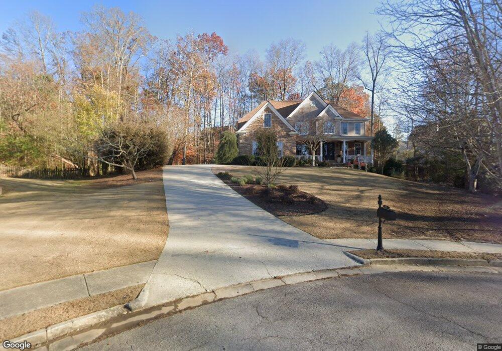
2030 Misty Oaks Dr Unit 3 Buford, GA 30519
Estimated Value: $610,863 - $684,000
4
Beds
4
Baths
3,701
Sq Ft
$174/Sq Ft
Est. Value
About This Home
This home is located at 2030 Misty Oaks Dr Unit 3, Buford, GA 30519 and is currently estimated at $642,466, approximately $173 per square foot. 2030 Misty Oaks Dr Unit 3 is a home located in Gwinnett County with nearby schools including Harmony Elementary School and Glenn C. Jones Middle School.
Ownership History
Date
Name
Owned For
Owner Type
Purchase Details
Closed on
Dec 6, 2001
Sold by
Hein Robert M
Bought by
Hein Robert M and Hein Rosanne
Current Estimated Value
Purchase Details
Closed on
Jan 6, 2001
Sold by
Four Points Builders Inc
Bought by
Hein Robert M
Home Financials for this Owner
Home Financials are based on the most recent Mortgage that was taken out on this home.
Original Mortgage
$248,750
Interest Rate
5.25%
Mortgage Type
New Conventional
Create a Home Valuation Report for This Property
The Home Valuation Report is an in-depth analysis detailing your home's value as well as a comparison with similar homes in the area
Home Values in the Area
Average Home Value in this Area
Purchase History
| Date | Buyer | Sale Price | Title Company |
|---|---|---|---|
| Hein Robert M | -- | -- | |
| Hein Robert M | $348,900 | -- |
Source: Public Records
Mortgage History
| Date | Status | Borrower | Loan Amount |
|---|---|---|---|
| Previous Owner | Hein Robert M | $248,750 |
Source: Public Records
Tax History Compared to Growth
Tax History
| Year | Tax Paid | Tax Assessment Tax Assessment Total Assessment is a certain percentage of the fair market value that is determined by local assessors to be the total taxable value of land and additions on the property. | Land | Improvement |
|---|---|---|---|---|
| 2024 | -- | $249,360 | $39,600 | $209,760 |
| 2023 | $6,328 | $223,760 | $39,600 | $184,160 |
| 2022 | $6,783 | $223,760 | $39,600 | $184,160 |
| 2021 | $5,960 | $178,920 | $30,720 | $148,200 |
| 2020 | $6,002 | $178,920 | $30,720 | $148,200 |
| 2019 | $5,823 | $178,920 | $30,720 | $148,200 |
| 2018 | $5,373 | $157,560 | $28,000 | $129,560 |
| 2016 | $5,069 | $142,680 | $25,600 | $117,080 |
| 2015 | $4,586 | $124,360 | $18,400 | $105,960 |
| 2014 | $4,309 | $115,880 | $18,400 | $97,480 |
Source: Public Records
Map
Nearby Homes
- 3600 Devenwood Way
- 3684 Heritage Crest Pkwy
- 2040 Harvest Ridge Cir
- 2040 Harvest Ridge Cir NE
- 190 Maddox Rd
- 2140 Harvest Ridge Cir
- 2183 Ivy Crest Dr
- 2361 Black Bear Ct Unit 2
- 3476 Harvest Ridge Ln
- 2398 E Maddox Rd
- 1970 Sturbridge Ln Unit 1
- 3560 Hanover Dr
- 2101 E Maddox Rd
- 2692 Bogan Creek Dr
- 1781 Plunketts Rd
- 3573 Fallen Oak Dr
- 4041 Lost Mill Ln
- 4316 Woodland Bank Blvd
- 3889 Hannahberry Place
- 2040 Misty Oaks Dr
- 3846 Heritage Crest Place
- 3823 Morning Meadow Ln
- 3828 Morning Meadow Ln Unit 44
- 3856 Heritage Crest Place
- 0 Heritage Crest Place Unit 7319117
- 0 Heritage Crest Place
- 3879 Hannahberry Place
- 2065 Misty Oaks Dr
- 3898 Hannahberry Place
- 3856 Heritage Crest Place
- 3879 Hannahberry Pl 0
- 3879 Hannahberry Place 0
- 0 Hannahberry Pl 0
- 2050 Misty Oaks Dr
- 3848 Morning Meadow Ln
- 2075 Misty Oaks Dr
- 3847 Heritage Crest Place
- 3888 Hannahberry Place