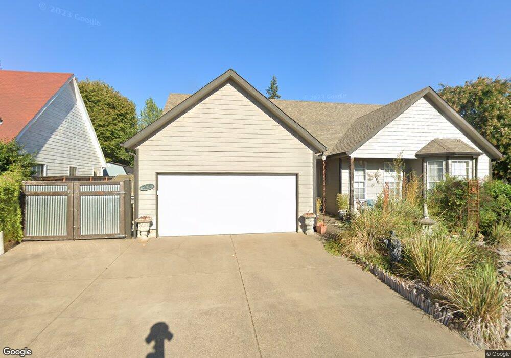
2030 Orchard Ln SW Albany, OR 97321
West Albany NeighborhoodEstimated Value: $456,888 - $460,000
3
Beds
2
Baths
1,761
Sq Ft
$260/Sq Ft
Est. Value
About This Home
This home is located at 2030 Orchard Ln SW, Albany, OR 97321 and is currently estimated at $458,444, approximately $260 per square foot. 2030 Orchard Ln SW is a home located in Linn County with nearby schools including Takena Elementary School, Central Elementary School, and Memorial Middle School.
Ownership History
Date
Name
Owned For
Owner Type
Purchase Details
Closed on
Nov 18, 2004
Sold by
Cheney Brad K
Bought by
Cheney Leslie M
Current Estimated Value
Create a Home Valuation Report for This Property
The Home Valuation Report is an in-depth analysis detailing your home's value as well as a comparison with similar homes in the area
Home Values in the Area
Average Home Value in this Area
Purchase History
| Date | Buyer | Sale Price | Title Company |
|---|---|---|---|
| Cheney Leslie M | -- | Fidelity Natl Title Ins Co |
Source: Public Records
Tax History Compared to Growth
Tax History
| Year | Tax Paid | Tax Assessment Tax Assessment Total Assessment is a certain percentage of the fair market value that is determined by local assessors to be the total taxable value of land and additions on the property. | Land | Improvement |
|---|---|---|---|---|
| 2025 | $5,099 | $256,200 | -- | -- |
| 2024 | $4,951 | $248,740 | -- | -- |
| 2023 | $4,810 | $241,500 | $0 | $0 |
| 2022 | $4,734 | $234,470 | $0 | $0 |
| 2021 | $4,455 | $227,650 | $0 | $0 |
| 2020 | $4,396 | $221,020 | $0 | $0 |
| 2019 | $4,293 | $214,590 | $0 | $0 |
| 2018 | $4,182 | $208,340 | $0 | $0 |
| 2017 | $3,977 | $202,280 | $0 | $0 |
| 2016 | $3,563 | $196,390 | $0 | $0 |
| 2015 | $3,341 | $190,670 | $0 | $0 |
| 2014 | $3,239 | $185,120 | $0 | $0 |
Source: Public Records
Map
Nearby Homes
- 1850 17th Ave SW
- 1712 25th Ave SW
- 1620 16th Ave SW
- (next to) 2020 SW 15th Ave
- 0 15th (Lot Unit 5) Av SW 825018
- 1510 Broadway St SW
- 1840 14th Ave SW
- 1420 Park Terrace SW
- 1240 SW Hop St
- 1230 SW Hop St
- 955 21st Ave SW
- 1248 Penn St SW
- 1215 10th Ave SW
- 1510 Walnut St SW
- 870 14th Ave SW
- 1220 Walnut St SW
- 1138 9th Ave SW
- 1095 33rd Ave SW
- 35968 Bryant Dr SW
- 906 11th Ave SW
- 2020 Orchard Ln SW
- 2060 Orchard Ln SW
- 2006 Chase Loop SW
- 2080 Orchard Ln SW
- 2033 Orchard Ln SW
- 2010 Chase Loop SW
- 2041 Orchard Ln SW
- 2027 Orchard Ln SW
- 2010 Orchard Ln SW
- 2015 Orchard Ln SW
- 2014 Chase Loop SW
- 2063 Orchard Ln SW
- 2071 Orchard Ln SW
- 2087 Orchard Ln SW
- 2046 Chase Loop SW
- 2005 Chase Loop SW
- 2044 Chase Loop SW
- 2050 Chase Loop SW
- 2003 Chase Loop SW
- 2093 Orchard Ln SW