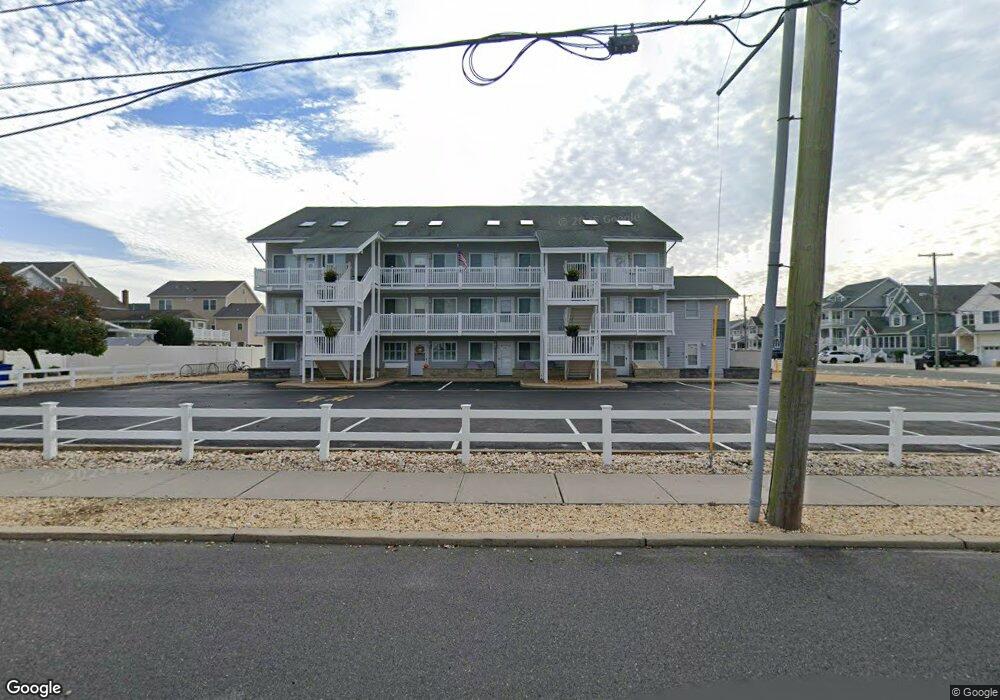
2030 Route 35 N Unit 1 Seaside Heights, NJ 08751
Dover Beaches South NeighborhoodEstimated Value: $514,000 - $576,988
2
Beds
1
Bath
640
Sq Ft
$858/Sq Ft
Est. Value
About This Home
This home is located at 2030 Route 35 N Unit 1, Seaside Heights, NJ 08751 and is currently estimated at $548,997, approximately $857 per square foot. 2030 Route 35 N Unit 1 is a home located in Ocean County.
Ownership History
Date
Name
Owned For
Owner Type
Purchase Details
Closed on
Mar 10, 2022
Sold by
Hill Siobhan M
Bought by
Bader Kerry
Current Estimated Value
Purchase Details
Closed on
May 19, 2005
Purchase Details
Closed on
Mar 22, 2002
Sold by
Pinto Frank
Bought by
Redl Joseph and Redl Nanette
Home Financials for this Owner
Home Financials are based on the most recent Mortgage that was taken out on this home.
Original Mortgage
$280,000
Interest Rate
6.85%
Mortgage Type
Purchase Money Mortgage
Purchase Details
Closed on
Apr 20, 1999
Sold by
Millburn Financial Inc
Bought by
Grodeck Paul and Grodeck Joan
Create a Home Valuation Report for This Property
The Home Valuation Report is an in-depth analysis detailing your home's value as well as a comparison with similar homes in the area
Home Values in the Area
Average Home Value in this Area
Purchase History
| Date | Buyer | Sale Price | Title Company |
|---|---|---|---|
| Bader Kerry | -- | Bucci Sharon P | |
| -- | $100 | -- | |
| Hill Siobhan M | -- | -- | |
| Redl Joseph | $360,000 | -- | |
| Grodeck Paul | $115,000 | -- |
Source: Public Records
Mortgage History
| Date | Status | Borrower | Loan Amount |
|---|---|---|---|
| Previous Owner | Redl Joseph | $280,000 |
Source: Public Records
Tax History Compared to Growth
Tax History
| Year | Tax Paid | Tax Assessment Tax Assessment Total Assessment is a certain percentage of the fair market value that is determined by local assessors to be the total taxable value of land and additions on the property. | Land | Improvement |
|---|---|---|---|---|
| 2025 | $6,137 | $337,000 | $220,000 | $117,000 |
| 2024 | $5,833 | $337,000 | $220,000 | $117,000 |
| 2023 | $5,625 | $337,000 | $220,000 | $117,000 |
| 2022 | $5,625 | $337,000 | $220,000 | $117,000 |
| 2021 | $4,577 | $182,700 | $125,000 | $57,700 |
| 2020 | $4,557 | $182,700 | $125,000 | $57,700 |
| 2019 | $4,359 | $182,700 | $125,000 | $57,700 |
| 2018 | $4,287 | $182,700 | $125,000 | $57,700 |
| 2017 | $4,209 | $182,700 | $125,000 | $57,700 |
| 2016 | $4,153 | $182,700 | $125,000 | $57,700 |
| 2015 | $3,996 | $182,700 | $125,000 | $57,700 |
| 2014 | $3,804 | $182,700 | $125,000 | $57,700 |
Source: Public Records
Map
Nearby Homes
- 2030 New Jersey 35 Unit 8
- 1 Diane Ln Unit A
- 2033 New Jersey 35
- 2033 Route 35 N Unit 3
- 2400 Oceanfront
- 211 1st Ave
- 15 7th Ave
- 1 7th Ave
- 1806 Grand Central Ave Unit U10
- 313 Shuster Ave
- 1820 E Pennsylvania Ave
- 8 Pennsylvania Ave
- 1605 Grand Central Ave Unit 1
- 49 Fort Ave
- 108 Dickman Dr
- 99 Coolidge Ave
- 1709 Route 35 N Unit 9
- 1709 Route 35 N
- 189 Pershing Blvd
- 113 New Brunswick Ave
- 2030 Route 35 N Unit B
- 2030 Route 35 N Unit B
- 2030 Route 35 N Unit 13
- 2030 Route 35 N Unit 3
- 2030 Route 35 N Unit 10
- 2030 Route 35 N Unit 5
- 2030 Route 35 N Unit 12
- 2030 Route 35 N Unit 11
- 2030 Route 35 N Unit 9
- 2030 Route 35 N Unit 8
- 2030 Route 35 N Unit 6
- 2030 Route 35 N Unit 4
- 2030 Route 35 N Unit 2
- 2030 Route 35 N Unit B
- 2030 Route 35 N Unit J
- 2030 Route 35 N Unit E
- 2030 Route 35 N Unit G
- 2030 Route 35 N Unit K
- 2032 Route 35 N Unit B
- 2032 Route 35 N Unit B