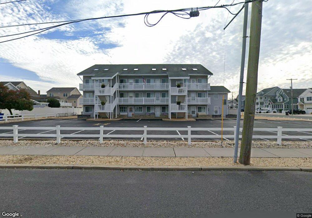
2030 Route 35 N Unit 10 Seaside Heights, NJ 08751
Dover Beaches South NeighborhoodEstimated Value: $604,477 - $663,000
2
Beds
2
Baths
800
Sq Ft
$786/Sq Ft
Est. Value
About This Home
This home is located at 2030 Route 35 N Unit 10, Seaside Heights, NJ 08751 and is currently estimated at $628,869, approximately $786 per square foot. 2030 Route 35 N Unit 10 is a home located in Ocean County.
Ownership History
Date
Name
Owned For
Owner Type
Purchase Details
Closed on
Jul 7, 2020
Sold by
Gazzo Thomas V and Gazzo Lisa A
Bought by
Deihl Rosemary
Current Estimated Value
Purchase Details
Closed on
Aug 4, 2004
Sold by
Geraghty Joseph F
Bought by
Muller Michael G and Muller Karen C
Home Financials for this Owner
Home Financials are based on the most recent Mortgage that was taken out on this home.
Original Mortgage
$288,000
Interest Rate
5.87%
Mortgage Type
Fannie Mae Freddie Mac
Create a Home Valuation Report for This Property
The Home Valuation Report is an in-depth analysis detailing your home's value as well as a comparison with similar homes in the area
Home Values in the Area
Average Home Value in this Area
Purchase History
| Date | Buyer | Sale Price | Title Company |
|---|---|---|---|
| Deihl Rosemary | $360,000 | Trident Abstract Ttl Agcy Ll | |
| Muller Michael G | $360,000 | None Available |
Source: Public Records
Mortgage History
| Date | Status | Borrower | Loan Amount |
|---|---|---|---|
| Previous Owner | Muller Michael G | $288,000 |
Source: Public Records
Tax History Compared to Growth
Tax History
| Year | Tax Paid | Tax Assessment Tax Assessment Total Assessment is a certain percentage of the fair market value that is determined by local assessors to be the total taxable value of land and additions on the property. | Land | Improvement |
|---|---|---|---|---|
| 2025 | $6,319 | $347,000 | $220,000 | $127,000 |
| 2024 | $6,007 | $347,000 | $220,000 | $127,000 |
| 2023 | $5,791 | $347,000 | $220,000 | $127,000 |
| 2022 | $5,791 | $347,000 | $220,000 | $127,000 |
| 2021 | $4,890 | $195,200 | $125,000 | $70,200 |
| 2020 | $4,868 | $195,200 | $125,000 | $70,200 |
| 2019 | $4,657 | $195,200 | $125,000 | $70,200 |
| 2018 | $4,533 | $193,200 | $125,000 | $68,200 |
| 2017 | $4,451 | $193,200 | $125,000 | $68,200 |
| 2016 | $4,391 | $193,200 | $125,000 | $68,200 |
| 2015 | $4,225 | $193,200 | $125,000 | $68,200 |
| 2014 | $4,022 | $193,200 | $125,000 | $68,200 |
Source: Public Records
Map
Nearby Homes
- 2030 New Jersey 35 Unit 8
- 1 Diane Ln Unit A
- 2033 New Jersey 35
- 2033 Route 35 N Unit 3
- 2400 Oceanfront
- 211 1st Ave
- 15 7th Ave
- 1 7th Ave
- 1806 Grand Central Ave Unit U10
- 313 Shuster Ave
- 1820 E Pennsylvania Ave
- 8 Pennsylvania Ave
- 1605 Grand Central Ave Unit 1
- 49 Fort Ave
- 108 Dickman Dr
- 99 Coolidge Ave
- 1709 Route 35 N Unit 9
- 1709 Route 35 N
- 189 Pershing Blvd
- 113 New Brunswick Ave
- 2030 Route 35 N Unit B
- 2030 Route 35 N Unit B
- 2030 Route 35 N Unit 13
- 2030 Route 35 N Unit 3
- 2030 Route 35 N Unit 5
- 2030 Route 35 N Unit 1
- 2030 Route 35 N Unit 12
- 2030 Route 35 N Unit 11
- 2030 Route 35 N Unit 9
- 2030 Route 35 N Unit 8
- 2030 Route 35 N Unit 6
- 2030 Route 35 N Unit 4
- 2030 Route 35 N Unit 2
- 2030 Route 35 N Unit B
- 2030 Route 35 N Unit J
- 2030 Route 35 N Unit E
- 2030 Route 35 N Unit G
- 2030 Route 35 N Unit K
- 2032 Route 35 N Unit B
- 2032 Route 35 N Unit B