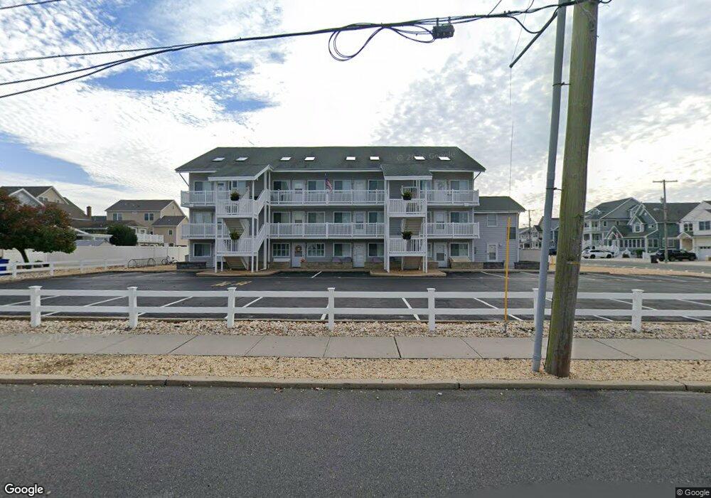
2030 Route 35 N Unit 8 Seaside Heights, NJ 08751
Dover Beaches South NeighborhoodEstimated Value: $534,000 - $583,092
2
Beds
1
Bath
640
Sq Ft
$883/Sq Ft
Est. Value
About This Home
This home is located at 2030 Route 35 N Unit 8, Seaside Heights, NJ 08751 and is currently estimated at $565,273, approximately $883 per square foot. 2030 Route 35 N Unit 8 is a home located in Ocean County.
Ownership History
Date
Name
Owned For
Owner Type
Purchase Details
Closed on
Apr 1, 2021
Sold by
Castano Louis T
Bought by
Minore Gavin M and Minore Linh
Current Estimated Value
Purchase Details
Closed on
Jan 30, 2007
Sold by
Castano Louis T and Castano Kathleen P
Bought by
Castano Louis T
Purchase Details
Closed on
Sep 17, 2004
Sold by
Castano Louis
Bought by
Castano Louis T and Castano Kathleen P
Create a Home Valuation Report for This Property
The Home Valuation Report is an in-depth analysis detailing your home's value as well as a comparison with similar homes in the area
Home Values in the Area
Average Home Value in this Area
Purchase History
| Date | Buyer | Sale Price | Title Company |
|---|---|---|---|
| Minore Gavin M | $375,000 | Belmont Ttl & Setmnt Svcs Ll | |
| Minore Gavin M | $375,000 | Old Republic Title | |
| Castano Louis T | -- | None Available | |
| Castano Louis T | -- | Chicago Title Insurance Co |
Source: Public Records
Tax History Compared to Growth
Tax History
| Year | Tax Paid | Tax Assessment Tax Assessment Total Assessment is a certain percentage of the fair market value that is determined by local assessors to be the total taxable value of land and additions on the property. | Land | Improvement |
|---|---|---|---|---|
| 2025 | $6,137 | $337,000 | $220,000 | $117,000 |
| 2024 | $5,833 | $337,000 | $220,000 | $117,000 |
| 2023 | $5,625 | $337,000 | $220,000 | $117,000 |
| 2022 | $5,625 | $337,000 | $220,000 | $117,000 |
| 2021 | $4,577 | $182,700 | $125,000 | $57,700 |
| 2020 | $4,557 | $182,700 | $125,000 | $57,700 |
| 2019 | $4,359 | $182,700 | $125,000 | $57,700 |
| 2018 | $4,287 | $182,700 | $125,000 | $57,700 |
| 2017 | $4,209 | $182,700 | $125,000 | $57,700 |
| 2016 | $4,153 | $182,700 | $125,000 | $57,700 |
| 2015 | $3,996 | $182,700 | $125,000 | $57,700 |
| 2014 | $3,804 | $182,700 | $125,000 | $57,700 |
Source: Public Records
Map
Nearby Homes
- 2030 New Jersey 35 Unit 8
- 1 Diane Ln Unit A
- 2033 New Jersey 35
- 2033 Route 35 N Unit 3
- 2400 Oceanfront
- 211 1st Ave
- 15 7th Ave
- 1 7th Ave
- 1806 Grand Central Ave Unit U10
- 313 Shuster Ave
- 1820 E Pennsylvania Ave
- 8 Pennsylvania Ave
- 1605 Grand Central Ave Unit 1
- 49 Fort Ave
- 108 Dickman Dr
- 99 Coolidge Ave
- 1709 Route 35 N Unit 9
- 1709 Route 35 N
- 189 Pershing Blvd
- 113 New Brunswick Ave
- 2030 Route 35 N Unit B
- 2030 Route 35 N Unit B
- 2030 Route 35 N Unit 13
- 2030 Route 35 N Unit 3
- 2030 Route 35 N Unit 10
- 2030 Route 35 N Unit 5
- 2030 Route 35 N Unit 1
- 2030 Route 35 N Unit 12
- 2030 Route 35 N Unit 11
- 2030 Route 35 N Unit 9
- 2030 Route 35 N Unit 6
- 2030 Route 35 N Unit 4
- 2030 Route 35 N Unit 2
- 2030 Route 35 N Unit B
- 2030 Route 35 N Unit J
- 2030 Route 35 N Unit E
- 2030 Route 35 N Unit G
- 2030 Route 35 N Unit K
- 2032 Route 35 N Unit B
- 2032 Route 35 N Unit B