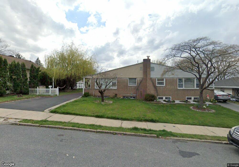
2030 S 2nd St Allentown, PA 18103
Southside NeighborhoodEstimated Value: $251,000 - $284,000
3
Beds
1
Bath
1,274
Sq Ft
$214/Sq Ft
Est. Value
About This Home
This home is located at 2030 S 2nd St, Allentown, PA 18103 and is currently estimated at $272,213, approximately $213 per square foot. 2030 S 2nd St is a home located in Lehigh County with nearby schools including Hiram W Dodd Elementary School, South Mountain Middle School, and Louis E. Dieruff High School.
Ownership History
Date
Name
Owned For
Owner Type
Purchase Details
Closed on
Feb 21, 2023
Sold by
Rodriguez Leonardo and Rodriguez Diana
Bought by
Rodriguez Kiara and Grullon Albert
Current Estimated Value
Home Financials for this Owner
Home Financials are based on the most recent Mortgage that was taken out on this home.
Original Mortgage
$244,489
Interest Rate
6.6%
Mortgage Type
FHA
Purchase Details
Closed on
Sep 28, 2009
Sold by
Berger Michael B
Bought by
Rodriguez Leonardo
Home Financials for this Owner
Home Financials are based on the most recent Mortgage that was taken out on this home.
Original Mortgage
$126,000
Interest Rate
5.31%
Mortgage Type
New Conventional
Purchase Details
Closed on
Nov 18, 1998
Sold by
Henneborn Gustav J
Bought by
Berger Michael Benson
Purchase Details
Closed on
Jan 21, 1991
Bought by
Henneborn Gustov J
Create a Home Valuation Report for This Property
The Home Valuation Report is an in-depth analysis detailing your home's value as well as a comparison with similar homes in the area
Home Values in the Area
Average Home Value in this Area
Purchase History
| Date | Buyer | Sale Price | Title Company |
|---|---|---|---|
| Rodriguez Kiara | $249,000 | None Listed On Document | |
| Rodriguez Leonardo | $140,000 | -- | |
| Berger Michael Benson | $77,900 | -- | |
| Henneborn Gustov J | $92,900 | -- |
Source: Public Records
Mortgage History
| Date | Status | Borrower | Loan Amount |
|---|---|---|---|
| Previous Owner | Rodriguez Kiara | $244,489 | |
| Previous Owner | Rodriguez Leonardo | $126,000 |
Source: Public Records
Tax History Compared to Growth
Tax History
| Year | Tax Paid | Tax Assessment Tax Assessment Total Assessment is a certain percentage of the fair market value that is determined by local assessors to be the total taxable value of land and additions on the property. | Land | Improvement |
|---|---|---|---|---|
| 2025 | $4,048 | $119,600 | $18,600 | $101,000 |
| 2024 | $4,048 | $119,600 | $18,600 | $101,000 |
| 2023 | $4,048 | $119,600 | $18,600 | $101,000 |
| 2022 | $452 | $119,600 | $18,600 | $101,000 |
| 2021 | $3,837 | $119,600 | $18,600 | $101,000 |
| 2020 | $3,741 | $119,600 | $18,600 | $101,000 |
| 2019 | $3,682 | $119,600 | $18,600 | $101,000 |
| 2018 | $3,414 | $119,600 | $18,600 | $101,000 |
| 2017 | $3,331 | $119,600 | $18,600 | $101,000 |
| 2016 | -- | $119,600 | $18,600 | $101,000 |
| 2015 | -- | $119,600 | $18,600 | $101,000 |
| 2014 | -- | $119,600 | $18,600 | $101,000 |
Source: Public Records
Map
Nearby Homes
- 206 208 W Emaus Ave
- 2429 S Front St
- 2421 S Wood St
- 2441 S 4th St
- 121 Woodcrest Cir
- 316 W Mountain Rd
- 1852 S 2nd St
- 2416 S Alice St Unit 2418
- 2347 S Law St Unit 2349
- 102 W Brookdale St
- 148 W Brookdale St
- 1865 Chapel Ave
- 203 W Brookdale St
- 566 W Emaus Ave
- 566 588 W Emaus Ave
- 135 W Wabash St
- 2401 S Church St
- 2413 S Church St
- 642 W Emaus Ave
- 618 Clifford St
- 2028 S 2nd St
- 2036 S 2nd St Unit 2040
- 2022 S 2nd St
- 2020 S 2nd St
- 2042 S 2nd St Unit 2046
- 2014 S 2nd St
- 2035 S 3rd St Unit 2037
- 2041 S 3rd St
- 2031 S 3rd St Unit 2033
- 2029 S 2nd St
- 2027 S 2nd St
- 2050 S 2nd St
- 2043 S 3rd St Unit 2303
- 2035 S 2nd St
- 2025 S 2nd St
- 2037 S 2nd St
- 2012 S 2nd St
- 2025 S 3rd St Unit 2029
- 2021 S 2nd St
- 2021 S 2nd St Unit V-9