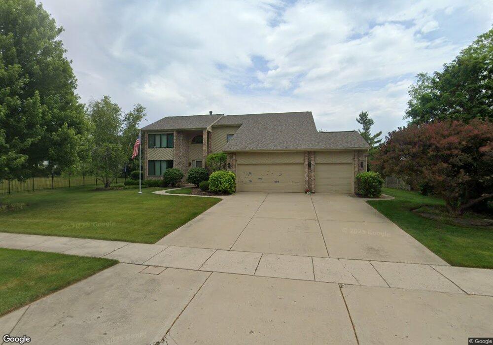
2030 Sheridan Rd Buffalo Grove, IL 60089
Rolling Hills NeighborhoodEstimated Value: $867,458 - $977,000
--
Bed
4
Baths
3,506
Sq Ft
$262/Sq Ft
Est. Value
About This Home
This home is located at 2030 Sheridan Rd, Buffalo Grove, IL 60089 and is currently estimated at $920,115, approximately $262 per square foot. 2030 Sheridan Rd is a home located in Lake County with nearby schools including Ivy Hall Elementary School, Twin Groves Middle School, and Adlai E Stevenson High School.
Ownership History
Date
Name
Owned For
Owner Type
Purchase Details
Closed on
May 24, 2000
Sold by
Cooper Neil R and Cooper Sheri E
Bought by
Lillis Jim and Lillis Gail
Current Estimated Value
Home Financials for this Owner
Home Financials are based on the most recent Mortgage that was taken out on this home.
Original Mortgage
$431,250
Outstanding Balance
$151,774
Interest Rate
8.4%
Estimated Equity
$768,341
Purchase Details
Closed on
Apr 10, 1996
Sold by
American National Bk & Tr Co Of Chicago
Bought by
Cooper Neil R and Cooper Sheri E
Home Financials for this Owner
Home Financials are based on the most recent Mortgage that was taken out on this home.
Original Mortgage
$358,400
Interest Rate
7.5%
Create a Home Valuation Report for This Property
The Home Valuation Report is an in-depth analysis detailing your home's value as well as a comparison with similar homes in the area
Home Values in the Area
Average Home Value in this Area
Purchase History
| Date | Buyer | Sale Price | Title Company |
|---|---|---|---|
| Lillis Jim | $585,000 | Chicago Title Insurance Co | |
| Cooper Neil R | $448,500 | Chicago Title Insurance Co |
Source: Public Records
Mortgage History
| Date | Status | Borrower | Loan Amount |
|---|---|---|---|
| Open | Lillis Jim | $431,250 | |
| Previous Owner | Cooper Neil R | $358,400 |
Source: Public Records
Tax History Compared to Growth
Tax History
| Year | Tax Paid | Tax Assessment Tax Assessment Total Assessment is a certain percentage of the fair market value that is determined by local assessors to be the total taxable value of land and additions on the property. | Land | Improvement |
|---|---|---|---|---|
| 2024 | $20,244 | $230,288 | $54,489 | $175,799 |
| 2023 | $19,060 | $206,946 | $48,966 | $157,980 |
| 2022 | $19,060 | $192,656 | $45,585 | $147,071 |
| 2021 | $18,451 | $190,578 | $45,093 | $145,485 |
| 2020 | $18,089 | $191,228 | $45,247 | $145,981 |
| 2019 | $17,651 | $190,523 | $45,080 | $145,443 |
| 2018 | $19,133 | $211,530 | $48,983 | $162,547 |
| 2017 | $18,829 | $206,593 | $47,840 | $158,753 |
| 2016 | $19,993 | $217,168 | $45,811 | $171,357 |
| 2015 | $19,581 | $203,094 | $42,842 | $160,252 |
| 2014 | $20,281 | $206,825 | $46,013 | $160,812 |
| 2012 | $20,178 | $207,239 | $46,105 | $161,134 |
Source: Public Records
Map
Nearby Homes
- 1998 Sheridan Ct
- 5255 Danbury Ct
- 1903 Sheridan Rd
- 1901 Brandywyn Ln
- 486 Satinwood Terrace Unit 11
- 5328 Oak Grove Dr
- 333 Didier Ct
- 538 Lasalle Ct
- 268 Hoffmann Dr
- 361 Hoffmann Dr
- 890 Knollwood Dr
- 327 Lasalle Ln
- 361 Willow Pkwy Unit 234
- 259 Willow Pkwy Unit 403
- 2770 Sandalwood Rd Unit 3
- 896 Chaucer Way Unit 2
- 1265 Devonshire Rd
- 2033 Olive Hill Dr
- 5107 N Arlington Heights Rd
- 2071 Wright Blvd
- 2034 Sheridan Rd
- 2026 Sheridan Ct
- 2022 Sheridan Ct
- 810 Edgemere Rd
- 2018 Sheridan Ct
- 800 Edgemere Rd
- 2039 Sheridan Rd
- 2043 Sheridan Rd
- 2035 Sheridan Rd
- 2035 Sheridan Rd
- 2035 Sheridan Rd
- 2047 Sheridan Rd
- 790 Edgemere Rd
- 2038 Sheridan Rd
- 2014 Sheridan Ct
- 811 Edgemere Rd
- 2051 Sheridan Rd
- 801 Edgemere Rd
- 1994 Sheridan Ct
- 2002 Sheridan Ct