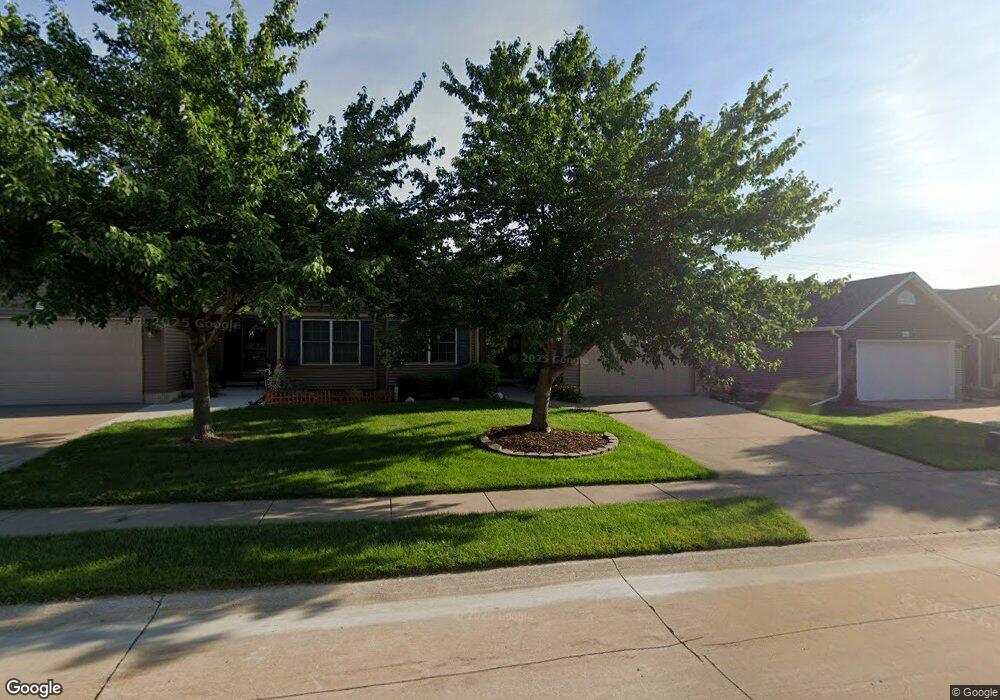
2030 W 59th St Davenport, IA 52806
North Side NeighborhoodEstimated Value: $276,000 - $309,000
2
Beds
3
Baths
1,352
Sq Ft
$214/Sq Ft
Est. Value
About This Home
This home is located at 2030 W 59th St, Davenport, IA 52806 and is currently estimated at $289,316, approximately $213 per square foot. 2030 W 59th St is a home located in Scott County with nearby schools including Martin Luther King Jr. Elementary School, Truman Elementary School, and Cumberland Hall School.
Ownership History
Date
Name
Owned For
Owner Type
Purchase Details
Closed on
Aug 25, 2020
Sold by
Ruplinger Nicholas J and Ruplinger Jennifer M
Bought by
Beale Joanna K and Beale Richard J
Current Estimated Value
Home Financials for this Owner
Home Financials are based on the most recent Mortgage that was taken out on this home.
Original Mortgage
$165,600
Outstanding Balance
$146,009
Interest Rate
2.8%
Mortgage Type
New Conventional
Estimated Equity
$143,307
Purchase Details
Closed on
Aug 21, 2015
Sold by
Robbins Elvina and Robbins William
Bought by
Robbins Elvina and Thomsen Virginia T
Purchase Details
Closed on
Mar 7, 2014
Sold by
Robbins William and Robbins Elvina
Bought by
Robbins Elvina
Create a Home Valuation Report for This Property
The Home Valuation Report is an in-depth analysis detailing your home's value as well as a comparison with similar homes in the area
Home Values in the Area
Average Home Value in this Area
Purchase History
| Date | Buyer | Sale Price | Title Company |
|---|---|---|---|
| Beale Joanna K | $207,000 | None Available | |
| Robbins Elvina | -- | Attorney | |
| Robbins Elvina | -- | None Available |
Source: Public Records
Mortgage History
| Date | Status | Borrower | Loan Amount |
|---|---|---|---|
| Open | Beale Joanna K | $165,600 |
Source: Public Records
Tax History Compared to Growth
Tax History
| Year | Tax Paid | Tax Assessment Tax Assessment Total Assessment is a certain percentage of the fair market value that is determined by local assessors to be the total taxable value of land and additions on the property. | Land | Improvement |
|---|---|---|---|---|
| 2025 | -- | $263,460 | $37,700 | $225,760 |
| 2024 | -- | $246,640 | $37,700 | $208,940 |
| 2023 | -- | $239,830 | $37,700 | $202,130 |
| 2022 | $0 | $195,230 | $33,800 | $161,430 |
| 2021 | $0 | $187,620 | $33,800 | $153,820 |
| 2020 | $4,188 | $187,620 | $33,800 | $153,820 |
| 2019 | $3,111 | $178,480 | $33,800 | $144,680 |
| 2018 | $3,488 | $178,480 | $33,800 | $144,680 |
| 2017 | $3,444 | $170,870 | $33,800 | $137,070 |
| 2016 | $3,312 | $163,250 | $0 | $0 |
| 2015 | $3,312 | $155,140 | $0 | $0 |
| 2014 | $3,178 | $155,140 | $0 | $0 |
| 2013 | $3,118 | $0 | $0 | $0 |
| 2012 | -- | $159,910 | $31,450 | $128,460 |
Source: Public Records
Map
Nearby Homes
- 1927 W 55th St
- 2434 W 59th St
- 2508 W 60th Place
- 2514 W 60th St
- 5510 N Division St
- 6504 Cedar St
- 5436 N Division St
- 5556 N Thornwood Ave
- Lot 65 W 66th St
- 1729 Welshire Dr
- 5812 Hillandale Rd
- 5824 Hillandale Rd
- 5904 Hillandale Rd
- 2620 W 54th St
- 6050 Hillandale Rd
- 2822 High Point Dr
- 2012 W 68th St
- 2714 W 66th St
- 2110 W 68th St
- 5210 N Division St