Estimated Value: $191,000 - $200,901
3
Beds
2
Baths
1,325
Sq Ft
$148/Sq Ft
Est. Value
About This Home
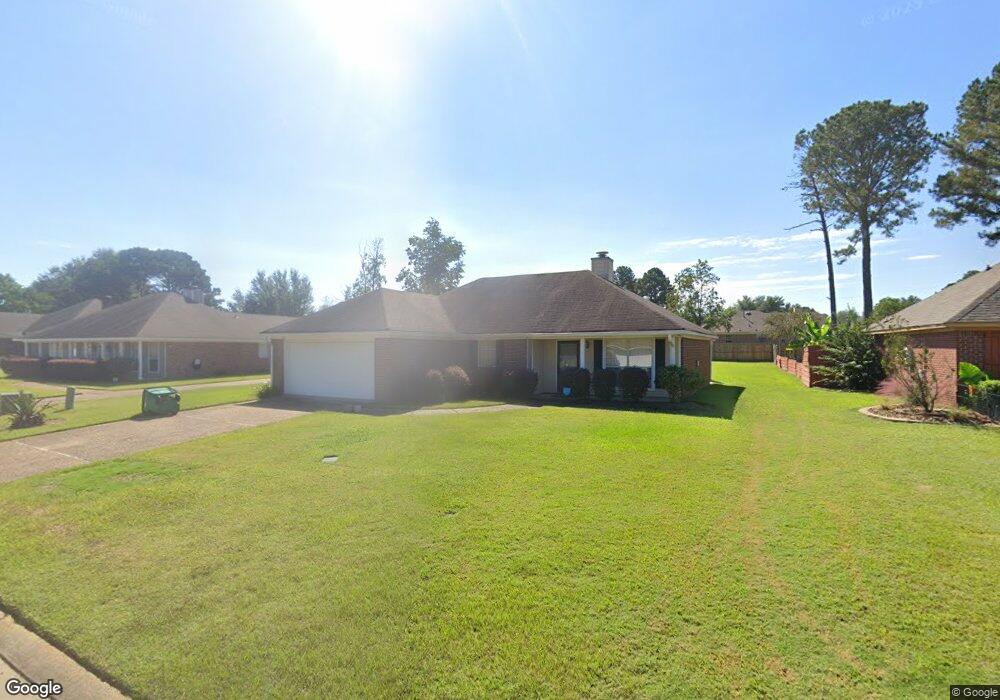
This home is located at 2031 Branch Creek Dr, Byram, MS 39272 and is currently estimated at $195,475, approximately $147 per square foot. 2031 Branch Creek Dr is a home located in Hinds County with nearby schools including Gary Road Elementary School, Gary Road Intermediate School, and Byram Middle School.
Ownership History
Date
Name
Owned For
Owner Type
Purchase Details
Closed on
Dec 11, 2007
Sold by
Gibson Steven Wayne
Bought by
White Jennie
Current Estimated Value
Home Financials for this Owner
Home Financials are based on the most recent Mortgage that was taken out on this home.
Original Mortgage
$118,655
Outstanding Balance
$74,792
Interest Rate
6.22%
Mortgage Type
Purchase Money Mortgage
Estimated Equity
$120,683
Create a Home Valuation Report for This Property
The Home Valuation Report is an in-depth analysis detailing your home's value as well as a comparison with similar homes in the area
Home Values in the Area
Average Home Value in this Area
Purchase History
| Date | Buyer | Sale Price | Title Company |
|---|---|---|---|
| White Jennie | -- | -- |
Source: Public Records
Mortgage History
| Date | Status | Borrower | Loan Amount |
|---|---|---|---|
| Open | White Jennie | $118,655 |
Source: Public Records
Tax History Compared to Growth
Tax History
| Year | Tax Paid | Tax Assessment Tax Assessment Total Assessment is a certain percentage of the fair market value that is determined by local assessors to be the total taxable value of land and additions on the property. | Land | Improvement |
|---|---|---|---|---|
| 2025 | $485 | $10,598 | $3,000 | $7,598 |
| 2024 | $485 | $10,598 | $3,000 | $7,598 |
| 2023 | $485 | $10,598 | $3,000 | $7,598 |
| 2022 | $1,630 | $10,598 | $3,000 | $7,598 |
| 2021 | $470 | $10,598 | $3,000 | $7,598 |
| 2020 | $444 | $10,463 | $3,000 | $7,463 |
| 2019 | $1,260 | $10,463 | $3,000 | $7,463 |
| 2018 | $1,260 | $10,463 | $3,000 | $7,463 |
| 2017 | $1,231 | $10,463 | $3,000 | $7,463 |
| 2016 | $1,231 | $10,463 | $3,000 | $7,463 |
| 2015 | $1,216 | $10,360 | $3,000 | $7,360 |
| 2014 | $1,195 | $10,360 | $3,000 | $7,360 |
Source: Public Records
Map
Nearby Homes
- 2120 Meagan Dr
- 38 Stacy Cove
- 85 Susan Cove
- 880 Redwood Cove
- 909 Eagles Nest Dr
- 1213 Lake Shore Dr
- Cali Plan at Cedars of Byram Estates
- Aria Plan at Cedars of Byram Estates
- 8834 Gary Rd
- 109 Lucas Ct
- 104 Lucas Ct
- 344 Brannan Ave
- 4417 Blake Cir
- 213 Longfellow Cove
- 0 Terry Rd Unit 21325508
- 0 Terry Rd Unit 24270230
- 0 Terry Rd Unit 4130083
- 368 Brannon Ave
- 109 Grand Oaks Place
- 5306 Gardens Way
- 2027 Branch Creek Dr
- 4274 Glenn Oak Dr
- 4266 Glenn Oak Dr
- 4276 Glenn Oak Dr
- 2035 Branch Creek Dr
- 120 Highland Cove
- 110 Trelles Cove
- 2039 Branch Creek Dr
- 190 Highland Cove
- 3188 Glennhaven Dr
- 130 Highland Cove
- 3192 Glennhaven Dr
- 3184 Glennhaven Dr
- 2023 Branch Creek Dr
- 180 Highland Cove
- 100 Trelles Cove
- 60 Trelles Cove
- 3180 Glennhaven Dr
- 4059 Glenn Oak Dr
- 140 Highland Cove