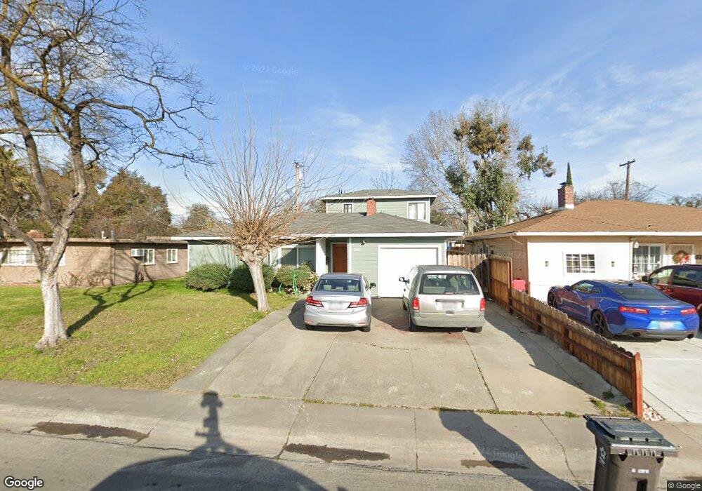
2031 Calhoun Way Unit 9 Stockton, CA 95207
Lincoln Village NeighborhoodEstimated Value: $321,000 - $422,000
3
Beds
2
Baths
1,628
Sq Ft
$236/Sq Ft
Est. Value
About This Home
This home is located at 2031 Calhoun Way Unit 9, Stockton, CA 95207 and is currently estimated at $383,717, approximately $235 per square foot. 2031 Calhoun Way Unit 9 is a home located in San Joaquin County with nearby schools including Tully C. Knoles School, Sierra Middle School, and Lincoln High School.
Ownership History
Date
Name
Owned For
Owner Type
Purchase Details
Closed on
May 20, 1994
Sold by
Thomas Brenton R and Thomas Jane
Bought by
Tam David Wai and Tam Sandy S
Current Estimated Value
Home Financials for this Owner
Home Financials are based on the most recent Mortgage that was taken out on this home.
Original Mortgage
$52,800
Interest Rate
8.83%
Create a Home Valuation Report for This Property
The Home Valuation Report is an in-depth analysis detailing your home's value as well as a comparison with similar homes in the area
Home Values in the Area
Average Home Value in this Area
Purchase History
| Date | Buyer | Sale Price | Title Company |
|---|---|---|---|
| Tam David Wai | $66,000 | North American Title Company |
Source: Public Records
Mortgage History
| Date | Status | Borrower | Loan Amount |
|---|---|---|---|
| Closed | Tam David Wai | $52,800 |
Source: Public Records
Tax History Compared to Growth
Tax History
| Year | Tax Paid | Tax Assessment Tax Assessment Total Assessment is a certain percentage of the fair market value that is determined by local assessors to be the total taxable value of land and additions on the property. | Land | Improvement |
|---|---|---|---|---|
| 2025 | $3,689 | $140,385 | $67,967 | $72,418 |
| 2024 | $3,568 | $137,634 | $66,635 | $70,999 |
| 2023 | $3,476 | $134,936 | $65,329 | $69,607 |
| 2022 | $3,319 | $132,292 | $64,049 | $68,243 |
| 2021 | $3,258 | $129,699 | $62,794 | $66,905 |
| 2020 | $3,223 | $128,370 | $62,151 | $66,219 |
| 2019 | $3,198 | $125,854 | $60,933 | $64,921 |
| 2018 | $3,121 | $123,388 | $59,739 | $63,649 |
| 2017 | $3,091 | $120,969 | $58,568 | $62,401 |
| 2016 | $2,876 | $118,598 | $57,420 | $61,178 |
| 2014 | $2,891 | $114,530 | $55,450 | $59,080 |
Source: Public Records
Map
Nearby Homes
- 1864 Polk Way
- 2252 W Benjamin Holt Dr
- 1703 Polk Way
- 2447 Calhoun Way
- 1707 W Swain Rd Unit 5
- 2316 W Swain Rd
- 1633 Porter Way
- 1629 Porter Way
- 1720 Mcclellan Way
- 1719 W Swain Rd Unit A
- 2423 W Swain Rd
- 1545 Douglas Rd
- 1608 Porter Way
- 5860 Alexandria Place
- 1583 W Swain Rd
- 1489 W Swain Rd
- 2128 Canyon Creek Dr
- 6523 Vicksburg Place
- 2738 W Benjamin Holt Dr
- 1720 Silver Creek Cir
- 2023 Calhoun Way
- 2039 Calhoun Way
- 2032 Rutledge Way
- 2013 Calhoun Way
- 2049 Calhoun Way
- 2042 Rutledge Way
- 2014 Rutledge Way
- 2052 Rutledge Way Unit 9
- 2032 Calhoun Way
- 2003 Calhoun Way
- 2042 Calhoun Way
- 2024 Calhoun Way
- 2061 Calhoun Way
- 2052 Calhoun Way
- 2014 Calhoun Way
- 2006 Rutledge Way
- 2062 Rutledge Way
- 1959 Calhoun Way
- 2062 Calhoun Way
- 2006 Calhoun Way