Estimated Value: $314,000 - $387,000
3
Beds
3
Baths
3,268
Sq Ft
$111/Sq Ft
Est. Value
About This Home
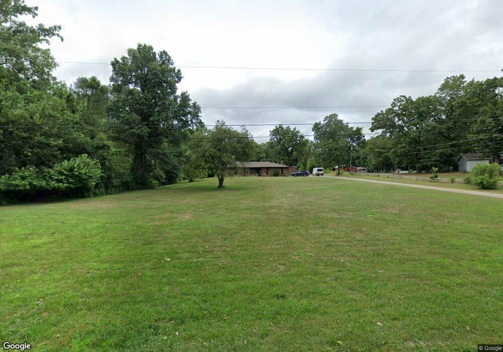
This home is located at 2031 Stateline Rd, Niles, MI 49120 and is currently estimated at $361,963, approximately $110 per square foot. 2031 Stateline Rd is a home located in Berrien County with nearby schools including Merritt Elementary School, Brandywine Elementary School, and Brandywine Middle School.
Ownership History
Date
Name
Owned For
Owner Type
Purchase Details
Closed on
Dec 8, 2005
Sold by
Jennings Marian J and Alexander Maxine K
Bought by
Rogers Charles R and Rogers Veronica
Current Estimated Value
Home Financials for this Owner
Home Financials are based on the most recent Mortgage that was taken out on this home.
Original Mortgage
$173,180
Outstanding Balance
$97,527
Interest Rate
6.4%
Mortgage Type
New Conventional
Estimated Equity
$264,436
Purchase Details
Closed on
Jul 8, 2004
Sold by
Jennings Marian J
Bought by
Jennings Marian J and Alexander Maxine K
Purchase Details
Closed on
Jul 6, 1979
Purchase Details
Closed on
Jan 23, 1979
Purchase Details
Closed on
Apr 18, 1977
Create a Home Valuation Report for This Property
The Home Valuation Report is an in-depth analysis detailing your home's value as well as a comparison with similar homes in the area
Home Values in the Area
Average Home Value in this Area
Purchase History
| Date | Buyer | Sale Price | Title Company |
|---|---|---|---|
| Rogers Charles R | $200,000 | None Available | |
| Jennings Marian J | -- | Chicago Title Insurance Comp | |
| -- | -- | -- | |
| -- | $7,000 | -- | |
| -- | $7,000 | -- |
Source: Public Records
Mortgage History
| Date | Status | Borrower | Loan Amount |
|---|---|---|---|
| Open | Rogers Charles R | $173,180 |
Source: Public Records
Tax History Compared to Growth
Tax History
| Year | Tax Paid | Tax Assessment Tax Assessment Total Assessment is a certain percentage of the fair market value that is determined by local assessors to be the total taxable value of land and additions on the property. | Land | Improvement |
|---|---|---|---|---|
| 2025 | $3,201 | $151,800 | $0 | $0 |
| 2024 | $2,212 | $147,700 | $0 | $0 |
| 2023 | $2,107 | $140,500 | $0 | $0 |
| 2022 | $2,017 | $121,100 | $0 | $0 |
| 2021 | $2,713 | $108,900 | $20,000 | $88,900 |
| 2020 | $2,701 | $104,300 | $0 | $0 |
| 2019 | $2,652 | $94,800 | $20,000 | $74,800 |
| 2018 | $2,558 | $94,800 | $0 | $0 |
| 2017 | $2,536 | $90,600 | $0 | $0 |
| 2016 | $2,496 | $87,800 | $0 | $0 |
| 2015 | $2,456 | $91,600 | $0 | $0 |
| 2014 | $1,771 | $88,600 | $0 | $0 |
Source: Public Records
Map
Nearby Homes
- 50562 Trammell Dr
- 2006 Ontario Rd Unit 78
- 33944 Redfield St
- 53384 Stone Ridge Dr Unit 18
- 18015 Stone Ridge Dr Unit 14
- 50525 Allegheny Ct
- 18445 Forest Glade Dr
- 51095 Chatham Ridge Dr
- 18560 Fontana Dr
- 29929 Ridge Cove
- 17768 Ashford Hills Ct
- 70700 Ironwood Dr
- 18008 Erin Ct
- 33649 Washington St
- VL Washington St
- 33192 Old Post Rd
- 19357 Orchard St
- 2801 Primrose Ct
- 50840 Mercury Dr
- 33081 Old Post Rd
- 2035 Stateline Rd
- 2041 Stateline Rd
- 2045 Stateline Rd
- 50525 Carrington Place Dr
- 18360 State Line Rd
- 2049 Stateline Rd
- 50524 Carrington Place Dr
- 50546 Carrington Place Dr
- 50521 Trammell Dr
- 18260 State Line Rd
- 50568 Carrington Place Dr
- 33972 Stateline Rd
- 50541 Trammell Dr
- 50561 Trammell Dr
- 50522 Trammell Dr
- 50581 Trammell Dr
- 50542 Trammell Dr
- 50608 Carrington Place Dr
- 33912 Stateline Rd
- 50607 Trammell Dr