
Seller's Agent in 2017
Peter May
Compass Commercial Real Estate
(541) 383-2444
3 in this area
17 Total Sales


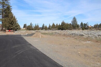

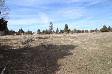
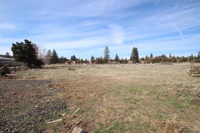
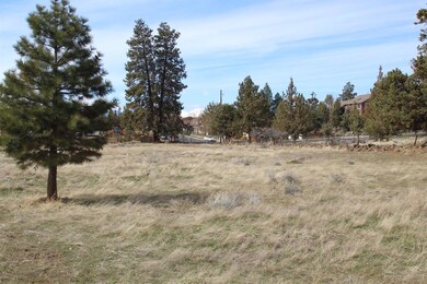
Centrally located residential development land available. 5.47 acres of mostly flat RM zoned and available for development. City water and sewer available in Britta Street. Located on Bend's desirable west side. Close to shopping and has easy access to Highway 97.
Last Agent to Sell the Property
Compass Commercial Real Estate License #200606373 Listed on: 03/25/2017
| Date | Event | Price | List to Sale | Price per Sq Ft |
|---|---|---|---|---|
| 09/29/2017 09/29/17 | Sold | $1,800,000 | -20.0% | $1,623 / Sq Ft |
| 06/19/2017 06/19/17 | Pending | -- | -- | -- |
| 03/24/2017 03/24/17 | For Sale | $2,250,000 | -- | $2,029 / Sq Ft |
| Year | Tax Paid | Tax Assessment Tax Assessment Total Assessment is a certain percentage of the fair market value that is determined by local assessors to be the total taxable value of land and additions on the property. | Land | Improvement |
|---|---|---|---|---|
| 2025 | $236,169 | $13,977,580 | -- | -- |
| 2024 | $227,217 | $13,570,470 | -- | -- |
| 2023 | $204,994 | $12,822,680 | $0 | $0 |
| 2022 | $2,317 | $174,520 | $0 | $0 |
| 2021 | $2,766 | $169,440 | $0 | $0 |
| 2020 | $2,624 | $169,440 | $0 | $0 |
| 2019 | $2,551 | $164,510 | $0 | $0 |
| 2018 | $2,479 | $159,720 | $0 | $0 |
| 2017 | $2,406 | $155,070 | $0 | $0 |
| 2016 | $2,295 | $150,560 | $0 | $0 |
| 2015 | $2,231 | $146,180 | $0 | $0 |
| 2014 | $2,166 | $141,930 | $0 | $0 |
Seller's Agent in 2017
Peter May
Compass Commercial Real Estate
(541) 383-2444
3 in this area
17 Total Sales
Seller Co-Listing Agent in 2017
Russell Huntamer
Compass Commercial Real Estate
(541) 848-4049
1 in this area
16 Total Sales
Buyer's Agent in 2017
Scott McAvoy
Knightsbridge International
(503) 534-1526
9 Total Sales
Source: Oregon Datashare
MLS Number: 201702152
APN: 171220 A0 00400
Disclaimer: Certain information contained herein is derived from information provided by parties other than Homes.com. All information provided is deemed reliable, but is not guaranteed to be accurate and should be independently verified.
![]() © 2026 Oregon Datashare (KCAR | MLSCO | SOMLS). All rights reserved. The data relating to real estate for sale on this web site comes in part from the Internet Data Exchange Program of the Oregon Datashare. Real estate listings held by IDX Brokerage firms other than Ten-X are marked with the Internet Data Exchange logo or the Internet Data Exchange thumbnail logo and detailed information about them includes the name of the listing Brokers. Information provided is for consumers' personal, non-commercial use and may not be used for any purpose other than to identify prospective properties the viewer may be interested in purchasing. The consumer will not copy, retransmit nor redistribute any of the content from this website. Information provided is deemed reliable, but not guaranteed.
© 2026 Oregon Datashare (KCAR | MLSCO | SOMLS). All rights reserved. The data relating to real estate for sale on this web site comes in part from the Internet Data Exchange Program of the Oregon Datashare. Real estate listings held by IDX Brokerage firms other than Ten-X are marked with the Internet Data Exchange logo or the Internet Data Exchange thumbnail logo and detailed information about them includes the name of the listing Brokers. Information provided is for consumers' personal, non-commercial use and may not be used for any purpose other than to identify prospective properties the viewer may be interested in purchasing. The consumer will not copy, retransmit nor redistribute any of the content from this website. Information provided is deemed reliable, but not guaranteed.