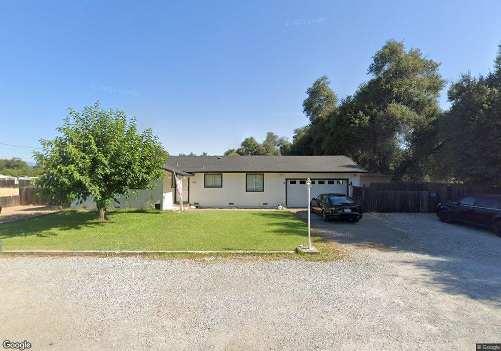
20318 Demac Dr Redding, CA 96002
Clover Creek NeighborhoodEstimated Value: $314,290 - $357,000
3
Beds
2
Baths
1,226
Sq Ft
$273/Sq Ft
Est. Value
About This Home
This home is located at 20318 Demac Dr, Redding, CA 96002 and is currently estimated at $335,073, approximately $273 per square foot. 20318 Demac Dr is a home located in Shasta County with nearby schools including Junction Elementary School, Foothill High School, and California Heritage Youth Build Academy.
Ownership History
Date
Name
Owned For
Owner Type
Purchase Details
Closed on
Aug 27, 2012
Sold by
Rotherham Jerlyn L
Bought by
Rotherham Jeffrey J
Current Estimated Value
Home Financials for this Owner
Home Financials are based on the most recent Mortgage that was taken out on this home.
Original Mortgage
$118,400
Outstanding Balance
$81,618
Interest Rate
3.49%
Mortgage Type
New Conventional
Estimated Equity
$253,455
Purchase Details
Closed on
May 29, 2012
Sold by
Clifton William T
Bought by
Fall River Development Inc
Purchase Details
Closed on
Nov 17, 1999
Sold by
Sp Clifton William T
Bought by
Clifton William T
Home Financials for this Owner
Home Financials are based on the most recent Mortgage that was taken out on this home.
Original Mortgage
$88,200
Interest Rate
7.82%
Create a Home Valuation Report for This Property
The Home Valuation Report is an in-depth analysis detailing your home's value as well as a comparison with similar homes in the area
Home Values in the Area
Average Home Value in this Area
Purchase History
| Date | Buyer | Sale Price | Title Company |
|---|---|---|---|
| Rotherham Jeffrey J | -- | Fidelity Natl Title Co Of Ca | |
| Rotherham Jeffrey J | $148,000 | Fidelity Natl Title Co Of Ca | |
| Fall River Development Inc | $76,100 | None Available | |
| Clifton William T | -- | Fidelity National Title |
Source: Public Records
Mortgage History
| Date | Status | Borrower | Loan Amount |
|---|---|---|---|
| Open | Rotherham Jeffrey J | $118,400 | |
| Previous Owner | Clifton William T | $88,200 |
Source: Public Records
Tax History Compared to Growth
Tax History
| Year | Tax Paid | Tax Assessment Tax Assessment Total Assessment is a certain percentage of the fair market value that is determined by local assessors to be the total taxable value of land and additions on the property. | Land | Improvement |
|---|---|---|---|---|
| 2025 | $1,948 | $182,241 | $36,938 | $145,303 |
| 2024 | $1,916 | $178,668 | $36,214 | $142,454 |
| 2023 | $1,916 | $175,165 | $35,504 | $139,661 |
| 2022 | $1,869 | $171,731 | $34,808 | $136,923 |
| 2021 | $1,836 | $168,365 | $34,126 | $134,239 |
| 2020 | $1,840 | $166,640 | $33,777 | $132,863 |
| 2019 | $1,770 | $163,373 | $33,115 | $130,258 |
| 2018 | $1,804 | $160,170 | $32,466 | $127,704 |
| 2017 | $1,751 | $157,030 | $31,830 | $125,200 |
| 2016 | $1,663 | $153,952 | $31,206 | $122,746 |
| 2015 | $1,593 | $151,641 | $30,738 | $120,903 |
| 2014 | $1,574 | $148,671 | $30,136 | $118,535 |
Source: Public Records
Map
Nearby Homes
- 4655 Goodwater Ave
- 5090 Bogie Ln
- 3086 Henrys Fork Dr
- 2877 Green Riffle Rd
- 5101 Mclaren Dr
- 3863 Indian Wells Ln
- 3424 Lowland Ave
- 2931 Hopkins Ave
- 3239 Lowland Ave
- 9105 Madrone Way
- 3258 Lower Ln
- 3225 Lower Ln
- 5528 Muir Peak Rd
- 2913 Hopkins Ave
- 3017 Renault Ct
- 3036 Legend Ln
- 3215 Lowland Ave
- 3324 Lowland Ave
- 3028 Legend Ln
- 3232 Lower Ln
- 0 Demac Dr
- 8700 Airport Rd
- 20319 Demac Dr
- 20307 Demac Dr
- 20299 Demac Dr
- 20270 Demac Dr
- 20291 Demac Dr
- 4738 Airport Rd
- 20277 Demac Dr
- 20259 Blue Jay Dr
- 8711 Airport Rd
- 8693 Airport Rd
- 8730 Airport Rd
- 20258 Demac Dr
- 8640 Airport Rd
- 20257 Demac Dr
- 8743 Airport Rd
- 20250 Demac Dr
- 8748 Airport Rd
- 99999 Airport Rd
