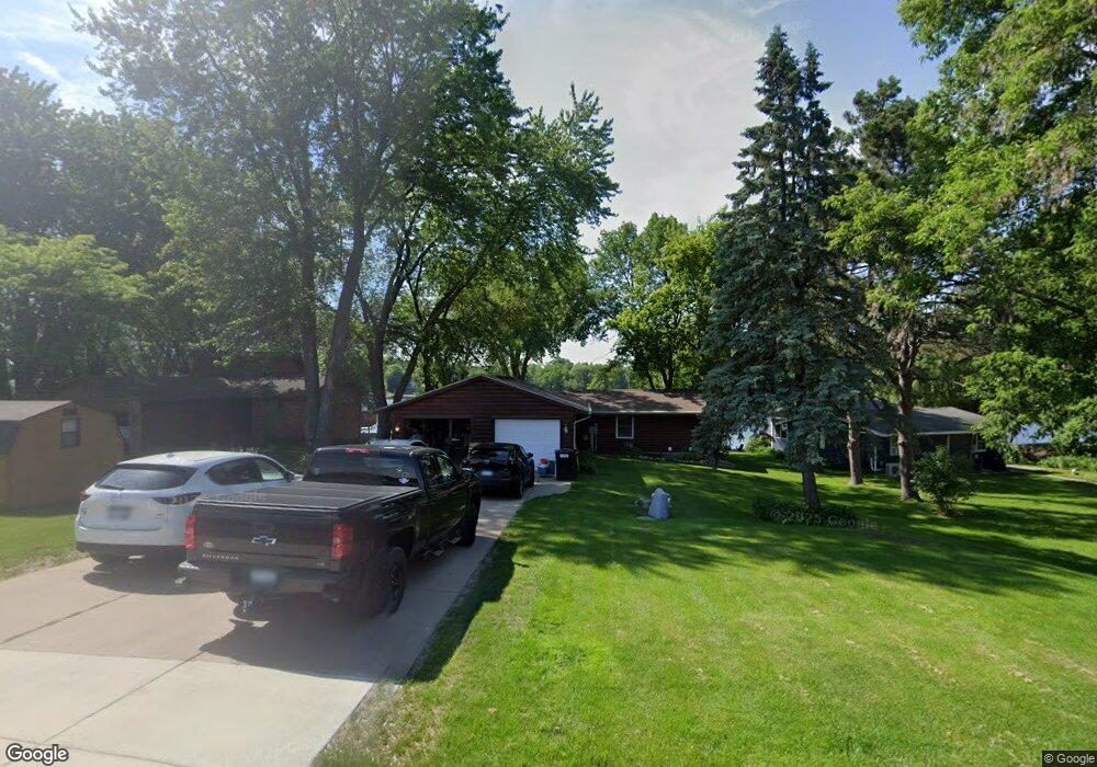
2032 Donnelly Dr NW Buffalo, MN 55313
Estimated Value: $620,000 - $743,284
3
Beds
2
Baths
1,152
Sq Ft
$590/Sq Ft
Est. Value
About This Home
This home is located at 2032 Donnelly Dr NW, Buffalo, MN 55313 and is currently estimated at $679,321, approximately $589 per square foot. 2032 Donnelly Dr NW is a home located in Wright County with nearby schools including Maple Lake Elementary School and Maple Lake High School.
Ownership History
Date
Name
Owned For
Owner Type
Purchase Details
Closed on
May 13, 2019
Sold by
Fobbe Robert R and Fobbe Tana K
Bought by
Knutson Theodore E
Current Estimated Value
Home Financials for this Owner
Home Financials are based on the most recent Mortgage that was taken out on this home.
Original Mortgage
$348,500
Outstanding Balance
$332,953
Interest Rate
10.25%
Mortgage Type
Adjustable Rate Mortgage/ARM
Estimated Equity
$346,368
Purchase Details
Closed on
Sep 2, 2005
Sold by
Olsen Nicholas A and Olsen Mary B
Bought by
Fobbe Robert R
Purchase Details
Closed on
May 2, 2005
Sold by
Root Ronald D
Bought by
Olsen Nicholas A and Olsen Mary B
Create a Home Valuation Report for This Property
The Home Valuation Report is an in-depth analysis detailing your home's value as well as a comparison with similar homes in the area
Home Values in the Area
Average Home Value in this Area
Purchase History
| Date | Buyer | Sale Price | Title Company |
|---|---|---|---|
| Knutson Theodore E | $410,000 | Northland Title | |
| Fobbe Robert R | $375,000 | -- | |
| Olsen Nicholas A | $300,000 | -- |
Source: Public Records
Mortgage History
| Date | Status | Borrower | Loan Amount |
|---|---|---|---|
| Open | Knutson Theodore E | $348,500 |
Source: Public Records
Tax History Compared to Growth
Tax History
| Year | Tax Paid | Tax Assessment Tax Assessment Total Assessment is a certain percentage of the fair market value that is determined by local assessors to be the total taxable value of land and additions on the property. | Land | Improvement |
|---|---|---|---|---|
| 2025 | $7,356 | $644,400 | $367,000 | $277,400 |
| 2024 | $5,270 | $604,500 | $337,500 | $267,000 |
| 2023 | $4,724 | $566,100 | $300,600 | $265,500 |
| 2022 | $4,510 | $483,000 | $241,600 | $241,400 |
| 2021 | $4,316 | $416,200 | $204,800 | $211,400 |
| 2020 | $4,360 | $382,800 | $186,200 | $196,600 |
| 2019 | $4,242 | $372,600 | $0 | $0 |
| 2018 | $3,872 | $354,900 | $0 | $0 |
| 2017 | $3,482 | $330,700 | $0 | $0 |
| 2016 | $3,404 | $0 | $0 | $0 |
| 2015 | $3,172 | $0 | $0 | $0 |
| 2014 | -- | $0 | $0 | $0 |
Source: Public Records
Map
Nearby Homes
- 1978 Donnelly Dr NW
- 2532 62nd St NW
- 4963 Crofoot Ave NW
- TBD 72nd St NW
- 655 55th St NE
- XXX 95th St NW
- 8486 Acacia Ave NE
- 1030 94th St NW
- 7952 Braddock Ave NE
- 210 6th St NW
- 198 35th St NE
- XXXX Highway 55
- 640 Robert Ave N
- 451 Marian Dr
- TBD 5th St S
- 2557 Clementa Ave NW
- 713 Danielson Ct
- 520 Ramey Rd
- 412 5th St NW
- 416 5th St NW
- 2042 Donnelly Dr NW
- 2022 Donnelly Dr NW
- 2022 2022 Nw Donnelly Dr NW
- 2022 2022 Donnelly Dr NW
- 2050 Donnelly Dr NW
- 2050 2050 Donnelly Dr NW
- 2012 Donnelly Dr NW
- 2000 Donnelly Dr NW
- 2000 2000 Donnelly Dr NW
- 2078 Donnelly Dr NW
- 1998 Donnelly Dr NW
- 2081 Donnelly Dr NW
- 2086 Donnelly Dr NW
- 2086 2086 Donnelly Dr NW
- 1978 1978 Se Donnelly-Drive-
- 1971 Donnelly Dr NW
- 2021 Donnelly Dr NW
- 2102 Donnelly Dr NW
- 1964 Donnelly Dr NW
- 2118 Donnelly Dr NW