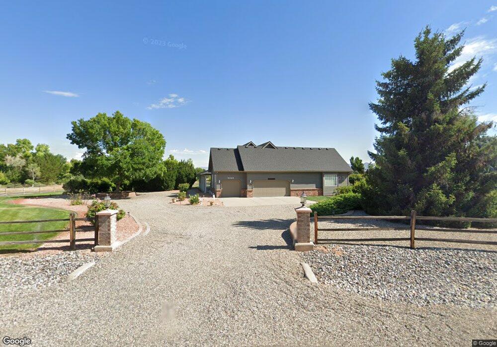
2032 E Liberty Ct Grand Junction, CO 81507
Redlands NeighborhoodEstimated Value: $1,085,026 - $1,258,000
4
Beds
4
Baths
4,585
Sq Ft
$254/Sq Ft
Est. Value
About This Home
This home is located at 2032 E Liberty Ct, Grand Junction, CO 81507 and is currently estimated at $1,164,507, approximately $253 per square foot. 2032 E Liberty Ct is a home located in Mesa County with nearby schools including Wingate Elementary School, Redlands Middle School, and Fruita 8/9 School.
Ownership History
Date
Name
Owned For
Owner Type
Purchase Details
Closed on
Jan 8, 2019
Sold by
Quamme Dean L and Quamme Suzanne I
Bought by
Quamme Dean L and Quamme Suzanne I
Current Estimated Value
Purchase Details
Closed on
Feb 26, 1998
Sold by
Quamme Dean L Quamme Suzanne I
Bought by
The Dean L Quamme Trust and The Suzanne I Quamme Trust
Purchase Details
Closed on
Aug 1, 1996
Sold by
Jim West Builders Inc
Bought by
Quamme Dean L and Quamme Suzanne I
Home Financials for this Owner
Home Financials are based on the most recent Mortgage that was taken out on this home.
Original Mortgage
$234,000
Outstanding Balance
$18,695
Interest Rate
8.33%
Estimated Equity
$1,145,812
Purchase Details
Closed on
Mar 19, 1996
Sold by
Independence Valley Corporation
Bought by
Quamme Suzanne I Trust
Create a Home Valuation Report for This Property
The Home Valuation Report is an in-depth analysis detailing your home's value as well as a comparison with similar homes in the area
Home Values in the Area
Average Home Value in this Area
Purchase History
| Date | Buyer | Sale Price | Title Company |
|---|---|---|---|
| Quamme Dean L | -- | None Available | |
| The Dean L Quamme Trust | -- | -- | |
| Quamme Dean L | $292,500 | -- | |
| Quamme Suzanne I Trust | -- | -- |
Source: Public Records
Mortgage History
| Date | Status | Borrower | Loan Amount |
|---|---|---|---|
| Open | Quamme Dean L | $234,000 |
Source: Public Records
Tax History Compared to Growth
Tax History
| Year | Tax Paid | Tax Assessment Tax Assessment Total Assessment is a certain percentage of the fair market value that is determined by local assessors to be the total taxable value of land and additions on the property. | Land | Improvement |
|---|---|---|---|---|
| 2024 | $3,914 | $62,090 | $12,650 | $49,440 |
| 2023 | $3,914 | $62,090 | $12,650 | $49,440 |
| 2022 | $3,206 | $51,610 | $11,470 | $40,140 |
| 2021 | $3,315 | $53,090 | $11,800 | $41,290 |
| 2020 | $3,058 | $51,020 | $11,800 | $39,220 |
| 2019 | $2,867 | $51,020 | $11,800 | $39,220 |
| 2018 | $2,922 | $47,650 | $12,240 | $35,410 |
| 2017 | $2,916 | $47,650 | $12,240 | $35,410 |
| 2016 | $2,837 | $52,000 | $13,530 | $38,470 |
| 2015 | $2,860 | $52,000 | $13,530 | $38,470 |
| 2014 | $2,392 | $44,810 | $13,530 | $31,280 |
Source: Public Records
Map
Nearby Homes
- 2035 Wrangler Way
- 2034 Rodeo Way
- 677 Roundup Dr
- 693 Roundup Dr
- 714 Malachi St
- 2057 Sienna Creek Ct
- 700 Roundup Dr
- 668 Ellen Dr
- 664 Ellen Dr
- 2057 Ferree Dr
- 659 Ellen Dr
- 651 Eagles Nest Ct
- 630 Manzanita Dr
- 631 Margarita Dr
- 605 Manzanita Dr
- 634 Manzanita Dr
- 606 Manzanita Dr
- 624 Manzanita Dr
- 632 Manzanita Dr
- 604 Manzanita Dr
- 2034 E Liberty Ct
- 670 Independence Valley Dr
- 2030 W Liberty Ct
- 2033 E Liberty Ct
- 2031 Roosevelt Ct
- W Liberty Ct
- 672 Independence Valley Dr
- 2035 E Liberty Ct
- 2031 W Liberty Ct
- 2031 Wrangler Way
- 2026 Stetson Ct
- 2028 W Liberty Ct
- 2029 Roosevelt Ct
- 2029 Wrangler Way
- 2033 Wrangler Way
- 2027 Wrangler Way
- 2028 Stetson Ct
- 674 Independence Valley Dr
- 0 Roosevelt Ct