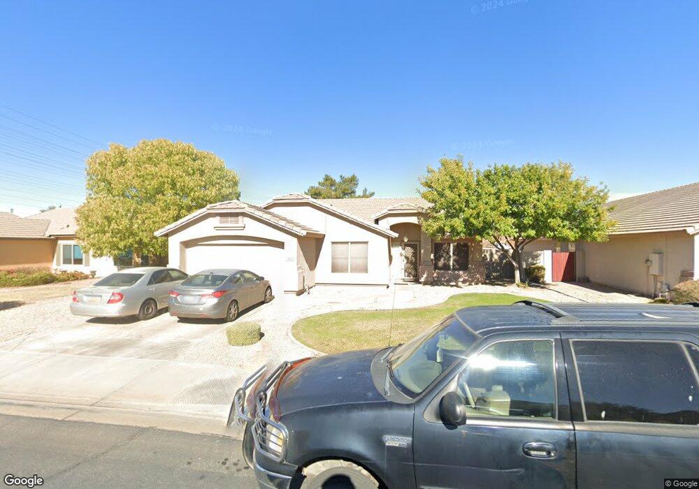
2032 E Smoke Tree Rd Gilbert, AZ 85296
East Gilbert NeighborhoodEstimated Value: $1,547,069 - $1,785,000
3
Beds
3
Baths
2,556
Sq Ft
$643/Sq Ft
Est. Value
About This Home
This home is located at 2032 E Smoke Tree Rd, Gilbert, AZ 85296 and is currently estimated at $1,644,267, approximately $643 per square foot. 2032 E Smoke Tree Rd is a home located in Maricopa County with nearby schools including Finley Farms Elementary School, Greenfield Junior High School, and American Leadership Academy Gilbert North 7-12.
Ownership History
Date
Name
Owned For
Owner Type
Purchase Details
Closed on
Dec 29, 2023
Sold by
Karl D And Donna G Guelich Family Trust
Bought by
Royse Revocable Trust and Royse
Current Estimated Value
Purchase Details
Closed on
Nov 29, 2007
Sold by
Whittington Thomas L
Bought by
Guelich Karl D and Guelich Donna G
Home Financials for this Owner
Home Financials are based on the most recent Mortgage that was taken out on this home.
Original Mortgage
$852,000
Interest Rate
5.87%
Mortgage Type
New Conventional
Purchase Details
Closed on
Jan 25, 2005
Sold by
Smoketree Llc
Bought by
Whittington Thomas L and Whittington Ashley
Home Financials for this Owner
Home Financials are based on the most recent Mortgage that was taken out on this home.
Original Mortgage
$641,250
Interest Rate
4.87%
Mortgage Type
Purchase Money Mortgage
Purchase Details
Closed on
Jan 24, 2001
Sold by
Vandegna Robert M
Bought by
Smoketree Llc
Create a Home Valuation Report for This Property
The Home Valuation Report is an in-depth analysis detailing your home's value as well as a comparison with similar homes in the area
Home Values in the Area
Average Home Value in this Area
Purchase History
| Date | Buyer | Sale Price | Title Company |
|---|---|---|---|
| Royse Revocable Trust | $1,650,000 | Arizona Premier Title | |
| Guelich Karl D | $1,065,000 | North American Title Company | |
| Whittington Thomas L | $855,000 | Fidelity National Title | |
| Smoketree Llc | $335,000 | Ati Title Agency |
Source: Public Records
Mortgage History
| Date | Status | Borrower | Loan Amount |
|---|---|---|---|
| Previous Owner | Guelich Karl D | $852,000 | |
| Previous Owner | Whittington Thomas L | $641,250 |
Source: Public Records
Tax History
| Year | Tax Paid | Tax Assessment Tax Assessment Total Assessment is a certain percentage of the fair market value that is determined by local assessors to be the total taxable value of land and additions on the property. | Land | Improvement |
|---|---|---|---|---|
| 2025 | $3,228 | $83,986 | -- | -- |
| 2024 | $3,039 | $79,987 | -- | -- |
| 2023 | $3,039 | $92,380 | $18,470 | $73,910 |
| 2022 | $2,977 | $78,460 | $15,690 | $62,770 |
| 2021 | $3,342 | $78,510 | $15,700 | $62,810 |
| 2020 | $3,294 | $77,480 | $15,490 | $61,990 |
| 2019 | $3,195 | $73,870 | $14,770 | $59,100 |
| 2018 | $3,075 | $71,130 | $14,220 | $56,910 |
| 2017 | $2,964 | $68,630 | $13,720 | $54,910 |
| 2016 | $2,948 | $62,410 | $12,480 | $49,930 |
| 2015 | $2,789 | $51,560 | $10,310 | $41,250 |
Source: Public Records
Map
Nearby Homes
- 1894 E Palomino Dr
- 2062 E Arabian Dr
- 2222 E Arabian Dr
- 2353 E Willow Wick Rd
- 1805 E Appaloosa Rd
- 1735 E Saratoga St
- 2069 E Sierra Madre Ave
- 1678 E Rawhide St
- 1675 E Robin Ln
- 1648 E Palomino Dr
- 2056 E San Tan Ct
- 1745 E Cheyenne St
- 952 S Canal Dr
- 2519 E Rawhide St
- 4161 E Pinto Dr
- 335 S Red Rock St
- 633 S Parkcrest St
- 2336 E San Tan Dr
- 2601 E Mesquite St
- 2284 E Stottler Dr
- 2032 E Smoke Tree Rd
- 2042 E Smoke Tree Rd
- 2022 E Smoke Tree Rd
- 2046 E Smoke Tree Rd
- 2033 E Willow Wick Rd
- 2052 E Smoke Tree Rd
- 2012 E Smoke Tree Rd
- 2043 E Willow Wick Rd
- 2035 E Smoke Tree Rd
- 2025 E Smoke Tree Rd
- 2003 E Smoke Tree Rd
- 2013 E Willow Wick Rd
- 2053 E Willow Wick Rd
- 2045 E Smoke Tree Rd
- 2045 E Smoke Tree Rd
- 2062 E Smoke Tree Rd
- 2015 E Smoke Tree Rd
- 2055 E Smoke Tree Rd
- 2005 E Smoke Tree Rd
- 2063 E Willow Wick Rd