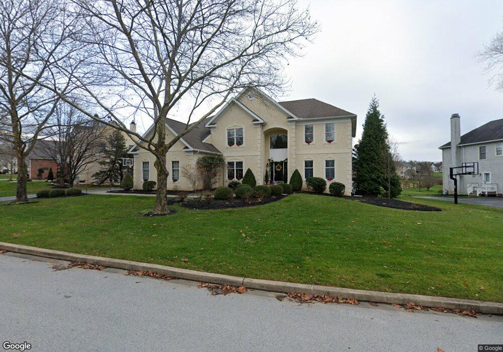
2032 Saint Andrews Dr Berwyn, PA 19312
Estimated Value: $1,605,434 - $1,827,000
4
Beds
5
Baths
4,086
Sq Ft
$419/Sq Ft
Est. Value
About This Home
This home is located at 2032 Saint Andrews Dr, Berwyn, PA 19312 and is currently estimated at $1,713,109, approximately $419 per square foot. 2032 Saint Andrews Dr is a home located in Chester County with nearby schools including Beaumont Elementary School, Tredyffrin-Easttown Middle School, and Conestoga Senior High School.
Ownership History
Date
Name
Owned For
Owner Type
Purchase Details
Closed on
Jun 6, 2003
Sold by
Rose Sheryl A
Bought by
Kent Michael A and Kent Nicole B
Current Estimated Value
Purchase Details
Closed on
Oct 3, 2000
Sold by
Greens At Waynesborough Lp
Bought by
Rose Sheryl A
Home Financials for this Owner
Home Financials are based on the most recent Mortgage that was taken out on this home.
Original Mortgage
$428,900
Interest Rate
7.88%
Create a Home Valuation Report for This Property
The Home Valuation Report is an in-depth analysis detailing your home's value as well as a comparison with similar homes in the area
Home Values in the Area
Average Home Value in this Area
Purchase History
| Date | Buyer | Sale Price | Title Company |
|---|---|---|---|
| Kent Michael A | $700,000 | -- | |
| Rose Sheryl A | $571,946 | -- |
Source: Public Records
Mortgage History
| Date | Status | Borrower | Loan Amount |
|---|---|---|---|
| Previous Owner | Rose Sheryl A | $428,900 |
Source: Public Records
Tax History Compared to Growth
Tax History
| Year | Tax Paid | Tax Assessment Tax Assessment Total Assessment is a certain percentage of the fair market value that is determined by local assessors to be the total taxable value of land and additions on the property. | Land | Improvement |
|---|---|---|---|---|
| 2025 | $17,730 | $475,330 | $177,600 | $297,730 |
| 2024 | $17,730 | $475,330 | $177,600 | $297,730 |
| 2023 | $16,577 | $475,330 | $177,600 | $297,730 |
| 2022 | $16,124 | $475,330 | $177,600 | $297,730 |
| 2021 | $15,774 | $475,330 | $177,600 | $297,730 |
| 2020 | $15,335 | $475,330 | $177,600 | $297,730 |
| 2019 | $14,908 | $475,330 | $177,600 | $297,730 |
| 2018 | $14,650 | $475,330 | $177,600 | $297,730 |
| 2017 | $14,319 | $475,330 | $177,600 | $297,730 |
| 2016 | -- | $475,330 | $177,600 | $297,730 |
| 2015 | -- | $475,330 | $177,600 | $297,730 |
| 2014 | -- | $475,330 | $177,600 | $297,730 |
Source: Public Records
Map
Nearby Homes
- 2000 Saint Andrews Dr
- 650 Augusta Ct
- 17 Foxchase Rd
- 1705 Weatherstone Dr
- 521 Foxwood Ln
- 1304 Weatherstone Dr Unit 1304
- 1441 Berwyn Paoli Rd
- 2102 Quail Ridge Dr
- 36 Rabbit Run Rd
- 121 Davis Rd
- 191 Stony Point Dr
- 206 Yorktown Place Unit 106
- 5 Kent Ln
- 837 Nathan Hale Rd
- 1179 Beaumont Rd
- 1242 Old Lancaster Rd
- 32 Manchester Ct
- 2490 White Horse Rd
- 6 Hunt Club Ln
- 114 Manor Rd
- 2036 Saint Andrews Dr
- 2033 Saint Andrews Dr
- 500 Doral Cir
- 2024 Saint Andrews Dr
- 527 Doral Cir
- 501 Doral Cir
- 526 Doral Cir
- 2018 Saint Andrews Dr
- 2037 Saint Andrews Dr
- 502 Doral Cir
- 524 Doral Cir
- 2016 Saint Andrews Dr
- 503 Doral Cir
- 2023 Saint Andrews Dr
- 525 Doral Cir
- 2027 Saint Andrews Dr
- 620 Olympia Hills Cir
- 528 Doral Cir
- 2014 Saint Andrews Dr
- 2021 Saint Andrews Dr