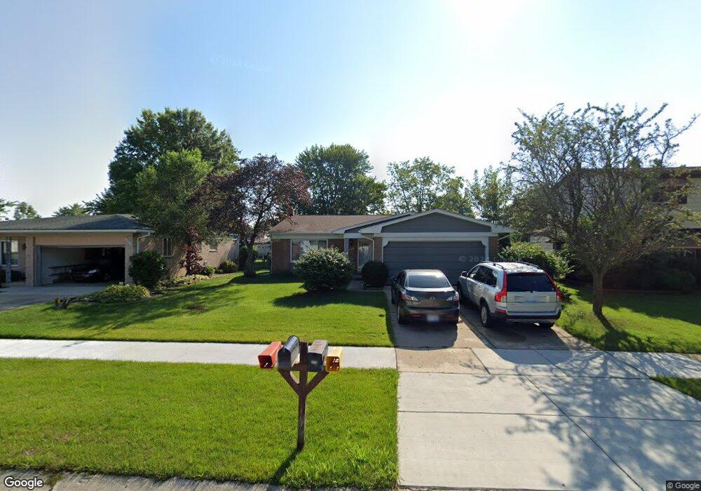
2033 Briarfield St Unit Bldg-Unit Canton, MI 48188
Estimated Value: $325,757 - $369,000
--
Bed
2
Baths
1,625
Sq Ft
$218/Sq Ft
Est. Value
About This Home
This home is located at 2033 Briarfield St Unit Bldg-Unit, Canton, MI 48188 and is currently estimated at $353,439, approximately $217 per square foot. 2033 Briarfield St Unit Bldg-Unit is a home located in Wayne County with nearby schools including Bentley Elementary School, Canton High School, and Salem High School.
Ownership History
Date
Name
Owned For
Owner Type
Purchase Details
Closed on
Aug 13, 2018
Sold by
Nechifor Diana
Bought by
Alla Entella and Majtara Anila
Current Estimated Value
Home Financials for this Owner
Home Financials are based on the most recent Mortgage that was taken out on this home.
Original Mortgage
$205,000
Outstanding Balance
$178,034
Interest Rate
4.5%
Mortgage Type
New Conventional
Estimated Equity
$175,405
Purchase Details
Closed on
Apr 22, 2006
Sold by
Maxwell Kathryn H and Maxwell Richard
Bought by
Nechifor Diana
Create a Home Valuation Report for This Property
The Home Valuation Report is an in-depth analysis detailing your home's value as well as a comparison with similar homes in the area
Home Values in the Area
Average Home Value in this Area
Purchase History
| Date | Buyer | Sale Price | Title Company |
|---|---|---|---|
| Alla Entella | $225,000 | None Available | |
| Nechifor Diana | $174,000 | Stewart Title |
Source: Public Records
Mortgage History
| Date | Status | Borrower | Loan Amount |
|---|---|---|---|
| Open | Alla Entella | $205,000 |
Source: Public Records
Tax History Compared to Growth
Tax History
| Year | Tax Paid | Tax Assessment Tax Assessment Total Assessment is a certain percentage of the fair market value that is determined by local assessors to be the total taxable value of land and additions on the property. | Land | Improvement |
|---|---|---|---|---|
| 2025 | $1,925 | $134,900 | $0 | $0 |
| 2024 | $1,925 | $132,400 | $0 | $0 |
| 2023 | $1,835 | $122,300 | $0 | $0 |
| 2022 | $4,049 | $112,300 | $0 | $0 |
| 2021 | $3,906 | $106,000 | $0 | $0 |
| 2020 | $3,855 | $104,700 | $0 | $0 |
| 2019 | $3,785 | $90,180 | $0 | $0 |
| 2018 | $2,171 | $86,140 | $0 | $0 |
| 2017 | $2,777 | $83,700 | $0 | $0 |
| 2016 | $3,496 | $81,700 | $0 | $0 |
| 2015 | $5,871 | $76,540 | $0 | $0 |
| 2013 | $5,687 | $62,520 | $0 | $0 |
| 2010 | -- | $62,800 | $29,510 | $33,290 |
Source: Public Records
Map
Nearby Homes
- 1937 S Cavalier Dr
- 2349 Abbey Ct
- 1619 Nowland Ct
- 2562 Woodmont Dr E
- 43661 Antietam Ct
- 1834 Maple Park Dr W Unit 9
- 2785 Woodmont Dr E
- 2210 Woodmont Dr W
- 43450 Fredericksburg St
- 2435 Woodmont Dr W
- 43664 Appomattox Ct
- 43871 Yorktown St
- 45179 Rudgate Rd
- 43592 Champlain Ct
- 345 Canton Center Rd
- 1530 Fairfax Dr
- 46449 Killarney Ct Unit Bldg-Unit160
- 44125 Michigan Ave
- 49963 Kent Ct
- 49976 Kent Ct
- 2033 Briarfield St
- 2045 Briarfield St Unit Bldg-Unit
- 2045 Briarfield St
- 2021 Briarfield St
- 0 Briarfield St
- 2034 S Cavalier Dr
- 2057 Briarfield St
- 2009 Briarfield St
- 2022 S Cavalier Dr
- 2044 S Cavalier Dr
- 2010 S Cavalier Dr
- 2032 Briarfield St
- 2069 Briarfield St
- 2044 Briarfield St
- 1995 Briarfield St
- 2020 Briarfield St
- 2056 Briarfield St
- 2008 Briarfield St
- 1996 S Cavalier Dr
- 2054 S Cavalier Dr