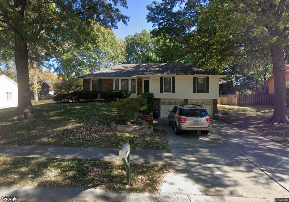
2033 Clay Dr Liberty, MO 64068
Estimated Value: $324,000 - $372,000
3
Beds
3
Baths
1,595
Sq Ft
$217/Sq Ft
Est. Value
About This Home
This home is located at 2033 Clay Dr, Liberty, MO 64068 and is currently estimated at $345,472, approximately $216 per square foot. 2033 Clay Dr is a home located in Clay County with nearby schools including Alexander Doniphan Elementary School, Discovery Middle School, and Liberty High School.
Ownership History
Date
Name
Owned For
Owner Type
Purchase Details
Closed on
Oct 15, 2014
Sold by
Wilson Jonathan M and Wilson Jonathon M
Bought by
Wilson Jonathan M
Current Estimated Value
Home Financials for this Owner
Home Financials are based on the most recent Mortgage that was taken out on this home.
Original Mortgage
$84,900
Outstanding Balance
$65,045
Interest Rate
4.16%
Mortgage Type
New Conventional
Estimated Equity
$280,427
Purchase Details
Closed on
Jul 28, 2003
Sold by
Mcgowan Mindi Lynne
Bought by
Wilson Jonathan M
Purchase Details
Closed on
Mar 19, 2001
Sold by
Frizzell Stuart R and Frizzell Lisa M
Bought by
Wilson Jonathon M and Mcgowan Mindi L
Home Financials for this Owner
Home Financials are based on the most recent Mortgage that was taken out on this home.
Original Mortgage
$139,175
Interest Rate
6.98%
Create a Home Valuation Report for This Property
The Home Valuation Report is an in-depth analysis detailing your home's value as well as a comparison with similar homes in the area
Home Values in the Area
Average Home Value in this Area
Purchase History
| Date | Buyer | Sale Price | Title Company |
|---|---|---|---|
| Wilson Jonathan M | -- | All American Title Co | |
| Wilson Jonathan M | -- | -- | |
| Wilson Jonathon M | -- | Chicago Title |
Source: Public Records
Mortgage History
| Date | Status | Borrower | Loan Amount |
|---|---|---|---|
| Open | Wilson Jonathan M | $84,900 | |
| Previous Owner | Wilson Jonathon M | $139,175 |
Source: Public Records
Tax History
| Year | Tax Paid | Tax Assessment Tax Assessment Total Assessment is a certain percentage of the fair market value that is determined by local assessors to be the total taxable value of land and additions on the property. | Land | Improvement |
|---|---|---|---|---|
| 2025 | $3,192 | $47,670 | -- | -- |
| 2024 | $3,192 | $41,500 | -- | -- |
| 2023 | $3,246 | $41,500 | $0 | $0 |
| 2022 | $3,017 | $38,080 | $0 | $0 |
| 2021 | $2,993 | $38,076 | $7,220 | $30,856 |
| 2020 | $2,869 | $34,280 | $0 | $0 |
| 2019 | $2,869 | $34,276 | $6,840 | $27,436 |
| 2018 | $2,519 | $29,560 | $0 | $0 |
| 2017 | $2,369 | $29,560 | $4,180 | $25,380 |
| 2016 | $2,369 | $28,060 | $4,750 | $23,310 |
| 2015 | $2,370 | $28,060 | $4,750 | $23,310 |
| 2014 | $2,389 | $28,060 | $4,750 | $23,310 |
Source: Public Records
Map
Nearby Homes
- 429 Pershing St
- 509 Belmont St
- 405 Wherritt Ln
- 406 Melrose St
- 2116 Winding Woods Dr
- 407 Glendale Rd
- Lot 2 Bent Oaks Dr
- 1601 Dunwich Dr
- Lot 2A Oak Crest Dr
- 1561 Parkside Dr
- 1327 Easton Ct
- 1836 Green Meadow Dr
- 1856 Arbor Trail
- 2153 Black Walnut Dr
- 2152 Black Walnut Dr
- 2157 Black Walnut Dr
- 1929 Longview Dr
- 1849 Arbor Trail
- 1845 Arbor Trail
- 2156 Black Walnut Dr
- 2037 Clay Dr
- 2027 Clay Dr
- 1720 Bluebell Ave
- 2005 Clay Cir
- 1726 Bluebell Ave
- 1714 Bluebell Ave
- 1730 Bluebell Ave
- 2036 Clay Dr
- 2043 Clay Dr
- 2040 Clay Dr
- 2032 Clay Dr
- 1708 Bluebell Ave
- 2044 Clay Dr
- 2028 Clay Dr
- 1736 Bluebell Ave
- 2001 Clay Cir
- 1719 Bluebell Ave
- 1725 Bluebell Ave
- 2021 Clay Dr
- 1702 Bluebell Ave
Your Personal Tour Guide
Ask me questions while you tour the home.