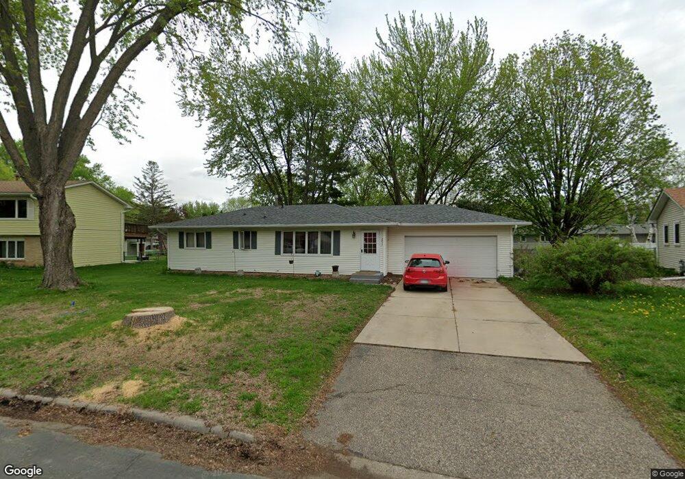
2033 Flint Ln Saint Paul, MN 55122
Estimated Value: $301,000 - $357,971
3
Beds
1
Bath
2,288
Sq Ft
$146/Sq Ft
Est. Value
About This Home
This home is located at 2033 Flint Ln, Saint Paul, MN 55122 and is currently estimated at $333,743, approximately $145 per square foot. 2033 Flint Ln is a home located in Dakota County with nearby schools including Burnsville High School, Gateway STEM Academy, and Sunrise International Montessori School.
Ownership History
Date
Name
Owned For
Owner Type
Purchase Details
Closed on
Nov 18, 2019
Sold by
Adrian Joe and Adrian Maria
Bought by
Swanson Graham
Current Estimated Value
Home Financials for this Owner
Home Financials are based on the most recent Mortgage that was taken out on this home.
Original Mortgage
$245,471
Outstanding Balance
$212,261
Interest Rate
3.62%
Mortgage Type
FHA
Estimated Equity
$121,482
Create a Home Valuation Report for This Property
The Home Valuation Report is an in-depth analysis detailing your home's value as well as a comparison with similar homes in the area
Home Values in the Area
Average Home Value in this Area
Purchase History
We collect this data history from publicly available records. To have your information removed, we recommend requesting removal directly through your county’s website.
| Date | Buyer | Sale Price | Title Company |
|---|---|---|---|
| Swanson Graham | $250,000 | Trademark Title Services Inc |
Source: Public Records
Mortgage History
We collect this data history from publicly available records. To have your information removed, we recommend requesting removal directly through your county’s website.
| Date | Status | Borrower | Loan Amount |
|---|---|---|---|
| Open | Swanson Graham | $245,471 |
Source: Public Records
Tax History
| Year | Tax Paid | Tax Assessment Tax Assessment Total Assessment is a certain percentage of the fair market value that is determined by local assessors to be the total taxable value of land and additions on the property. | Land | Improvement |
|---|---|---|---|---|
| 2025 | $3,032 | $309,100 | $88,200 | $220,900 |
| 2024 | $2,786 | $300,400 | $85,800 | $214,600 |
| 2023 | $2,786 | $300,300 | $86,000 | $214,300 |
| 2022 | $2,390 | $289,200 | $85,800 | $203,400 |
| 2021 | $2,358 | $249,900 | $74,600 | $175,300 |
| 2020 | $2,436 | $233,600 | $71,100 | $162,500 |
| 2019 | $2,406 | $231,900 | $67,700 | $164,200 |
| 2018 | $2,216 | $220,500 | $64,500 | $156,000 |
| 2017 | $2,321 | $197,400 | $61,400 | $136,000 |
| 2016 | $2,160 | $191,400 | $58,500 | $132,900 |
| 2015 | $2,028 | $165,173 | $52,033 | $113,140 |
| 2014 | -- | $160,377 | $50,333 | $110,044 |
| 2013 | -- | $134,435 | $44,043 | $90,392 |
Source: Public Records
Map
Nearby Homes
- 2049 Bluestone Ln
- 4002 Cedar Grove Ln
- 2156 Cedar Grove Trail
- 2013 Jade Ln
- 4022 Cedar Grove Ln
- 2018 Jade Ln
- 2041 Emerald Ln
- 4110 Rahn Rd Unit 201
- 4110 Rahn Rd Unit 221
- 4110 Rahn Rd Unit 115
- 4110 Rahn Rd Unit 121
- 4110 Rahn Rd Unit 317
- 4130 Rahn Rd Unit B119
- 4130 Rahn Rd Unit B206
- 3904 Rahn Rd
- 3902 Rahn Rd
- 4005 River Valley Way
- 4126 Durham Ct Unit 136
- 1958 Glenfield Ct Unit 25
- 2134 Garnet Dr
- 2037 Flint Ln
- 2029 Flint Ln
- 2030 Bluestone Ln
- 2026 Bluestone Ln
- 2034 Bluestone Ln
- 2038 Bluestone Ln
- 2025 Flint Ln
- 2041 Flint Ln
- 2022 Bluestone Ln
- 2038 Flint Ln
- 2042 Flint Ln
- 2034 Flint Ln
- 2021 Flint Ln
- 2046 Flint Ln
- 2045 Flint Ln
- 2018 Bluestone Ln
- 2046 Bluestone Ln
- 2030 Flint Ln
- 2033 2033 Bluestone-Lane-
- 2029 Bluestone Ln
Your Personal Tour Guide
Ask me questions while you tour the home.