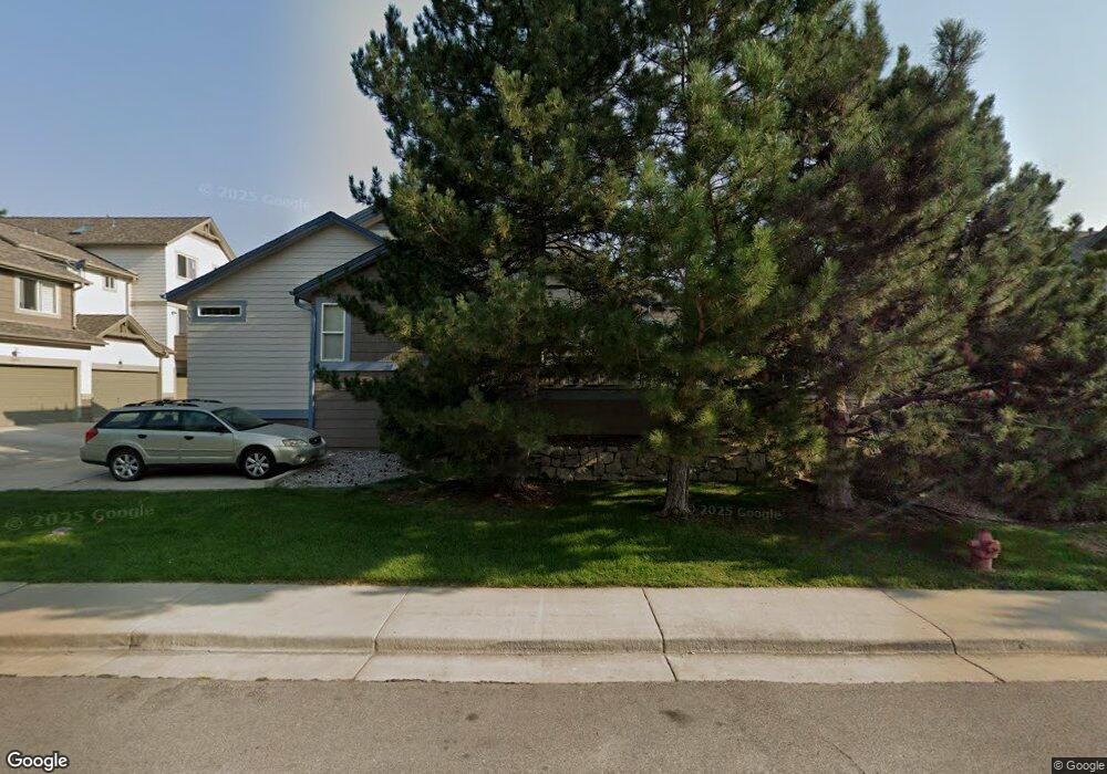
2033 N Fork Dr Lafayette, CO 80026
Estimated Value: $448,975 - $574,000
3
Beds
4
Baths
1,558
Sq Ft
$330/Sq Ft
Est. Value
About This Home
This home is located at 2033 N Fork Dr, Lafayette, CO 80026 and is currently estimated at $514,244, approximately $330 per square foot. 2033 N Fork Dr is a home located in Boulder County with nearby schools including Lafayette Elementary School, Angevine Middle School, and Centaurus High School.
Ownership History
Date
Name
Owned For
Owner Type
Purchase Details
Closed on
Aug 1, 2005
Sold by
Charnotskii Mikhail I
Bought by
Wobus Nicole R
Current Estimated Value
Home Financials for this Owner
Home Financials are based on the most recent Mortgage that was taken out on this home.
Original Mortgage
$175,200
Outstanding Balance
$91,739
Interest Rate
5.61%
Mortgage Type
Fannie Mae Freddie Mac
Estimated Equity
$422,505
Purchase Details
Closed on
Jun 16, 1999
Sold by
Skiffich David M
Bought by
Charnotskii Mikhail I
Home Financials for this Owner
Home Financials are based on the most recent Mortgage that was taken out on this home.
Original Mortgage
$157,500
Interest Rate
6.62%
Purchase Details
Closed on
Aug 8, 1996
Sold by
Mcstain Enterprises Inc
Bought by
Skiffich David M
Home Financials for this Owner
Home Financials are based on the most recent Mortgage that was taken out on this home.
Original Mortgage
$112,000
Interest Rate
8.32%
Create a Home Valuation Report for This Property
The Home Valuation Report is an in-depth analysis detailing your home's value as well as a comparison with similar homes in the area
Home Values in the Area
Average Home Value in this Area
Purchase History
| Date | Buyer | Sale Price | Title Company |
|---|---|---|---|
| Wobus Nicole R | $219,000 | First Colorado Title | |
| Charnotskii Mikhail I | $175,000 | -- | |
| Skiffich David M | $127,621 | -- |
Source: Public Records
Mortgage History
| Date | Status | Borrower | Loan Amount |
|---|---|---|---|
| Open | Wobus Nicole R | $175,200 | |
| Previous Owner | Charnotskii Mikhail I | $157,500 | |
| Previous Owner | Skiffich David M | $112,000 |
Source: Public Records
Tax History
| Year | Tax Paid | Tax Assessment Tax Assessment Total Assessment is a certain percentage of the fair market value that is determined by local assessors to be the total taxable value of land and additions on the property. | Land | Improvement |
|---|---|---|---|---|
| 2025 | $2,741 | $33,687 | $6,331 | $27,356 |
| 2024 | $2,741 | $33,687 | $6,331 | $27,356 |
| 2023 | $2,694 | $30,934 | $7,002 | $27,617 |
| 2022 | $2,710 | $28,849 | $5,247 | $23,602 |
| 2021 | $2,680 | $29,679 | $5,398 | $24,281 |
| 2020 | $2,527 | $27,650 | $4,934 | $22,716 |
| 2019 | $2,492 | $27,650 | $4,934 | $22,716 |
| 2018 | $2,396 | $26,251 | $5,400 | $20,851 |
| 2017 | $2,333 | $29,022 | $5,970 | $23,052 |
| 2016 | $1,927 | $20,991 | $5,015 | $15,976 |
| 2015 | $1,806 | $17,543 | $5,890 | $11,653 |
| 2014 | $1,517 | $17,543 | $5,890 | $11,653 |
Source: Public Records
Map
Nearby Homes
- 2251 Evening Star Ln
- 2325 Glacier Ct
- 1809 Keel Ct
- 2387 Sandpiper Dr
- 2395 Sandpiper Dr
- 561 Homestead St Unit 561
- 365 Vernier Ave
- 1519 Greenlee Way
- 448 N 96th St
- 1215 Devonshire Ct
- 2509 Ravenwood Ln
- 1525 Harvest Dr
- 1362 Golden Eagle Way
- 815 Latigo Loop
- 1140 Devonshire Ct
- 255 Rendezvous Dr
- 187 Rendezvous Dr
- 179 Rendezvous Dr
- 1140 Nottingham St
- 839 Latigo Loop
- 2031 N Fork Dr
- 2037 N Fork Dr
- 2029 N Fork Dr
- 2039 N Fork Dr
- 2049 N Fork Dr
- 2047 N Fork Dr
- 2019 N Fork Dr
- 2021 N Fork Dr
- 2051 N Fork Dr
- 2051 N Fork Dr Unit 6
- 2045 N Fork Dr
- 2023 N Fork Dr
- 2053 N Fork Dr
- 2015 N Fork Dr
- 2043 N Fork Dr
- 2025 N Fork Dr
- 2013 N Fork Dr
- 2041 N Fork Dr
- 2005 N Fork Dr
- 2007 N Fork Dr
Your Personal Tour Guide
Ask me questions while you tour the home.