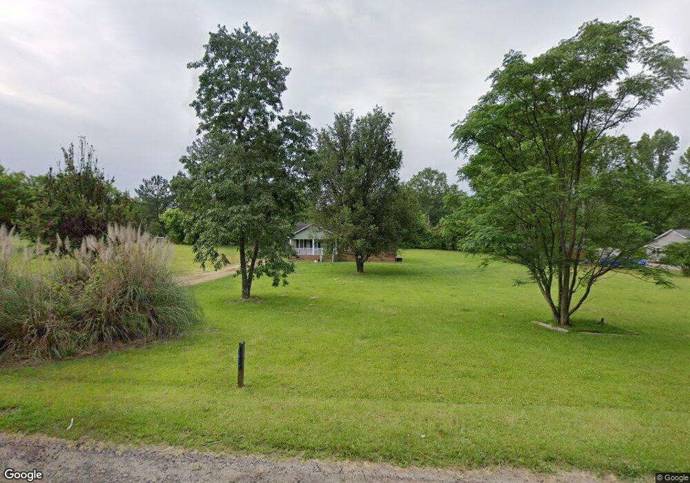
2033 Pheasant Rd Lancaster, SC 29720
Estimated Value: $164,965 - $228,000
Studio
2
Baths
1,152
Sq Ft
$170/Sq Ft
Est. Value
About This Home
This home is located at 2033 Pheasant Rd, Lancaster, SC 29720 and is currently estimated at $195,991, approximately $170 per square foot. 2033 Pheasant Rd is a home located in Lancaster County with nearby schools including Erwin Elementary School, South Middle School, and Lancaster High School.
Ownership History
Date
Name
Owned For
Owner Type
Purchase Details
Closed on
Apr 26, 2023
Sold by
Clyburn Belinda
Bought by
Kennedy Tiffany S
Current Estimated Value
Purchase Details
Closed on
Apr 4, 2023
Sold by
Bell Otis
Bought by
Clyburn Belinda
Purchase Details
Closed on
Sep 15, 2011
Sold by
Bell Annie Belk
Bought by
Bell Otis
Purchase Details
Closed on
Sep 21, 2009
Sold by
Secretary Of Housing & Urban Development
Bought by
Bell Otis and Bell Annie Belk
Home Financials for this Owner
Home Financials are based on the most recent Mortgage that was taken out on this home.
Original Mortgage
$60,000
Interest Rate
5.1%
Mortgage Type
Future Advance Clause Open End Mortgage
Purchase Details
Closed on
Oct 17, 2008
Sold by
Mobley Travis M
Bought by
Secretary Of Housing & Urban Development
Create a Home Valuation Report for This Property
The Home Valuation Report is an in-depth analysis detailing your home's value as well as a comparison with similar homes in the area
Home Values in the Area
Average Home Value in this Area
Purchase History
| Date | Buyer | Sale Price | Title Company |
|---|---|---|---|
| Kennedy Tiffany S | -- | None Listed On Document | |
| Kennedy Tiffany S | -- | None Listed On Document | |
| Clyburn Belinda | $7,000 | None Listed On Document | |
| Bell Otis | -- | -- | |
| Bell Otis | $24,000 | -- | |
| Secretary Of Housing & Urban Development | $71,730 | -- |
Source: Public Records
Mortgage History
| Date | Status | Borrower | Loan Amount |
|---|---|---|---|
| Previous Owner | Bell Otis | $60,000 |
Source: Public Records
Tax History
| Year | Tax Paid | Tax Assessment Tax Assessment Total Assessment is a certain percentage of the fair market value that is determined by local assessors to be the total taxable value of land and additions on the property. | Land | Improvement |
|---|---|---|---|---|
| 2024 | $1,485 | $4,482 | $702 | $3,780 |
| 2023 | $1,483 | $4,482 | $702 | $3,780 |
| 2022 | $1,478 | $4,482 | $702 | $3,780 |
| 2021 | $1,455 | $4,482 | $702 | $3,780 |
| 2020 | $1,355 | $4,176 | $702 | $3,474 |
| 2019 | $1,413 | $4,176 | $702 | $3,474 |
| 2018 | $1,360 | $4,176 | $702 | $3,474 |
| 2017 | $416 | $0 | $0 | $0 |
| 2016 | $406 | $0 | $0 | $0 |
| 2015 | $340 | $0 | $0 | $0 |
| 2014 | $340 | $0 | $0 | $0 |
| 2013 | $340 | $0 | $0 | $0 |
Source: Public Records
Map
Nearby Homes
- 1017 Pemberley St Unit 3182
- 970 Pemberley St Unit 3192
- 940 Pemberley St Unit 3199
- 997 Pemberley St Unit 3177
- 1927 Terra Ln
- 335 Maplestead St Unit 1112
- 944 Pemberley St Unit 3198
- 170 Basildon St Unit 1062
- 1790 Havenwood Dr
- 359 Maplestead St Unit 1107
- 367 Maplestead St Unit 1105
- 1780 Havenwood Dr Unit 37
- 466 Derbyshire St Unit 2121
- 609 Nesbe St
- 00 Lynn Cir Unit 11-14
- 571 Nesbe St Unit 2221
- 581 Nesbe St Unit 2223
- 162 Basildon St Unit 1064
- 174 Basildon St Unit 1061
- Grand Cayman Plan at Basildon - Ranches
- 2047 Pheasant Rd
- 2019 Pheasant Rd
- 2034 Dover Ln
- 2046 Dover Ln
- 2022 Dover Ln
- 2020 Pheasant Rd
- 2061 Pheasant Rd
- 778 W Shiloh Unity Rd
- 2062 Dover Ln
- 744 W Shiloh Unity Rd
- 2058 Pheasant Rd
- 2035 Dover Ln
- 2019 Dover Ln
- 2047 Dover Ln
- 2077 Pheasant Rd
- 2070 Pheasant Rd
- 2076 Dover Ln
- 802 W Shiloh Unity Rd
- 2063 Dover Ln
- 759 W Shiloh Unity Rd