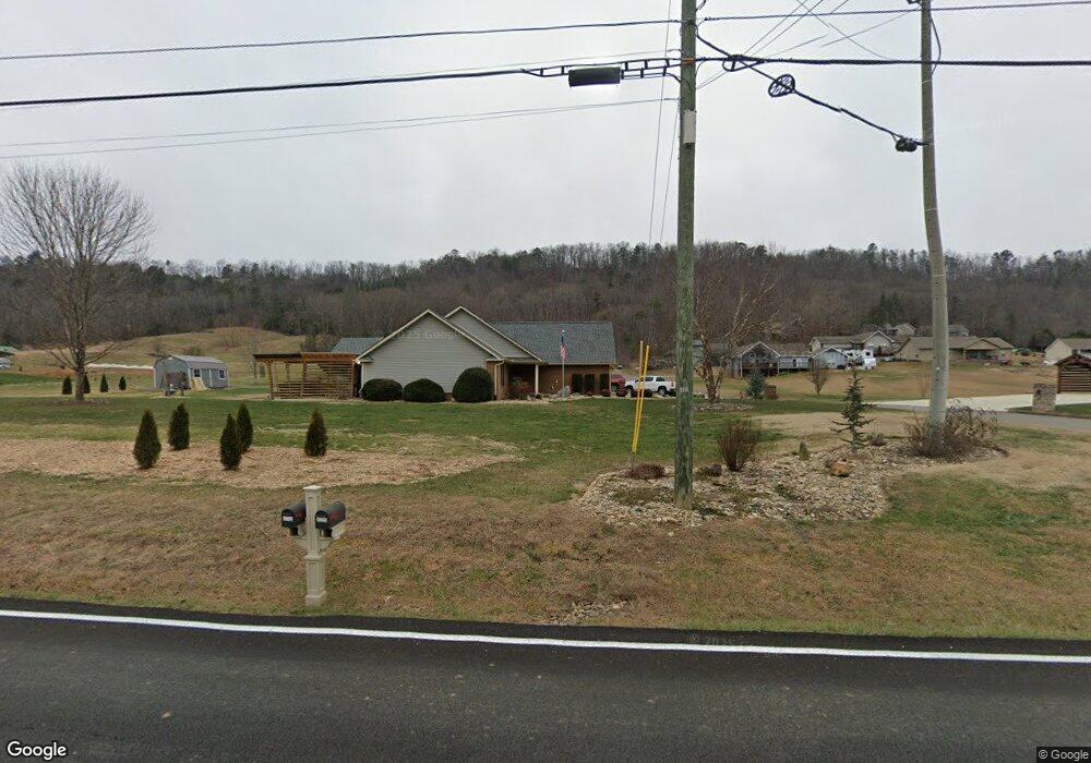
2034 Creswell Rd Seymour, TN 37865
Estimated Value: $78,927 - $496,000
--
Bed
--
Bath
1,404
Sq Ft
$205/Sq Ft
Est. Value
About This Home
This home is located at 2034 Creswell Rd, Seymour, TN 37865 and is currently estimated at $287,464, approximately $204 per square foot. 2034 Creswell Rd is a home with nearby schools including Northview Elementary School, Catons Chapel Elementary School, and Jones Cove Elementary School.
Ownership History
Date
Name
Owned For
Owner Type
Purchase Details
Closed on
Apr 12, 2018
Sold by
Ballard James and Ballard Stacy
Bought by
Barry William R and Barry Tammy N
Current Estimated Value
Purchase Details
Closed on
Jun 11, 2015
Sold by
Mccarter Harold
Bought by
Ballard Jim
Purchase Details
Closed on
Jan 17, 2013
Sold by
Brabson Ben D
Bought by
Barry Tammy N and Yates Martin D
Purchase Details
Closed on
Sep 10, 2012
Sold by
Dearmond David
Bought by
Brabson Ben
Purchase Details
Closed on
Jul 6, 2007
Bought by
Dearmond David
Purchase Details
Closed on
Jun 2, 2006
Sold by
Mink Allan S
Bought by
Robbins Calvin P
Home Financials for this Owner
Home Financials are based on the most recent Mortgage that was taken out on this home.
Original Mortgage
$22,700
Interest Rate
6.44%
Purchase Details
Closed on
Dec 2, 2005
Bought by
Carmichael John W
Create a Home Valuation Report for This Property
The Home Valuation Report is an in-depth analysis detailing your home's value as well as a comparison with similar homes in the area
Home Values in the Area
Average Home Value in this Area
Purchase History
| Date | Buyer | Sale Price | Title Company |
|---|---|---|---|
| Barry William R | $36,000 | Professional Title | |
| Ballard Jim | $30,000 | -- | |
| Barry Tammy N | $20,000 | -- | |
| Barry Tammy N | $20,000 | -- | |
| Brabson Ben | $31,000 | -- | |
| Dearmond David | $102,000 | -- | |
| Robbins Calvin P | $37,700 | -- | |
| Carmichael John W | $718,900 | -- |
Source: Public Records
Mortgage History
| Date | Status | Borrower | Loan Amount |
|---|---|---|---|
| Previous Owner | Carmichael John W | $22,700 |
Source: Public Records
Tax History Compared to Growth
Tax History
| Year | Tax Paid | Tax Assessment Tax Assessment Total Assessment is a certain percentage of the fair market value that is determined by local assessors to be the total taxable value of land and additions on the property. | Land | Improvement |
|---|---|---|---|---|
| 2025 | $696 | $47,000 | $17,325 | $29,675 |
| 2024 | $696 | $47,000 | $17,325 | $29,675 |
| 2023 | $696 | $47,000 | $0 | $0 |
| 2022 | $696 | $47,000 | $17,325 | $29,675 |
| 2021 | $696 | $47,000 | $17,325 | $29,675 |
| 2020 | $735 | $47,000 | $17,325 | $29,675 |
| 2019 | $694 | $39,500 | $16,775 | $22,725 |
| 2018 | $694 | $37,300 | $14,575 | $22,725 |
| 2017 | $694 | $37,300 | $14,575 | $22,725 |
| 2016 | $694 | $37,300 | $14,575 | $22,725 |
| 2015 | -- | $36,900 | $0 | $0 |
| 2014 | $602 | $36,916 | $0 | $0 |
Source: Public Records
Map
Nearby Homes
- 0 Bobbie Jean Ln Unit 1303758
- 948 Bobbie Jean Ln
- Lot 41-R1 Bobbie Jean Ln
- 1913 E Union Valley Rd
- 2045 Kings View Loop
- 2102 Kings View Loop
- 2050 Kings View Loop
- 1474 Broadview Cir
- 1550 Ellis Woods Loop
- 1901 Pine Ridge Rd
- 2216 French Broad River Rd
- 2115 Bradley Ln
- 1761 Rays Gap Rd
- 1923 Big Chiefs Skyview Dr
- 1418 Rippling Waters Cir
- 562 Illinois Ave
- 2067 Highpoint Ln
- 0 Highpoint Dr Unit 1250528
- 279 Mississippi Ave
- 1912 Smokey High Ln
- 2026 Creswell Rd
- 0 Creswell Rd - 53 & 54
- 2042 Creswell Rd
- 2038 Creswell Rd
- 2050 Creswell Rd
- 2046 Creswell Rd
- 705 Mountain Grove Ln
- 2054 Creswell Rd
- 2049 Creswell Rd
- 709 Mountain Grove Ln
- 2019 Creswell Rd
- 2055 Creswell Rd
- 2062 Creswell Rd
- 2009 Creswell Rd
- 713 Mountain Grove Ln
- 2002 Creswell Rd
- 2059 Creswell Rd
- 2004 Bill Hicks Dr
- 2082 Creswell Rd
- 2010 Bill Hicks Dr