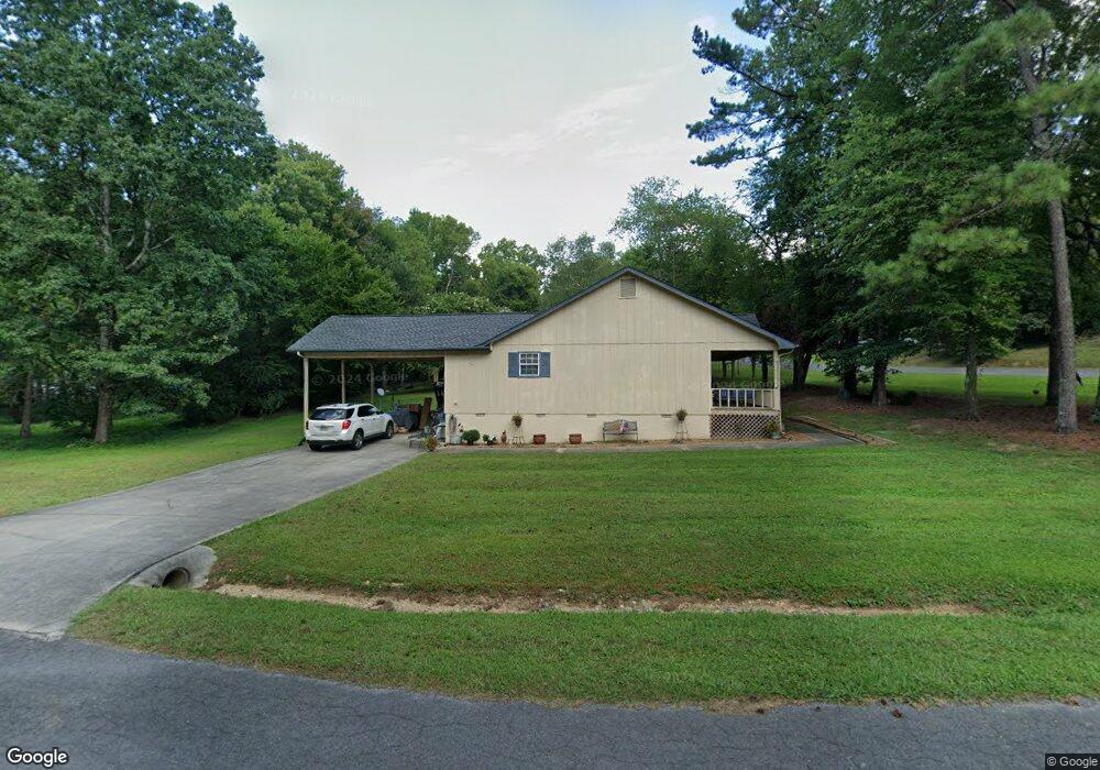
2034 Lelia Dr NW Dalton, GA 30721
Estimated Value: $251,650 - $315,000
--
Bed
2
Baths
1,722
Sq Ft
$166/Sq Ft
Est. Value
About This Home
This home is located at 2034 Lelia Dr NW, Dalton, GA 30721 and is currently estimated at $286,413, approximately $166 per square foot. 2034 Lelia Dr NW is a home located in Whitfield County with nearby schools including New Hope Elementary School, New Hope Middle School, and Northwest Whitfield County High School.
Ownership History
Date
Name
Owned For
Owner Type
Purchase Details
Closed on
May 11, 2020
Sold by
Hanes Geneva
Bought by
Rollins Andrew T
Current Estimated Value
Purchase Details
Closed on
Mar 31, 2005
Sold by
Not Provided
Bought by
Linda Land Geneva Hanes
Purchase Details
Closed on
Mar 2, 2000
Sold by
Hackney Marty Lynn and Tessa Lee
Bought by
Hackney Marty Lynn
Create a Home Valuation Report for This Property
The Home Valuation Report is an in-depth analysis detailing your home's value as well as a comparison with similar homes in the area
Home Values in the Area
Average Home Value in this Area
Purchase History
| Date | Buyer | Sale Price | Title Company |
|---|---|---|---|
| Rollins Andrew T | -- | -- | |
| Linda Land Geneva Hanes | $83,425 | -- | |
| Hackney Marty Lynn | -- | -- |
Source: Public Records
Tax History Compared to Growth
Tax History
| Year | Tax Paid | Tax Assessment Tax Assessment Total Assessment is a certain percentage of the fair market value that is determined by local assessors to be the total taxable value of land and additions on the property. | Land | Improvement |
|---|---|---|---|---|
| 2024 | $2,124 | $99,502 | $14,600 | $84,902 |
| 2023 | $2,124 | $70,866 | $12,800 | $58,066 |
| 2022 | $1,798 | $60,951 | $12,800 | $48,151 |
| 2021 | $1,798 | $60,951 | $12,800 | $48,151 |
| 2020 | $1,842 | $60,392 | $12,800 | $47,592 |
| 2019 | $1,873 | $60,392 | $12,800 | $47,592 |
| 2018 | $1,543 | $48,970 | $12,800 | $36,170 |
| 2017 | $1,544 | $48,970 | $12,800 | $36,170 |
| 2016 | $1,108 | $36,560 | $5,250 | $31,310 |
| 2014 | $984 | $36,560 | $5,250 | $31,310 |
| 2013 | -- | $36,559 | $5,250 | $31,309 |
Source: Public Records
Map
Nearby Homes
- 303 Cherokee Trail NW
- 609 Cherokee Trail NW
- 287 Williams Rd NW
- 1425 Wiggs Dr
- 3025 Cleveland Hwy
- 3147 Cleveland Hwy
- 2002 Broadacre Dr NW
- 1626 Lagenia Ct
- 1015 S Ridge Dr
- 466 Scarlet Dr
- 3216 Cleveland Hwy
- 0 West R W Ridge Dr
- 3201 Maple Grove Dr NW
- 3450 Misty Meadows Dr NW
- 337 Pacer Ln Unit 4
- 360 Pacer Ln
- 322 Pacer Ln
- 0 Pacer Ln
- 2256 Waring Rd NW