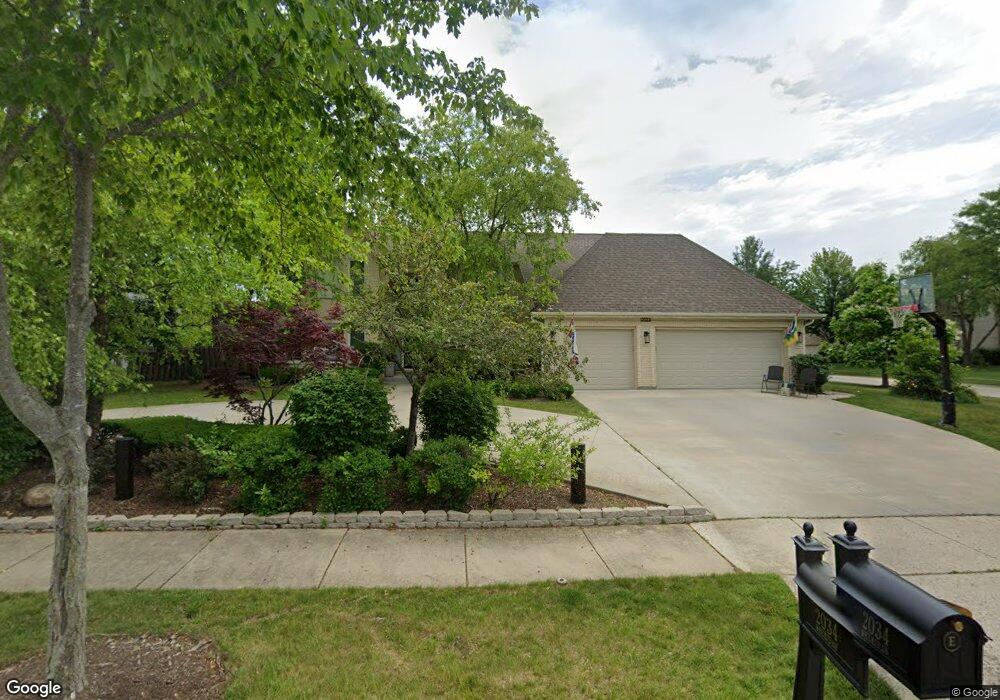
2034 Sheridan Rd Buffalo Grove, IL 60089
Rolling Hills NeighborhoodEstimated Value: $898,000 - $955,000
6
Beds
4
Baths
3,380
Sq Ft
$274/Sq Ft
Est. Value
About This Home
This home is located at 2034 Sheridan Rd, Buffalo Grove, IL 60089 and is currently estimated at $926,269, approximately $274 per square foot. 2034 Sheridan Rd is a home located in Lake County with nearby schools including Ivy Hall Elementary School, Twin Groves Middle School, and Adlai E Stevenson High School.
Ownership History
Date
Name
Owned For
Owner Type
Purchase Details
Closed on
Apr 7, 2017
Sold by
Shekman Walter and Shekman Jane
Bought by
Eason Lloyd B and Eason Laura
Current Estimated Value
Home Financials for this Owner
Home Financials are based on the most recent Mortgage that was taken out on this home.
Original Mortgage
$415,000
Outstanding Balance
$346,036
Interest Rate
4.37%
Mortgage Type
New Conventional
Estimated Equity
$580,233
Purchase Details
Closed on
Jul 3, 2003
Sold by
Rudnick Laurence M and Rudnick Georgiann M
Bought by
Shekman Walter and Shekman Jane
Purchase Details
Closed on
Oct 1, 1998
Sold by
Firstar Bank Illinois
Bought by
Rudnick Laurence M and Rudnick Georgiann M
Purchase Details
Closed on
Feb 22, 1995
Sold by
American National Bk & Tr Co Of Chicago
Bought by
First Colonial Bank
Create a Home Valuation Report for This Property
The Home Valuation Report is an in-depth analysis detailing your home's value as well as a comparison with similar homes in the area
Home Values in the Area
Average Home Value in this Area
Purchase History
| Date | Buyer | Sale Price | Title Company |
|---|---|---|---|
| Eason Lloyd B | $615,000 | Cambridge Title Company | |
| Shekman Walter | $670,000 | Fidelity Natl Title Ins Co | |
| Rudnick Laurence M | $485,000 | -- | |
| First Colonial Bank | $428,000 | Chicago Title Insurance Co |
Source: Public Records
Mortgage History
| Date | Status | Borrower | Loan Amount |
|---|---|---|---|
| Open | Eason Lloyd B | $415,000 |
Source: Public Records
Tax History Compared to Growth
Tax History
| Year | Tax Paid | Tax Assessment Tax Assessment Total Assessment is a certain percentage of the fair market value that is determined by local assessors to be the total taxable value of land and additions on the property. | Land | Improvement |
|---|---|---|---|---|
| 2024 | $21,950 | $248,950 | $52,607 | $196,343 |
| 2023 | $21,950 | $223,717 | $47,275 | $176,442 |
| 2022 | $20,654 | $208,269 | $44,010 | $164,259 |
| 2021 | $19,995 | $206,023 | $43,535 | $162,488 |
| 2020 | $19,603 | $206,726 | $43,684 | $163,042 |
| 2019 | $19,128 | $205,964 | $43,523 | $162,441 |
| 2018 | $20,466 | $222,405 | $47,313 | $175,092 |
| 2017 | $20,389 | $217,214 | $46,209 | $171,005 |
| 2016 | $19,693 | $217,650 | $44,249 | $173,401 |
| 2015 | $20,221 | $203,544 | $41,381 | $162,163 |
| 2014 | $18,802 | $186,196 | $44,443 | $141,753 |
| 2012 | $18,237 | $186,569 | $44,532 | $142,037 |
Source: Public Records
Map
Nearby Homes
- 1998 Sheridan Ct
- 1903 Sheridan Rd
- 5255 Danbury Ct
- 1901 Brandywyn Ln
- 486 Satinwood Terrace Unit 11
- 5328 Oak Grove Dr
- 333 Didier Ct
- 538 Lasalle Ct
- 890 Knollwood Dr
- 327 Lasalle Ln
- 268 Hoffmann Dr
- 361 Hoffmann Dr
- 896 Chaucer Way Unit 2
- 1265 Devonshire Rd
- 361 Willow Pkwy Unit 234
- 259 Willow Pkwy Unit 403
- 5107 N Arlington Heights Rd
- 2770 Sandalwood Rd Unit 3
- 2033 Olive Hill Dr
- 4143 3 Lakes Ct
- 2030 Sheridan Rd
- 810 Edgemere Rd
- 2038 Sheridan Rd
- 811 Edgemere Rd
- 800 Edgemere Rd
- 2047 Sheridan Rd
- 2051 Sheridan Rd
- 2022 Sheridan Ct
- 801 Edgemere Rd
- 2026 Sheridan Ct
- 2043 Sheridan Rd
- 2018 Sheridan Ct
- 2042 Sheridan Rd
- 2039 Sheridan Rd
- 2055 Sheridan Rd
- 790 Edgemere Rd
- 791 Edgemere Rd
- 2035 Sheridan Rd
- 2035 Sheridan Rd
- 2035 Sheridan Rd