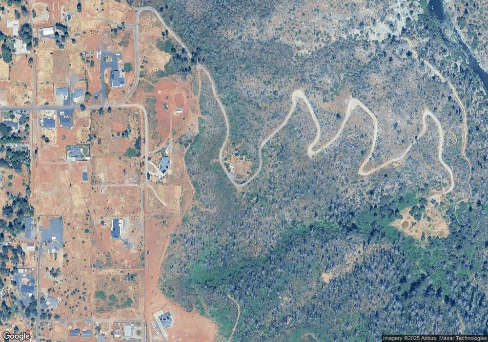
2035 Dean Rd Paradise, CA 95969
Estimated Value: $72,586 - $235,000
3
Beds
2
Baths
1,512
Sq Ft
$102/Sq Ft
Est. Value
About This Home
This home is located at 2035 Dean Rd, Paradise, CA 95969 and is currently estimated at $153,793, approximately $101 per square foot. 2035 Dean Rd is a home located in Butte County with nearby schools including Ponderosa Elementary School, Paradise Junior High School, and Paradise Senior High School.
Ownership History
Date
Name
Owned For
Owner Type
Purchase Details
Closed on
Jul 18, 2019
Sold by
Thomas Peggy
Bought by
Perron Mary Alice
Current Estimated Value
Purchase Details
Closed on
Nov 15, 2006
Sold by
Lebeau Michael and Lebeau Sharon
Bought by
Thomas Daniel W and Thomas Peggy
Home Financials for this Owner
Home Financials are based on the most recent Mortgage that was taken out on this home.
Original Mortgage
$200,000
Interest Rate
6.25%
Mortgage Type
Purchase Money Mortgage
Purchase Details
Closed on
May 4, 2001
Sold by
Wray Robert J and Wray Donna Mary
Bought by
Lebeau Michael and Lebeau Sharon
Home Financials for this Owner
Home Financials are based on the most recent Mortgage that was taken out on this home.
Original Mortgage
$105,000
Interest Rate
6.89%
Mortgage Type
Seller Take Back
Create a Home Valuation Report for This Property
The Home Valuation Report is an in-depth analysis detailing your home's value as well as a comparison with similar homes in the area
Home Values in the Area
Average Home Value in this Area
Purchase History
| Date | Buyer | Sale Price | Title Company |
|---|---|---|---|
| Perron Mary Alice | $60,000 | None Available | |
| Thomas Daniel W | $280,000 | Mid Valley Title & Escrow Co | |
| Lebeau Michael | $125,000 | Fidelity National Title Co |
Source: Public Records
Mortgage History
| Date | Status | Borrower | Loan Amount |
|---|---|---|---|
| Previous Owner | Thomas Daniel W | $200,000 | |
| Previous Owner | Lebeau Michael | $105,000 |
Source: Public Records
Tax History Compared to Growth
Tax History
| Year | Tax Paid | Tax Assessment Tax Assessment Total Assessment is a certain percentage of the fair market value that is determined by local assessors to be the total taxable value of land and additions on the property. | Land | Improvement |
|---|---|---|---|---|
| 2025 | $694 | $65,616 | $65,616 | -- |
| 2024 | $694 | $64,330 | $64,330 | $0 |
| 2023 | $617 | $63,069 | $63,069 | $0 |
| 2022 | $604 | $61,833 | $61,833 | $0 |
| 2021 | $590 | $60,621 | $60,621 | $0 |
| 2020 | $633 | $60,000 | $60,000 | $0 |
| 2019 | $424 | $40,000 | $40,000 | $0 |
| 2018 | $2,724 | $260,000 | $100,000 | $160,000 |
| 2017 | $2,474 | $235,000 | $85,000 | $150,000 |
| 2016 | $2,159 | $210,000 | $75,000 | $135,000 |
| 2015 | $1,955 | $190,000 | $75,000 | $115,000 |
| 2014 | $1,730 | $175,000 | $75,000 | $100,000 |
Source: Public Records
Map
Nearby Homes
- 6888 Dean Place
- 2015 Picnic Ln
- 6779 Matell Rd
- 1945 Merrill Rd
- 6521 Wheeler Rd
- 6541 Wheeler Rd
- 6820 Leone Way
- 0 Summerwood Ct Unit PA25231363
- 1805 Merrill Rd
- 1819 Apple View Way
- 6794 Rexdale Ln
- 6666 Shay Ln
- 6807 Rexdale Ln
- 6839 Pentz Rd
- 1871 June Way
- 1711 Timber Ln
- 1620 Timber Ln
- 6674 Pentz Rd
- 7075 Pentz Rd
- 7083 Pentz Rd
- 6904 Dean Place
- 6916 Dean Place
- 2020 Picnic Ln
- 1954 Dean Rd
- 2017 Picnic Ln
- 6875 Dean Place
- 1960 Dean Rd
- 1939 Dean Rd
- 1916 Dean Rd
- 6928 Sesame St
- 1919 Dean Rd
- 1903 Moll Rd
- 0 Dean Rd Unit PA16026058
- 0 Dean Rd Unit PA16026041
- 0 Dean Rd Unit PA16738635
- 0 Dean Rd Unit PA16738637
- 0 Dean Rd Unit PA22219636
- 0 Moll Rd
- 1906 Dean Rd
- 1915 Dean Rd
