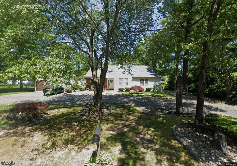
2035 Norris Ave Atco, NJ 08004
Waterford Township NeighborhoodEstimated Value: $375,000 - $467,000
--
Bed
--
Bath
2,360
Sq Ft
$173/Sq Ft
Est. Value
About This Home
This home is located at 2035 Norris Ave, Atco, NJ 08004 and is currently estimated at $409,239, approximately $173 per square foot. 2035 Norris Ave is a home located in Camden County with nearby schools including Waterford Elementary School, Thomas Richards Elementary School, and Atco Elementary School.
Ownership History
Date
Name
Owned For
Owner Type
Purchase Details
Closed on
Apr 23, 2020
Sold by
Regalbuto John
Bought by
Regalbuto Danielle
Current Estimated Value
Purchase Details
Closed on
Jan 30, 2008
Sold by
Raio Yolanda
Bought by
Regalbuto John and Regalbuto Danielle
Purchase Details
Closed on
Jan 30, 2007
Sold by
Raio Yolanda
Bought by
Regalbuto John and Regalbuto Danielle
Home Financials for this Owner
Home Financials are based on the most recent Mortgage that was taken out on this home.
Original Mortgage
$88,400
Interest Rate
6.22%
Create a Home Valuation Report for This Property
The Home Valuation Report is an in-depth analysis detailing your home's value as well as a comparison with similar homes in the area
Home Values in the Area
Average Home Value in this Area
Purchase History
| Date | Buyer | Sale Price | Title Company |
|---|---|---|---|
| Regalbuto Danielle | -- | Title America | |
| Regalbuto John | $136,000 | -- | |
| Regalbuto John | $136,000 | -- |
Source: Public Records
Mortgage History
| Date | Status | Borrower | Loan Amount |
|---|---|---|---|
| Previous Owner | Regalbuto John | $37,500 | |
| Previous Owner | Regalbuto John | $193,325 | |
| Previous Owner | Regalbuto John | $22,000 | |
| Previous Owner | Regalbuto John | $165,000 | |
| Previous Owner | Regalbuto John | $140,000 | |
| Previous Owner | Regalbuto John | $25,000 | |
| Previous Owner | Regalbuto John | $88,400 |
Source: Public Records
Tax History Compared to Growth
Tax History
| Year | Tax Paid | Tax Assessment Tax Assessment Total Assessment is a certain percentage of the fair market value that is determined by local assessors to be the total taxable value of land and additions on the property. | Land | Improvement |
|---|---|---|---|---|
| 2024 | $9,569 | $222,700 | $50,200 | $172,500 |
| 2023 | $9,569 | $222,700 | $50,200 | $172,500 |
| 2022 | $9,144 | $222,700 | $50,200 | $172,500 |
| 2021 | $9,100 | $222,700 | $50,200 | $172,500 |
| 2020 | $9,055 | $222,700 | $50,200 | $172,500 |
| 2019 | $8,917 | $222,700 | $50,200 | $172,500 |
| 2018 | $8,908 | $222,700 | $50,200 | $172,500 |
| 2017 | $8,770 | $222,700 | $50,200 | $172,500 |
| 2016 | $8,643 | $222,700 | $50,200 | $172,500 |
| 2015 | $8,416 | $222,700 | $50,200 | $172,500 |
| 2014 | $8,036 | $145,500 | $38,000 | $107,500 |
Source: Public Records
Map
Nearby Homes
- 788 White Horse Pike
- 785 White Horse Pike
- 812 White Horse Pike
- 2039 Hendricks Ave
- 2073 Hendricks Ave
- 2076 Hendricks Ave
- 249 Girard Ave
- 243 Camden Ave
- 111 Garfield Ave
- 125 Ebbetts Dr
- 109 Fenway Ave
- 426 Washington Ave
- 201 Thompson Ave
- 124 Stevens Ave
- 520 E Atlantic Ave
- 509 3rd Ave
- 246 Hayes Mill Rd
- 475 White Horse Pike
- 77 Oakton Dr
- 2216 Harrison Ave
- 2029 Norris Ave
- 2024 Elm Ave
- 2042 Norris Ave
- 2033 Lambert Ave
- 654 Pacific Ave
- 793 W Atlantic Ave
- 647 Pacific Ave
- 2026 Ohio Ave
- 769 W Atlantic Ave
- 655 Pacific Ave
- 2034 Lambert Ave
- 661 Pacific Ave
- 772 White Horse Pike
- 803 W Atlantic Ave
- 2014 Norris Ave
- 2020 Ohio Ave
- 2010 Norris Ave
- 2035 Dale Ave
- 614 Pacific Ave
- 2016 Ohio Ave