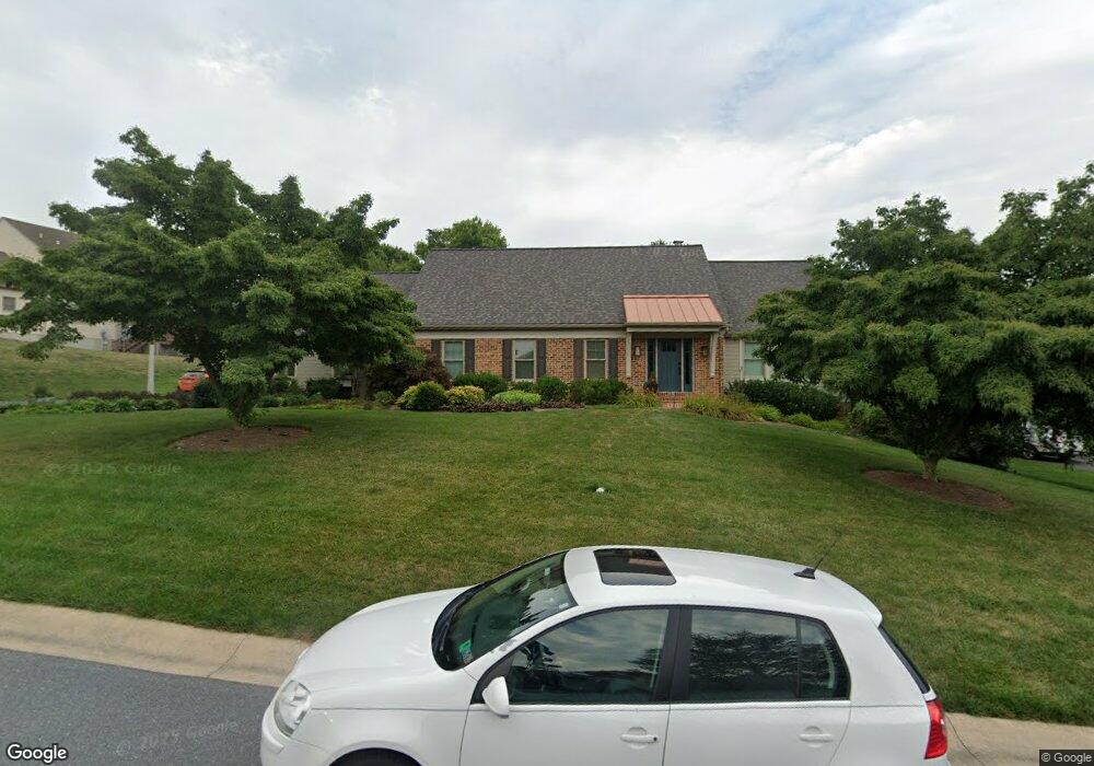
2035 Wynfield Dr Lancaster, PA 17601
Eden NeighborhoodEstimated Value: $590,770 - $718,000
3
Beds
3
Baths
2,520
Sq Ft
$256/Sq Ft
Est. Value
About This Home
This home is located at 2035 Wynfield Dr, Lancaster, PA 17601 and is currently estimated at $645,443, approximately $256 per square foot. 2035 Wynfield Dr is a home located in Lancaster County with nearby schools including Nitrauer School, Landis Run Intermediate School, and Manheim Township Middle School.
Ownership History
Date
Name
Owned For
Owner Type
Purchase Details
Closed on
May 15, 2008
Sold by
Zeller Robert P and Zeller Kathleen P
Bought by
Billoni Philip J and Billoni Lianne C
Current Estimated Value
Home Financials for this Owner
Home Financials are based on the most recent Mortgage that was taken out on this home.
Original Mortgage
$295,920
Outstanding Balance
$187,699
Interest Rate
5.91%
Mortgage Type
Purchase Money Mortgage
Estimated Equity
$457,744
Create a Home Valuation Report for This Property
The Home Valuation Report is an in-depth analysis detailing your home's value as well as a comparison with similar homes in the area
Home Values in the Area
Average Home Value in this Area
Purchase History
| Date | Buyer | Sale Price | Title Company |
|---|---|---|---|
| Billoni Philip J | $369,900 | United General Title Ins Co |
Source: Public Records
Mortgage History
| Date | Status | Borrower | Loan Amount |
|---|---|---|---|
| Open | Billoni Philip J | $295,920 |
Source: Public Records
Tax History Compared to Growth
Tax History
| Year | Tax Paid | Tax Assessment Tax Assessment Total Assessment is a certain percentage of the fair market value that is determined by local assessors to be the total taxable value of land and additions on the property. | Land | Improvement |
|---|---|---|---|---|
| 2025 | $6,816 | $315,000 | $74,400 | $240,600 |
| 2024 | $6,816 | $315,000 | $74,400 | $240,600 |
| 2023 | $6,638 | $315,000 | $74,400 | $240,600 |
| 2022 | $6,526 | $315,000 | $74,400 | $240,600 |
| 2021 | $6,381 | $315,000 | $74,400 | $240,600 |
| 2020 | $6,381 | $315,000 | $74,400 | $240,600 |
| 2019 | $6,319 | $315,000 | $74,400 | $240,600 |
| 2018 | $4,653 | $315,000 | $74,400 | $240,600 |
| 2017 | $6,061 | $238,200 | $70,100 | $168,100 |
| 2016 | $6,061 | $238,200 | $70,100 | $168,100 |
| 2015 | $1,523 | $238,200 | $70,100 | $168,100 |
| 2014 | $4,332 | $238,200 | $70,100 | $168,100 |
Source: Public Records
Map
Nearby Homes
- 1981 Landis Valley Rd
- 2111 Landis Valley Rd
- 1935 New Holland Pike
- 2010 Landis Valley Rd
- 1923 Pickering Trail
- 1919 Pickering Trail
- 1922 Pickering Trail
- 1915 Pickering Trail
- 1914 Pickering Trail
- 2007 Meadow Ridge Dr
- 0 Butter Rd
- 0 Butter Rd
- 1550 Euclid Dr
- 2043 Stonecrest Dr
- 2022 Meadow Ridge Dr
- 2098 Mallard Dr
- 212 Greenview Dr Unit T2212
- 1326 Stillwater Rd
- 1012 Whitfield Dr
- 672 Stockdale Dr
- 2027 Wynfield Dr
- 7 Northgate Ln
- 3 Northgate Ln
- 2034 Wynfield Dr
- 2038 Wynfield Dr
- 2023 Wynfield Dr
- 2030 Wynfield Dr
- 11 Northgate Ln
- 2026 Wynfield Dr
- 2042 Wynfield Dr
- 2153 Saddleridge Rd
- 2149 Saddleridge Rd
- 1994 Copperfield Dr
- 2019 Wynfield Dr
- 2046 Wynfield Dr
- 2144 Saddleridge Rd
- 1953 Glendower Dr
- 15 Northgate Ln
- 1961 Glendower Dr
- 2022 Wynfield Dr