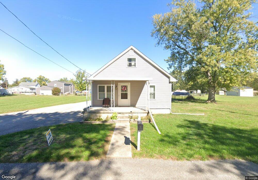
2036 Davis Ave Columbus, OH 43207
Obetz-Lockbourne NeighborhoodEstimated Value: $201,000 - $240,676
3
Beds
1
Bath
1,438
Sq Ft
$157/Sq Ft
Est. Value
About This Home
This home is located at 2036 Davis Ave, Columbus, OH 43207 and is currently estimated at $226,419, approximately $157 per square foot. 2036 Davis Ave is a home located in Franklin County with nearby schools including West Elementary School, Hamilton Elementary School, and Hamilton Intermediate School.
Ownership History
Date
Name
Owned For
Owner Type
Purchase Details
Closed on
Jul 28, 2022
Sold by
Mcquirt William R
Bought by
Davis Avenue Llc
Current Estimated Value
Purchase Details
Closed on
Nov 6, 2015
Sold by
Mcquirt Loretta
Bought by
Mcquirt William R
Purchase Details
Closed on
Mar 30, 2010
Sold by
Caudill Robin and Will Of Doris R Smith
Bought by
Mcquirt William and Mcquirt Loretta
Home Financials for this Owner
Home Financials are based on the most recent Mortgage that was taken out on this home.
Original Mortgage
$58,500
Interest Rate
4.96%
Mortgage Type
New Conventional
Purchase Details
Closed on
Jan 6, 2010
Sold by
Estate Of Arnold R Smith
Bought by
Smith Doris R
Purchase Details
Closed on
Jul 18, 1977
Bought by
Smith Doris and Smith Arnold
Create a Home Valuation Report for This Property
The Home Valuation Report is an in-depth analysis detailing your home's value as well as a comparison with similar homes in the area
Home Values in the Area
Average Home Value in this Area
Purchase History
| Date | Buyer | Sale Price | Title Company |
|---|---|---|---|
| Davis Avenue Llc | -- | New Title Company Name | |
| Mcquirt William R | -- | Attorney | |
| Mcquirt William | $78,000 | Talon Group | |
| Smith Doris R | -- | None Available | |
| Smith Doris | -- | -- |
Source: Public Records
Mortgage History
| Date | Status | Borrower | Loan Amount |
|---|---|---|---|
| Previous Owner | Mcquirt William | $58,500 |
Source: Public Records
Tax History Compared to Growth
Tax History
| Year | Tax Paid | Tax Assessment Tax Assessment Total Assessment is a certain percentage of the fair market value that is determined by local assessors to be the total taxable value of land and additions on the property. | Land | Improvement |
|---|---|---|---|---|
| 2024 | $3,330 | $71,200 | $23,560 | $47,640 |
| 2023 | $3,313 | $71,190 | $23,555 | $47,635 |
| 2022 | $2,644 | $47,640 | $12,530 | $35,110 |
| 2021 | $2,680 | $47,640 | $12,530 | $35,110 |
| 2020 | $2,730 | $47,640 | $12,530 | $35,110 |
| 2019 | $2,570 | $39,730 | $10,470 | $29,260 |
| 2018 | $1,841 | $39,730 | $10,470 | $29,260 |
| 2017 | $1,926 | $39,730 | $10,470 | $29,260 |
| 2016 | $1,420 | $21,390 | $4,170 | $17,220 |
| 2015 | $1,144 | $18,130 | $910 | $17,220 |
| 2014 | $1,138 | $18,130 | $910 | $17,220 |
| 2013 | $610 | $20,160 | $1,015 | $19,145 |
Source: Public Records
Map
Nearby Homes
- 1987 Reese Ave
- 1962 Reese Ave
- 1817 Marlboro Ave
- 4417 Lancaster Ave
- 1632 Marlboro Ave
- 4383 Lancaster Ave
- 1559 Obetz Ave
- 4410 Holstein Dr
- 1341 Halfhill Way
- 4412 Catamaran Dr
- 1597 Metcalfe Ave
- 1583 Metcalfe Ave
- 1315 Webb Dr Unit Lot 93
- 1292 Webb Dr Unit Lot 83
- 1291 Webb Dr Unit Lot 90
- 4231 Umiak Dr
- 1099 Secrest Ave
- 4310 Charlotte Rd
- 5081 Lockbourne Rd
- 1059 Belford Ave
- 2042 Davis Ave
- 2039 Reese Ave
- 2033 Reese Ave
- 2045 Reese Ave
- 0 Davis Ave
- 2031 Davis Ave
- 0 Reese Ave
- 2027 Davis Ave
- 2019 Davis Ave
- 0 Reese Ave
- 4815 Obetz Reese Rd
- 4784 Ridge St
- 2019 Reese Ave
- 2044 Reese Ave
- 4839 Obetz Reese Rd
- 2001 Reese Ave
- 4801 Obetz Reese Rd
- 2040 Reese Ave
- 4806 Ridge St
- 0 Reese Ave