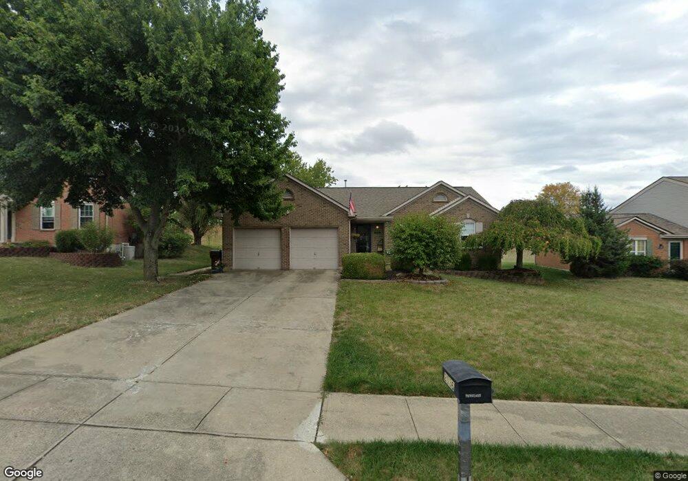
2036 Flintwood Ct Independence, KY 41051
Estimated Value: $295,000 - $324,000
3
Beds
2
Baths
1,152
Sq Ft
$267/Sq Ft
Est. Value
About This Home
This home is located at 2036 Flintwood Ct, Independence, KY 41051 and is currently estimated at $307,095, approximately $266 per square foot. 2036 Flintwood Ct is a home located in Kenton County with nearby schools including White's Tower Elementary School, Twenhofel Middle School, and Simon Kenton High School.
Ownership History
Date
Name
Owned For
Owner Type
Purchase Details
Closed on
Jul 14, 2006
Sold by
Henderson Bernard L and Henderson Karen M
Bought by
Hennessy Roxanne M
Current Estimated Value
Home Financials for this Owner
Home Financials are based on the most recent Mortgage that was taken out on this home.
Original Mortgage
$132,400
Outstanding Balance
$77,554
Interest Rate
6.6%
Mortgage Type
Purchase Money Mortgage
Estimated Equity
$229,541
Purchase Details
Closed on
Aug 22, 1995
Sold by
Arlinghaus Builder Inc
Bought by
Henderson Bernard L and Henderson Karen
Home Financials for this Owner
Home Financials are based on the most recent Mortgage that was taken out on this home.
Original Mortgage
$83,700
Interest Rate
7.54%
Mortgage Type
New Conventional
Create a Home Valuation Report for This Property
The Home Valuation Report is an in-depth analysis detailing your home's value as well as a comparison with similar homes in the area
Home Values in the Area
Average Home Value in this Area
Purchase History
| Date | Buyer | Sale Price | Title Company |
|---|---|---|---|
| Hennessy Roxanne M | $165,500 | Kentucky Land Title Agency | |
| Henderson Bernard L | $113,495 | -- |
Source: Public Records
Mortgage History
| Date | Status | Borrower | Loan Amount |
|---|---|---|---|
| Open | Hennessy Roxanne M | $132,400 | |
| Previous Owner | Henderson Bernard L | $83,700 |
Source: Public Records
Tax History Compared to Growth
Tax History
| Year | Tax Paid | Tax Assessment Tax Assessment Total Assessment is a certain percentage of the fair market value that is determined by local assessors to be the total taxable value of land and additions on the property. | Land | Improvement |
|---|---|---|---|---|
| 2025 | $2,739 | $235,500 | $40,000 | $195,500 |
| 2024 | $2,381 | $194,400 | $30,000 | $164,400 |
| 2023 | $2,453 | $194,400 | $30,000 | $164,400 |
| 2022 | $2,514 | $194,400 | $30,000 | $164,400 |
| 2021 | $2,551 | $194,400 | $30,000 | $164,400 |
| 2020 | $2,228 | $165,500 | $30,000 | $135,500 |
| 2019 | $2,234 | $165,500 | $30,000 | $135,500 |
| 2018 | $2,246 | $165,500 | $30,000 | $135,500 |
| 2017 | $2,185 | $165,500 | $30,000 | $135,500 |
| 2015 | $2,121 | $165,500 | $30,000 | $135,500 |
| 2014 | $2,091 | $165,500 | $30,000 | $135,500 |
Source: Public Records
Map
Nearby Homes
- 10737 Cypresswood Dr
- 5267 Pioneer Dr
- 10741 Lakefront Cir
- 1804 Cypress Way
- 5186 Christopher Dr
- 810 Durrow Dr Unit Lot 14
- 11147 Stafford Heights Rd
- 10434 Sharpsburg Dr
- 772 Durrow Dr Unit Lot 26
- 6681 Tullamore Ln Unit Lot 3
- 6703 Tullamore Ln Unit Lot 7
- 958 Don Victor
- 860 Stephens Rd
- 89 Bradley Dr
- 4389 Alleen Ct
- 72 Sherwood Dr
- 64 Sylvan Dr
- 1436 Rosewynne Way
- 10383 Lynchburg Dr
- 1427 Rosewynne Way
- 2032 Flintwood Ct
- 2040 Flintwood Ct
- 2028 Flintwood Ct
- 2044 Flintwood Ct
- 2048 Flintwood Ct
- 73 Flintwood Ct
- 75 Flintwood Ct
- 79 Flintwood Ct
- 65 Flintwood Ct
- 2024 Flintwood Ct
- 2033 Flintwood Ct
- 2037 Flintwood Ct
- 2029 Flintwood Ct
- 2041 Flintwood Ct
- 2052 Flintwood Ct
- 2025 Flintwood Ct
- 2020 Flintwood Ct
- 2045 Flintwood Ct
- 2021 Flintwood Ct
- 2056 Flintwood Ct