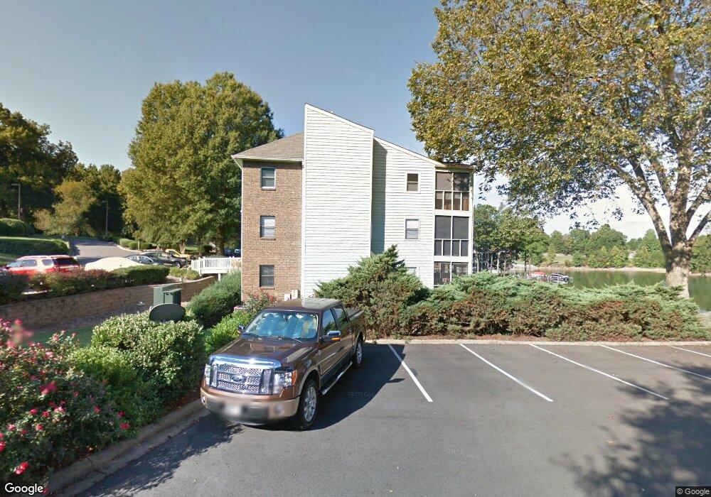
20367 Harborgate Ct Unit 304 Cornelius, NC 28031
Estimated Value: $595,763 - $669,000
3
Beds
2
Baths
1,369
Sq Ft
$463/Sq Ft
Est. Value
About This Home
This home is located at 20367 Harborgate Ct Unit 304, Cornelius, NC 28031 and is currently estimated at $634,191, approximately $463 per square foot. 20367 Harborgate Ct Unit 304 is a home located in Mecklenburg County with nearby schools including Cornelius Elementary School, Bailey Middle School, and William Amos Hough High School.
Ownership History
Date
Name
Owned For
Owner Type
Purchase Details
Closed on
Oct 18, 2012
Sold by
Mckee Thomas H and Mckee Nancy B
Bought by
Malesky Chester J and Malesky Cynthia
Current Estimated Value
Home Financials for this Owner
Home Financials are based on the most recent Mortgage that was taken out on this home.
Original Mortgage
$180,000
Outstanding Balance
$125,055
Interest Rate
3.58%
Mortgage Type
New Conventional
Estimated Equity
$509,136
Purchase Details
Closed on
Mar 14, 2003
Sold by
Briggs Kenneth A and Briggs Mary C
Bought by
Mckee Thomas H and Mckee Nancy B
Home Financials for this Owner
Home Financials are based on the most recent Mortgage that was taken out on this home.
Original Mortgage
$143,200
Interest Rate
4.75%
Mortgage Type
Adjustable Rate Mortgage/ARM
Create a Home Valuation Report for This Property
The Home Valuation Report is an in-depth analysis detailing your home's value as well as a comparison with similar homes in the area
Home Values in the Area
Average Home Value in this Area
Purchase History
| Date | Buyer | Sale Price | Title Company |
|---|---|---|---|
| Malesky Chester J | $250,000 | None Available | |
| Mckee Thomas H | $179,000 | -- |
Source: Public Records
Mortgage History
| Date | Status | Borrower | Loan Amount |
|---|---|---|---|
| Open | Malesky Chester J | $180,000 | |
| Previous Owner | Mckee Thomas H | $143,200 |
Source: Public Records
Tax History Compared to Growth
Tax History
| Year | Tax Paid | Tax Assessment Tax Assessment Total Assessment is a certain percentage of the fair market value that is determined by local assessors to be the total taxable value of land and additions on the property. | Land | Improvement |
|---|---|---|---|---|
| 2025 | $3,030 | $454,257 | -- | $454,257 |
| 2024 | $3,030 | $454,257 | -- | $454,257 |
| 2023 | $2,980 | $454,257 | $0 | $454,257 |
| 2022 | $2,712 | $314,800 | $0 | $314,800 |
| 2021 | $2,680 | $314,800 | $0 | $314,800 |
| 2020 | $2,680 | $314,800 | $0 | $314,800 |
| 2019 | $2,674 | $376,400 | $0 | $376,400 |
| 2018 | $2,991 | $274,900 | $100,000 | $174,900 |
| 2017 | $2,967 | $274,900 | $100,000 | $174,900 |
| 2016 | $2,964 | $274,900 | $100,000 | $174,900 |
| 2015 | $2,919 | $274,900 | $100,000 | $174,900 |
| 2014 | $2,917 | $274,900 | $100,000 | $174,900 |
Source: Public Records
Map
Nearby Homes
- 20721 Pointe Regatta Dr
- 20114 Norman Colony Rd
- 19934 Walter Henderson Rd
- 21520 Rio Oro Dr
- 20314 Colony Point Ln
- 21200 Rio Oro Dr
- 20332 Colony Point Ln
- 21617 Rio Oro Dr
- 20105 Chapel Point Ln
- 20115 Henderson Rd Unit D
- 20115 Henderson Rd Unit H
- 20305 Queensdale Dr
- 21228 Lakeview Cir
- 21300 Sandy Cove Rd
- 20517 Queensdale Dr
- 21316 Country Club Ln
- 21311 Baltic Dr
- 19329 Watermark Dr Unit 551/ 552
- 19329 Watermark Dr Unit 551
- 19901 Henderson Rd Unit C
- 20367 Harborgate Ct
- 20367 Harborgate Ct Unit 306
- 20367 Harborgate Ct Unit 305
- 20367 Harborgate Ct Unit 303
- 20367 Harborgate Ct Unit 302
- 20357 Harborgate Ct
- 20357 Harborgate Ct Unit 208
- 20357 Harborgate Ct Unit 205
- 20357 Harborgate Ct Unit 212
- 20357 Harborgate Ct Unit 211
- 20357 Harborgate Ct Unit 210
- 20357 Harborgate Ct Unit 209
- 20357 Harborgate Ct Unit 207
- 20357 Harborgate Ct Unit 206
- 20357 Harborgate Ct Unit 204
- 20357 Harborgate Ct Unit 203
- 20357 Harborgate Ct Unit 202
- 20357 Harborgate Ct Unit 201
- 207 Harborgate Ct Unit 207
- 203 Harborgate Ct