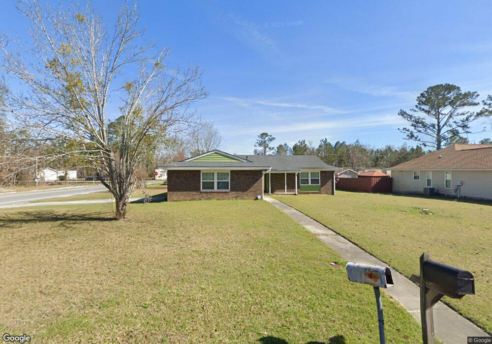
2037 Bancroft Rd Valdosta, GA 31602
Estimated Value: $130,000 - $167,000
--
Bed
2
Baths
1,389
Sq Ft
$105/Sq Ft
Est. Value
About This Home
This home is located at 2037 Bancroft Rd, Valdosta, GA 31602 and is currently estimated at $145,828, approximately $104 per square foot. 2037 Bancroft Rd is a home located in Lowndes County with nearby schools including W.G. Nunn Elementary School, Newbern Middle School, and Valdosta High School.
Ownership History
Date
Name
Owned For
Owner Type
Purchase Details
Closed on
Mar 31, 1999
Sold by
Hallman Crosby and Hallman Inc, A
Bought by
Jones Robbie L
Current Estimated Value
Purchase Details
Closed on
Jul 7, 1998
Bought by
Hallman Crosby and Hallman Inc, A
Purchase Details
Closed on
Jan 4, 1985
Bought by
Goode Lee R
Purchase Details
Closed on
Jul 14, 1977
Bought by
Goode Lee R and Goode Eloise S
Purchase Details
Closed on
Mar 25, 1977
Bought by
Shumphard W A
Create a Home Valuation Report for This Property
The Home Valuation Report is an in-depth analysis detailing your home's value as well as a comparison with similar homes in the area
Home Values in the Area
Average Home Value in this Area
Purchase History
| Date | Buyer | Sale Price | Title Company |
|---|---|---|---|
| Jones Robbie L | $69,500 | -- | |
| Hallman Crosby | $19,800 | -- | |
| Goode Lee R | -- | -- | |
| Goode Lee R | $39,500 | -- | |
| Shumphard W A | $6,000 | -- |
Source: Public Records
Tax History Compared to Growth
Tax History
| Year | Tax Paid | Tax Assessment Tax Assessment Total Assessment is a certain percentage of the fair market value that is determined by local assessors to be the total taxable value of land and additions on the property. | Land | Improvement |
|---|---|---|---|---|
| 2024 | $915 | $38,751 | $4,800 | $33,951 |
| 2023 | $915 | $38,751 | $4,800 | $33,951 |
| 2022 | $775 | $28,924 | $4,800 | $24,124 |
| 2021 | $695 | $25,990 | $4,800 | $21,190 |
| 2020 | $779 | $25,990 | $4,800 | $21,190 |
| 2019 | $675 | $25,012 | $4,800 | $20,212 |
| 2018 | $466 | $18,948 | $4,800 | $14,148 |
| 2017 | $469 | $18,948 | $4,800 | $14,148 |
| 2016 | $579 | $22,017 | $4,800 | $17,217 |
| 2015 | $532 | $22,017 | $4,800 | $17,217 |
| 2014 | $766 | $40,353 | $12,000 | $28,353 |
Source: Public Records
Map
Nearby Homes
- 1750 Almond Tree Place Unit A & B
- 11 Crestwood Cir
- 2570 Marathon Dr
- 1852 Chestnut Dr
- 1703 Largo Cir
- 1724 Eli Place
- 1739 Eli Place
- 2713 Pineview Dr Unit A&B
- 1761 Hyssop Crossing
- TBD Jaycee Shack Rd
- 1647 Fresno St
- 7.63 AC Tyndall Dr
- 1763 Eli Place
- 2400 Lowndes Dr
- 1 Pomona Cir
- 2737 Dogwood Cir
- 2311 Lowndes Dr
- 2517 Deborah Dr
- 1703 Leone Ave
- 3122 Tyndall Dr
- 2035 Bancroft Rd
- 3555 Northside Dr
- 2034 Bancroft Rd
- 2033 Bancroft Rd
- 2032 Bancroft Rd
- 2017 Northside Dr
- 2031 Bancroft Rd
- 2616 Quincy Cir
- 2016 Northside Dr
- ** Hunters Crossing
- 2015 Northside Dr
- 2029 Bancroft Rd
- 2028 Bancroft Rd
- 2614 Quincy Cir
- 2014 Northside Dr
- 2615 Quincy Cir
- 2013 Northside Dr
- 2027 Bancroft Rd
- 2017 Houston Ave
- 2012 Northside Dr